A control point that shifts by a few millimetres can become a very expensive problem once machine control, setting out, LiDAR registration or drone mapping all depend on it. That is why survey control network setup is not an administrative prelude to site work. It is the framework that determines whether every subsequent dataset agrees, scales correctly and stands up to scrutiny.
For contractors, consultants and asset owners, the issue is rarely whether control is needed. The real question is how much control is enough for the site, the specification and the programme. A small topographical survey on open ground does not need the same network design as a rail corridor, a deformation monitoring scheme or a multi-phase construction project where different teams return to site over several months.
What a survey control network setup needs to achieve
At a practical level, a control network must do three things well. It must provide positions that are accurate enough for the intended deliverable, remain stable for the life of the project and be recoverable by more than one crew or instrument.
That sounds straightforward, but performance depends on several linked decisions. Station spacing affects geometry. Monument type affects long-term reliability. Observation method affects achievable precision. Processing and adjustment affect whether errors are exposed or hidden. If one part is weak, the whole network becomes harder to trust.
For most professional projects, the target is not simply to create a series of coordinates. The target is to establish a control environment that supports total stations, GNSS rovers, laser scanners, mobile mapping systems and drones without introducing avoidable discrepancies between platforms.
Start with purpose, not equipment
A good survey control network setup starts with the end use of the data. If the output is a boundary survey tied to a national grid, the control strategy will differ from one designed for internal construction coordination. If the project includes scan-to-BIM, façade monitoring or volumetric measurement, vertical control may matter just as much as horizontal control.
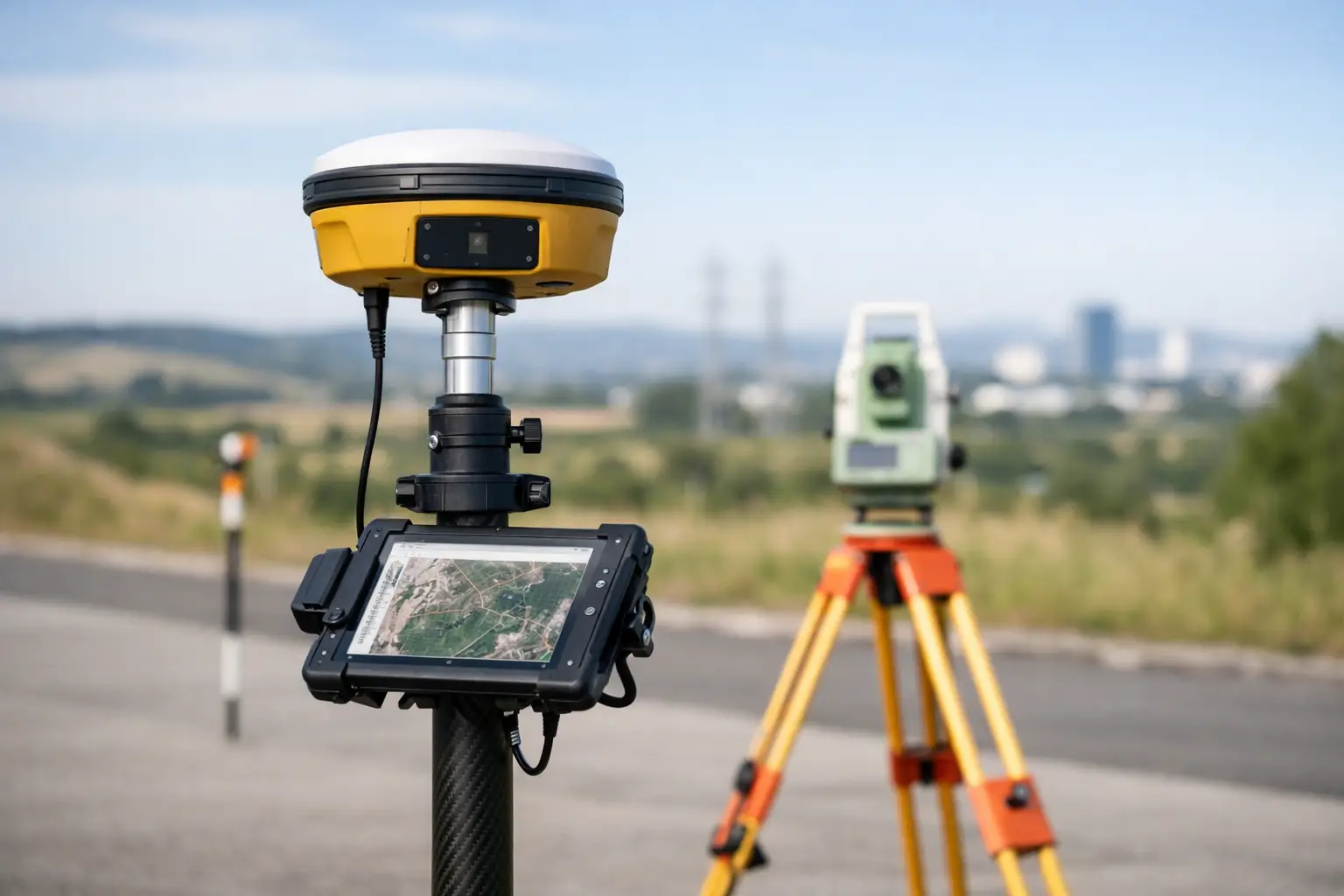
This is where many avoidable errors begin. Teams sometimes choose a method because the kit is available rather than because the project requires it. RTK GNSS may be efficient on open sites with good sky visibility, but it is less dependable around tall structures, heavy tree cover or reflective surfaces. A traversed total station network may deliver stronger local geometry, but it takes more field time and benefits from careful closure design. Static GNSS can tie a site into a wider reference frame very effectively, but it may be excessive for short-duration works where local relative accuracy is the priority.
The right approach is usually a combination. Primary control may be established with static GNSS or tied to known references, while secondary control is densified with total station observations to suit the site layout. That blended method often gives the best balance between absolute positioning and practical usability on site.
Planning the network geometry
Geometry matters more than many project teams realise. Well-placed stations create redundancy and make blunders easier to detect. Poorly placed stations produce a network that appears complete on paper but is fragile in practice.
Stations should be intervisible where possible, with lines that avoid long narrow chains of dependent points. A single linear traverse can be acceptable in constrained corridors, but it carries more risk than a network with loops and cross ties. On larger sites, enclosing the work area with control and adding internal checks generally produces more reliable results than pushing control progressively outward from one starting point.
Station location also needs practical judgement. A point that is theoretically ideal but likely to be disturbed by earthworks, resurfacing or plant movement is a bad investment. Permanent marks should sit outside likely construction impact zones while remaining convenient enough that crews will actually use them. There is no value in a perfect control mark if accessing it adds an hour to every visit.
Primary and secondary control
It helps to separate the network by function. Primary control should consist of the most stable, best-observed points on site. These points anchor the wider framework and should be protected accordingly. Secondary control can then support daily operations such as detail survey, scanning set-up or setting out.
This distinction is especially useful on active construction sites. Secondary points are more exposed to damage and may need replacing. If the primary framework is sound, secondary control can be rebuilt without compromising the overall coordinate integrity of the project.
Observation methods and trade-offs
No single method is best in every environment. GNSS is fast and efficient, especially when linked to reliable correction services, but performance depends on satellite visibility, multipath conditions and communications. Total stations provide excellent relative precision and remain indispensable where line-of-sight observations are manageable. Laser scanning can support local registration control, but it should not replace a properly designed control network when traceable accuracy is required.
A common commercial mistake is assuming that faster data capture offsets weaker control. It rarely does. If control is inconsistent, the time saved in the field is often lost in rework, alignment issues, failed quality checks or disputes over tolerances. On high-value projects, dependable control is usually one of the lowest-cost ways to reduce downstream risk.
Datum, projection and height control
Coordinate systems need explicit agreement at the start. National Grid, local grid, site grid and engineering grid all have their place, but mixing them carelessly creates confusion very quickly. The same applies to heights. Teams must know whether they are working with orthometric heights, ellipsoidal heights or a transformed site-specific height model.
This is not just a processing detail. If the site uses multiple subcontractors, machine control providers and remote sensing workflows, a shared understanding of datum and projection prevents costly misalignment between datasets. A point cloud that is accurate in itself can still be commercially useless if it is delivered in the wrong frame.
Quality control during survey control network setup
Quality assurance should be built into the fieldwork, not added afterwards. Independent checks, repeat occupations and loop closures are what turn observations into trusted control. If a point is occupied once and accepted without redundancy, the network may be fast to establish but difficult to defend.
Adjustment is equally important. Least squares adjustment is not simply a reporting formality. It helps identify residuals, weak geometry and observations that deserve scrutiny. Professional buyers increasingly expect this level of rigour because the control may support legal boundaries, design coordination or payment quantities.
Tolerance should always be linked to project need. There is no universal figure that suits every survey. A highway scheme, a utilities as-built survey and a heritage recording project each have different accuracy demands. Over-specifying can waste time and budget. Under-specifying is usually more expensive later.
Common reasons control networks fail
Most failed networks do not fail because of one dramatic mistake. They fail because small assumptions go unchallenged. A mark is set in an unstable location. A transformation is applied without proper validation. A GNSS fix is accepted in marginal conditions. Secondary control is treated as permanent. Field notes are incomplete, so future crews cannot verify what was done.
Another common issue is poor handover between teams. If surveyors, drone operators, scanning specialists and engineers are not working from the same control logic, discrepancies emerge that look like software problems but are actually control problems. Clear control reports, point schedules, sketches and method statements are part of the technical solution, not optional paperwork.
Making control work across modern geospatial workflows
Projects now depend on more than one instrument type. A network may need to support RTK rovers for topographical work, total stations for setting out, terrestrial LiDAR for detailed capture and drones for coverage at scale. The control strategy should anticipate that from the outset.
For example, scanner targets and check points should be placed where they help registration without compromising the integrity of the wider framework. Drone ground control should be distributed for geometry rather than clustered where access happens to be easiest. Construction teams may need local working points, but those points should still resolve back to the primary network cleanly.
This is where a joined-up provider adds value. LiDAR Tech UK supports organisations that need hardware, technical guidance and field-ready workflows to work together rather than operate as separate purchases. For many clients, that reduces the gap between specification and real-world deployment.
When to redesign rather than extend
There is a point where extending an ageing network becomes less efficient than redesigning it. If site conditions have changed, if several stations have been lost, or if the project scope now demands higher precision than originally planned, adding more patches can create confusion. A partial reset with clear control hierarchy is often the better commercial decision.
The same applies when a project shifts from one phase to another. Early earthworks control may not be sufficient for structural steel, façade installation or deformation monitoring. Each phase should be assessed against current tolerance, access and programme requirements rather than assuming the original setup remains suitable.
A well-designed control network does not attract much attention on a good day, and that is precisely the point. It lets every survey, scan and set-out task proceed with confidence. If you are planning new works, introducing GNSS or LiDAR workflows, or trying to bring consistency across multiple crews, getting the control right first will save far more than it costs.