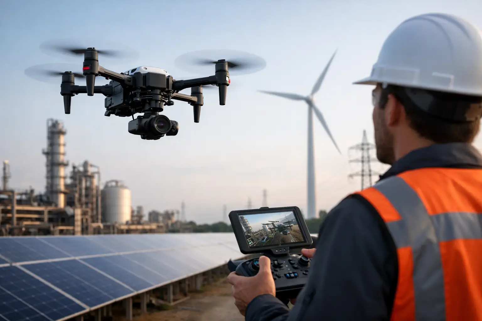
A bridge inspection missed in the wrong weather window, a flare stack that needs urgent visual review, or a solar farm with intermittent faults across hundreds of panels – this is where choosing the best drone for asset inspection becomes a commercial decision, not just a technical one. The right platform reduces time on site, keeps teams out of hazardous access scenarios, and produces usable inspection data the first time.
For most professional operators, there is no single answer that suits every asset class. The best choice depends on what you are inspecting, the level of detail required, the sensor payload, site constraints, and how the data will be used after capture. A drone that performs well on roof surveys may not be the right fit for utilities, and a platform suited to broad-area thermal scans may not be ideal for confined industrial structures.
What makes the best drone for asset inspection?
For professional inspection work, airframe quality matters, but payload capability matters more. Asset inspection typically depends on collecting high-quality visual, thermal, or spatial data from difficult viewpoints while maintaining safe stand-off distances. That means camera resolution, zoom range, thermal sensitivity, stabilisation, and low-light performance often have a greater impact on results than headline speed alone.
Flight performance is the next filter. Wind resistance, endurance, obstacle sensing, and transmission stability all influence whether the aircraft can work productively on live infrastructure or exposed sites. Inspection teams also need predictable operational behaviour. A drone that is theoretically capable but awkward to deploy, slow to position, or inconsistent near structures will quickly become expensive in the field.
Data workflow should not be treated as an afterthought. The best drone for asset inspection is one that supports the end result you actually need – whether that is a defect report, thermal anomaly map, orthomosaic, 3D model, or CAD-ready dataset. If the aircraft captures good imagery but the workflow to process and present that data is weak, the operational value drops.
Matching the drone to the asset
Different sectors place very different demands on inspection equipment. Building and roof inspections often prioritise high-resolution RGB imaging, oblique capture, and safe operation close to structures. Utility and powerline work may require strong zoom capability and stable imaging at distance. Solar inspection depends heavily on thermal quality, repeatability, and efficient coverage over large areas. Industrial plant inspections often need a balance of zoom, thermal, and obstacle awareness where access is tight and safety controls are strict.
This is why specification sheets on their own can be misleading. A platform with a larger sensor may produce excellent imagery, but if it lacks the zoom range to inspect elevated assets from a safe stand-off position, it may not be the best fit. Likewise, a thermal payload can look attractive on paper, but thermal resolution, calibration, and reporting workflow matter far more than simply having a heat camera on board.
DJI Matrice 4T for general inspection work
For many organisations, the DJI Matrice 4T is currently one of the strongest answers to the question of the best drone for asset inspection. It is particularly well suited to teams that need a compact enterprise platform for routine inspection across buildings, utilities, solar, and light industrial assets.
Its strength is versatility. A multi-sensor payload gives operators visual and thermal capability in one aircraft, which is valuable when inspections need both defect identification and thermal verification. This reduces the need for multiple flights or separate platforms and helps site teams move from survey to assessment more quickly.
The compact format also matters. Larger aircraft can offer payload advantages, but they are not always the most efficient choice for routine deployment. Where teams need rapid mobilisation, straightforward transport, and consistent repeat inspections, a smaller enterprise platform can offer better operational value.
That said, suitability depends on inspection depth. If your work involves highly specialised sensors, larger payload requirements, or advanced LiDAR capture alongside imaging, a compact thermal platform may not cover every use case.
When the Matrice 350 RTK is the better fit
If inspections are part of a wider enterprise workflow, the DJI Matrice 350 RTK often becomes the stronger option. This is especially true for operators working across large infrastructure, demanding environments, or projects where payload flexibility is central to the job.
The key advantage is expandability. Rather than locking you into a single inspection profile, this platform supports a broader range of payloads and mission types. That makes it suitable for organisations that carry out visual inspection one week, thermal diagnostics the next, and LiDAR or mapping work on another project. For asset owners and service providers managing mixed workloads, that flexibility can justify the higher investment.
It also offers practical benefits in challenging field conditions. Better endurance, stronger weather resistance, and enterprise-grade redundancy improve reliability on longer or more exposed operations. For critical infrastructure inspections, those gains are not minor. They affect job completion, safety margins, and confidence in the aircraft when site conditions are less than ideal.
The trade-off is cost and complexity. Not every inspection programme needs a heavy-duty modular platform. If your work is mainly visual and thermal capture on standard assets, the additional capability may sit underused.
Sensor choice matters as much as the aircraft
A professional inspection outcome is driven by sensor selection. High-resolution RGB is the baseline for crack detection, façade review, roof condition assessment, and general visual reporting. Zoom capability becomes essential when the asset cannot be approached closely or where exclusion zones limit flight paths.
Thermal imaging is critical for several sectors, but expectations need to be realistic. It is highly effective for solar faults, building envelope issues, overheating components, and some utility inspections. It is less useful where material behaviour, ambient conditions, or asset design limit clear thermal interpretation. Good thermal surveys depend on timing, environmental conditions, and an operator who understands what the data is actually showing.
LiDAR adds another layer where geometry matters as much as imagery. For certain assets, especially where inspection overlaps with modelling, clearance analysis, vegetation encroachment, or structural context, LiDAR can significantly improve deliverables. In those cases, the best drone for asset inspection may not be the smallest or cheapest option. It may be the one that fits into a broader geospatial workflow.
Operational factors buyers should not overlook
Many buying decisions focus too narrowly on camera specifications. In practice, deployment efficiency often has equal value. Battery management, controller usability, mission planning software, RTK capability, and post-processing support all influence the total cost of ownership.
Support should also be part of the evaluation. Professional buyers are not simply purchasing an aircraft. They are investing in an operational system that may require training, compliance guidance, payload integration, maintenance planning, and workflow support. This is where working with a specialist supplier such as LiDAR Tech UK can make a measurable difference, particularly for organisations building in-house inspection capability rather than buying a single unit off the shelf.
Another factor is output expectation. If your client or internal asset team needs annotated defect reports, thermal comparisons, or measurable 3D outputs, choose a platform and software workflow that supports those deliverables from the start. It is far more efficient to design the workflow around the required output than to retrofit reporting after capture.
So, which is the best drone for asset inspection?
If you need a practical answer, the best drone for asset inspection is usually an enterprise platform with integrated visual and thermal capability, strong stability near structures, dependable obstacle sensing, and a data workflow that supports reporting. For many organisations, that points to the DJI Matrice 4T as the strongest all-round choice.
If your inspections sit inside a broader geospatial, infrastructure, or multi-payload operation, the DJI Matrice 350 RTK is often the better long-term investment. It offers more headroom, greater payload flexibility, and stronger suitability for mixed operational requirements.
The right decision comes down to inspection type, reporting requirements, operating environment, and whether you need a single-purpose inspection drone or a platform that supports wider surveying and data capture work. The most effective buyers assess the asset first, then the sensor, then the aircraft.
A good inspection drone should not simply get airborne. It should reduce access risk, shorten capture time, improve data quality, and fit the way your organisation actually delivers projects.