
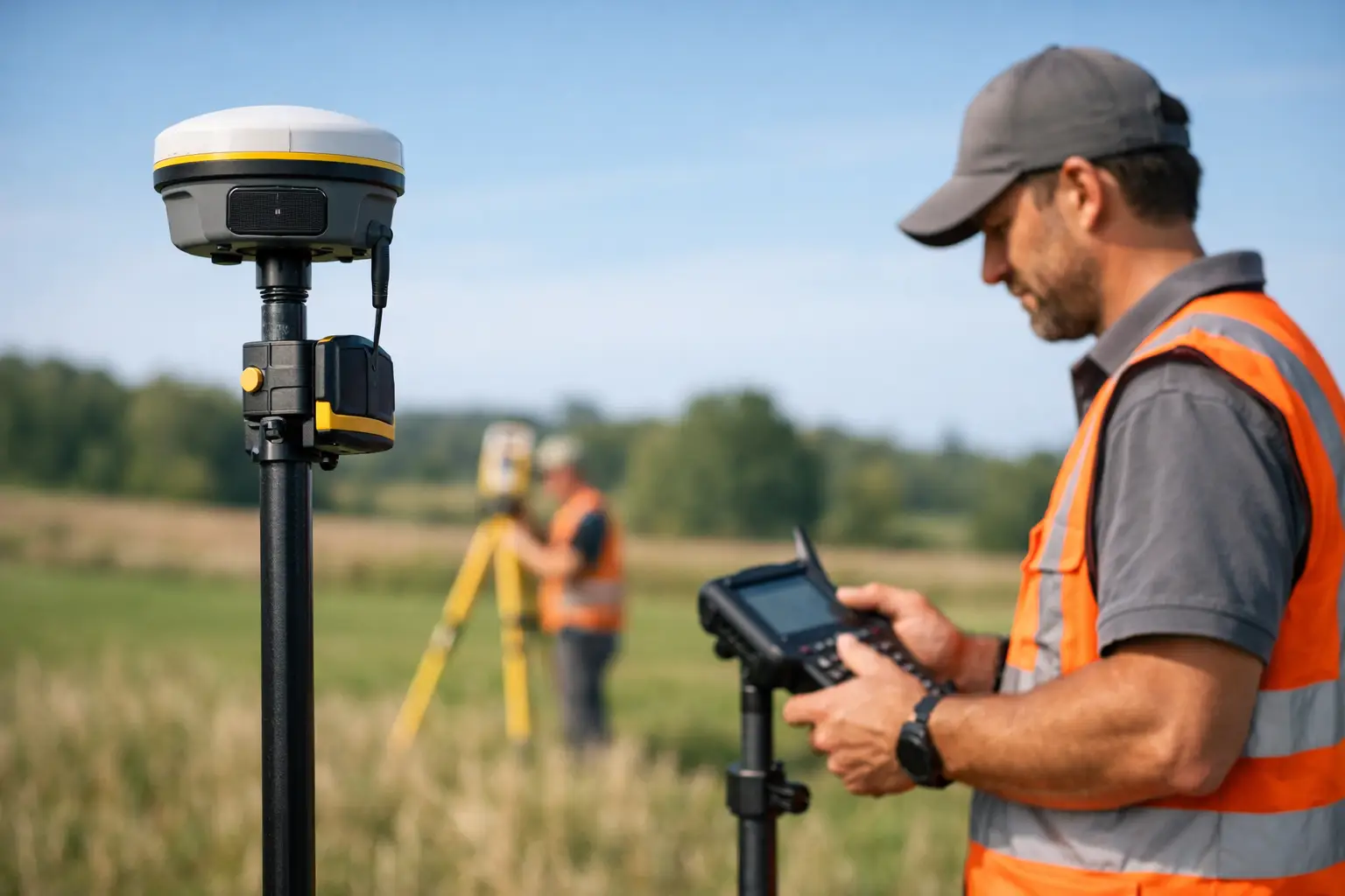
A standard GNSS receiver can place you within a few metres. On a construction set-out, a boundary survey, or a control network check, that margin is nowhere near good enough. When clients ask how does RTK surveying work, they are usually asking a more practical question – how does satellite positioning become precise enough for real survey and engineering decisions?
The short answer is that RTK, or Real-Time Kinematic surveying, improves satellite positioning by applying live correction data from a known point. That lets a rover calculate its position far more accurately than standalone GNSS. In the right conditions, RTK can consistently deliver centimetre-level results, which is why it has become a standard workflow across surveying, civils, utilities, agriculture, and drone operations.
How does RTK surveying work?
RTK surveying works by combining satellite observations from two GNSS receivers. One receiver sits on a known point and acts as the base station. The other is the rover, which moves through the site collecting positions. Because both receivers are observing many of the same satellites at the same time, the system can compare what the rover sees against what the base sees.
The base station already knows its true coordinates. It can therefore work out the errors affecting the GNSS signals at that moment, including satellite orbit uncertainty, clock errors, atmospheric delay, and some local effects. It then sends correction data to the rover in real time, usually by radio or mobile data connection.
The rover uses those corrections to resolve its position much more precisely than it could on its own. Rather than relying only on a broad code-based position, RTK uses carrier phase measurements from the satellite signals. This is where the high accuracy comes from. The system is effectively measuring fractions of the signal wavelength and resolving integer ambiguities to refine the final position.
That is the technical core of RTK. In practical terms, it means your rover is no longer guessing within a few metres. It is calculating a corrected position tied to a known reference, updated live as you work.
The key components in an RTK workflow
An RTK setup is straightforward on paper, but performance depends on each part of the chain working properly.
Base station or correction source
The correction source can be a local base station set up on site or a network RTK service delivered over mobile internet. A local base gives you direct control and can perform very well on contained sites. A network service uses multiple permanent reference stations and computes corrections across a wider area, which is often more convenient for mobile teams covering different locations.
The right choice depends on site size, mobile coverage, required traceability, and whether your team is working repeatedly in the same area.
Rover receiver
The rover is the field unit used to record points, stake out coordinates, or collect topographic data. Modern rovers track multiple constellations such as GPS, GLONASS, Galileo, and BeiDou. More satellites generally improve reliability, especially around obstructions or during challenging sky conditions.
Data link
Corrections must reach the rover quickly and consistently. If that link drops, so does the quality of the RTK fix. UHF radio is common for local base-to-rover setups. NTRIP over 4G or 5G is common for network RTK or internet-connected base stations.
Survey software and control
The software manages coordinate systems, logging, quality checks, stake-out routines, and export. This matters more than many buyers expect. Good hardware with poor configuration can still produce poor outcomes.
Why RTK is more accurate than standard GNSS
Standalone GNSS calculates a position from satellite timing signals, but several error sources affect the result. Satellite clocks are not perfect. Orbits are predicted rather than absolute. Signals slow as they pass through the ionosphere and troposphere. Reflections from buildings, vehicles, and structures can introduce multipath.
RTK improves this because the base station experiences nearly the same satellite and atmospheric conditions as the rover, provided the two are not too far apart. By comparing observations, the system removes much of the common error. The remaining challenge is resolving the carrier phase ambiguities correctly. Once fixed, the rover can report a highly precise position in real time.
That is also why RTK performance is not just about owning a rover. Accuracy depends on baseline length, correction quality, satellite visibility, receiver capability, and operator practice.
What accuracy can you expect?
Under suitable conditions, RTK commonly delivers around 10 to 20 mm horizontal accuracy and 20 to 30 mm vertical accuracy, though this varies by equipment, environment, method, and quality control. Manufacturers may quote similar figures, but field conditions always matter more than brochure numbers.
Open-sky sites with good satellite geometry and a stable correction link usually perform well. Tight urban corridors, steep cuttings, tree cover, heavy plant movement, or reflective surfaces can degrade results. Vertical accuracy is usually less forgiving than horizontal, which is important when setting levels, drainage falls, or finished surfaces.
For that reason, professional users should think in terms of achievable site accuracy rather than ideal laboratory accuracy.
Where RTK works well – and where it does not
RTK is highly effective for topographic surveys, construction set-out, as-built capture, machine control support, ground control for drone surveying, utility mapping, and agricultural guidance. It is fast, efficient, and well suited to projects where teams need accurate coordinates immediately in the field.
It is less effective where satellite visibility is poor or unstable. Dense woodland, urban canyons, tunnels, indoor spaces, and locations with severe multipath can all limit the ability to maintain a fixed solution. In these cases, users may need to switch methods, integrate total station workflows, or use post-processed techniques.
This is one of the key trade-offs. RTK is quick and accurate, but it is still dependent on signal conditions. It is not a universal substitute for every survey instrument on every site.
How does RTK surveying work on a live project?
On a live project, the workflow usually starts with control. If using a local base, the base station is set over a known coordinate or established control point. If using a network correction service, the rover connects through the appropriate mountpoint and coordinate framework.
The operator then initialises the rover, confirms satellite lock, and waits for a fixed RTK solution rather than a float solution. That distinction matters. A fixed solution means the carrier phase ambiguities have been resolved with confidence. A float solution is less certain and generally not suitable for precision work.
Once fixed, the surveyor can begin recording points, checking features, or staking out design coordinates. Good practice includes regular checks against known control, monitoring precision indicators, and being alert to changes in signal quality. If the fix status drops, the operator should stop and verify rather than simply continue logging.
For organisations running multiple field teams, this is where a supported workflow makes the difference. Equipment choice, correction service configuration, training, and data handling all affect whether RTK saves time or creates rework.
Common reasons RTK results go wrong
Most RTK problems are not caused by the concept itself. They come from setup, environment, or process.
Using the wrong coordinate system is a common issue, particularly when moving between grid, local, and site calibration workflows. Poor base setup, unstable poles, inaccurate antenna heights, weak mobile coverage, and inadequate checks can all compromise results. Operators can also place too much trust in a fixed status without considering whether the broader survey control supports it.
There is also a commercial point here. Buying capable GNSS hardware is only part of the decision. Teams also need training, technical support, and a workflow that fits the project environment. That is why many UK organisations work with providers such as LiDAR Tech UK that can support equipment supply, correction-enabled workflows, implementation, and field delivery rather than simply dispatching a box.
RTK versus other high-accuracy methods
RTK is often compared with PPK, static GNSS, and total station surveying. Each has a place.
RTK is strongest when you need immediate coordinates on site. PPK can be advantageous where live corrections are unreliable but raw data can be processed afterwards. Static GNSS is better suited to longer occupation control work. Total stations remain essential where line of sight is available but satellite visibility is poor, or where extremely precise local measurement is required.
For many projects, the best answer is not one method alone. It is a combined workflow built around the site constraints and required deliverable.
If you are assessing RTK for operational use, the real question is not simply whether it works. It is whether the equipment, corrections, support, and survey method are aligned well enough to produce repeatable, defensible results when time and accuracy both matter.