


Plan your field capture
Prepare capture tasks in Model Web before sending your team onsite.

Keep scanning on track
Onscreen guidance helps operators follow the planned capture route.

Record issues where they occur
Link observations to their position in the captured scene.

Add your field observations
Voice notes provide context for colleagues reviewing the survey.

Review the complete project
Bring captured data and observations into Model Web for reporting.

Capture with an integrated system
LiDAR, panoramic cameras and a built-in display support field capture.

See your capture onsite
Review the scan directly on X1’s integrated screen.
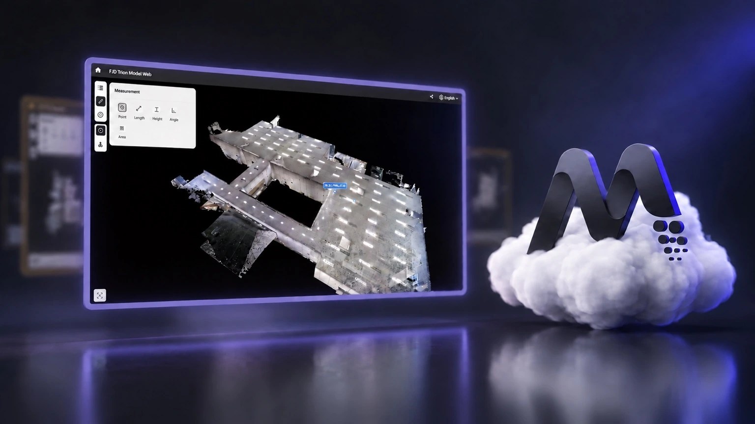
FJD Trion Model Web
Coordinate projects and review captured data in your browser.
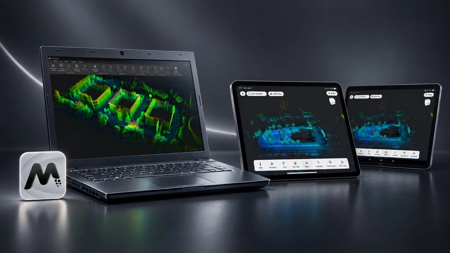
FJD Trion Model
Edit and analyse your point clouds on PC or tablet.
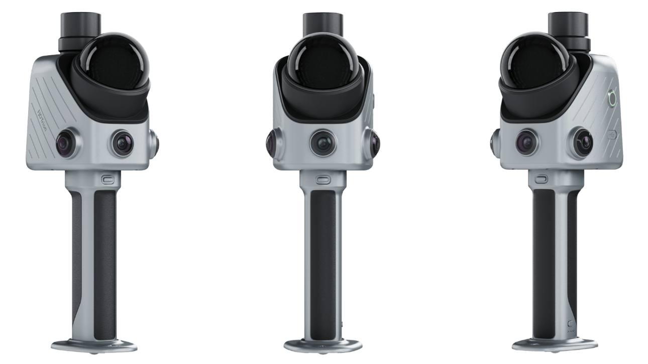
The FJD Trion X1 is a handheld professional 3D LiDAR reality-capture system designed for repeatable field capture across sites and operators. It combines LiDAR, Visual SLAM, panoramic imaging, GNSS support and a built-in OLED display.
Key specifications
- 384,000 points/second
- 40 m at 10% reflectivity; 70 m at 80% reflectivity
- Post-processing accuracy: relative ±1 cm; absolute ±3 cm under specified conditions
- Two 48 MP panoramic cameras plus front camera
- 900 g main unit; approximately 1.3 kg full setup
- Up to 5 hours battery runtime
- LAS, PLY, PTS and E57 point-cloud formats
- IP54
Typical applications
Professional surveying and reality capture, construction documentation, asset records, architecture, infrastructure and repeatable multi-site field workflows.
Official X1 launch resources
FJD Trion X1 is now officially launched. Use the manufacturer resources below to explore the system in more detail, review the official brochure and inspect real sample datasets before deciding whether X1 fits your workflow.
Review X1 sample data
Want to see the output before arranging a demonstration? FJD has provided X1 sample data so surveyors, architects and reality-capture teams can assess the dataset and consider how it will fit their own processing, CAD and BIM workflow.
Why consider the Trion X1?
X1 brings LiDAR, panoramic imaging, Visual SLAM, GNSS support and an integrated display into a compact professional field system. The combination is designed to make repeatable reality capture easier across surveying, construction, architecture, infrastructure and asset-documentation projects.
Need help evaluating the X1? LiDAR Tech UK can help you compare X1 with the P2, S2 and T1, review your required deliverables and arrange a UK demonstration.
Frequently asked questions
What is the FJD Trion X1?
A handheld 3D LiDAR system combining LiDAR scanning, 360-degree imaging, Visual SLAM, GNSS support and guided field workflows.
How accurate is the X1?
FJD specifies post-processed relative accuracy of ±1 cm and absolute accuracy of ±3 cm under specified conditions.
What is the X1 scanning range?
FJD specifies 40 m at 10% reflectivity and 70 m at 80% reflectivity.
Can X1 export standard point-cloud formats?
Yes. Supported point-cloud formats include LAS, PLY, PTS and E57.
What software works with X1?
X1 projects can be processed and managed using FJD Trion Model and Trion Model Web.
Compare the FJD Trion range
Not sure which system best fits your work? Use our FJD Trion LiDAR Scanner Comparison Guide 2026. For building workflows, see LiDAR scanners for architects and measured building surveys and our Scan-to-BIM, Revit & ArchiCAD guide.
