
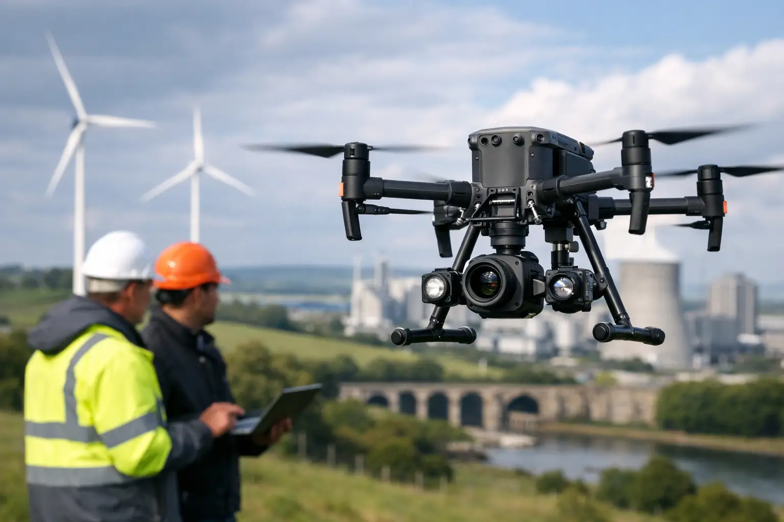
A drone platform is only as useful as the sensor it carries. For a roof survey, a high-resolution visual camera may be sufficient. For an overheating substation component, thermal sensitivity matters more. For a rail corridor, stockpile or complex structure where accurate dimensions are required, LiDAR or survey-grade photogrammetry may be the deciding factor. Selecting the best drone payloads for inspections starts with the defect, measurement or deliverable your team needs to identify.
For UK infrastructure, construction, utilities and asset-management teams, the right payload reduces time at height, limits site access requirements and produces defensible records for maintenance planning. The wrong choice can create attractive imagery that does not answer the engineering question. Payload selection should therefore be tied to inspection criteria, required accuracy, operating environment and the software workflow used after the flight.
The best drone payloads for inspections by application
Thermal and zoom payloads for asset condition surveys
A combined thermal and optical zoom payload is often the most commercially effective option for general infrastructure inspections. It allows the pilot to locate an anomaly thermally, then confirm its physical condition with a detailed RGB image from a safe standoff distance.
This combination is particularly useful for electrical assets, solar farms, roofs, façades, telecoms masts and industrial plant. Thermal imaging can reveal temperature differences associated with loose electrical connections, failing PV modules, blocked pipework, moisture ingress and insulation defects. Optical zoom then provides evidence of corrosion, damaged fittings, missing fixings or surface degradation without positioning the aircraft close to the structure.
The DJI Zenmuse H30T is an example of an enterprise inspection payload designed around this requirement. It combines high-resolution thermal imaging with a wide camera, zoom camera and laser rangefinder in one unit. Its long-range visual capability supports inspections where close approach would be inefficient or unsafe, while the laser rangefinder helps operators establish the position and distance of a point of interest.
Thermal results need careful interpretation. Reflections, solar loading, wind, emissivity and viewing angle can all affect apparent temperatures. A thermal payload is highly capable, but it should support a defined inspection method rather than replace engineering judgement. Repeatable flight timing, appropriate thermal settings and clear acceptance criteria are essential where results will inform maintenance decisions.
High-resolution visual cameras for close visual inspection
For assets where the objective is to document visible condition, a high-resolution RGB camera is usually the correct starting point. These payloads are suited to building envelopes, bridges, towers, roofs, heritage structures, quarries and general construction quality checks.
The key specification is not megapixels alone. Useful inspection imagery depends on sensor size, lens quality, optical zoom, stabilisation and the ability to hold a consistent viewing angle. A camera that captures sharp detail from a sensible stand-off distance is more valuable than one that demands close flight around complex steelwork or fragile structures.
Full-frame photogrammetry payloads, such as the DJI Zenmuse P1, are intended primarily for high-accuracy mapping and modelling rather than live defect inspection. However, they can be highly valuable when an inspection project requires a detailed, measurable visual record of a large asset. Captured imagery can support orthomosaics, textured 3D models and repeat surveys, allowing teams to compare condition across project stages or inspection cycles.
For smaller sites and rapid-response work, an integrated enterprise camera drone may be more practical than a larger interchangeable-payload platform. The DJI Mavic 3 Enterprise range, for example, gives teams a compact route to visual documentation and mapping. The trade-off is payload flexibility: an integrated system cannot be reconfigured for every specialist sensor requirement.
LiDAR payloads for geometry, clearance and inaccessible detail
LiDAR is the preferred payload type when the inspection question depends on geometry rather than surface appearance. It measures large numbers of points in three-dimensional space, producing an accurate point cloud that can be used to model structure, quantify clearance, assess deformation and document difficult terrain.
A drone LiDAR payload such as the DJI Zenmuse L2 is well suited to corridor mapping, powerline surveys, earthworks, vegetation encroachment, quarry faces and complex industrial environments. It is particularly effective where vegetation obscures the ground or where conventional photogrammetry struggles with uniform, reflective or low-texture surfaces.
For inspection teams, the practical value lies in what the point cloud can answer. You can measure distances between conductors and vegetation, calculate volumes, identify encroachments, create sections through embankments or record the position of inaccessible structural elements. LiDAR also supports repeatable comparison when a baseline survey is available.
LiDAR is not automatically the best answer for every asset. It carries a higher investment in equipment, mission planning and data processing, and its output requires competent registration, classification and quality assurance. If the requirement is simply to identify cracked render or a missing roof tile, high-resolution RGB imagery will usually provide a faster and more economical result. Where the requirement is CAD-ready geometry or a reliable 3D record, LiDAR becomes considerably more persuasive.
Multispectral payloads for vegetation and land condition
Multispectral cameras capture reflected light beyond the visible spectrum, helping teams assess vegetation condition over large areas. They are commonly used for agriculture, environmental monitoring, forestry and land management, but they also have inspection value around infrastructure corridors and sites where vegetation creates operational risk.
A multispectral payload can help identify stressed vegetation, map invasive growth and prioritise ground inspection along utility routes. It is not a substitute for LiDAR where clearance measurement is required, nor is it the best tool for structural defects. Its strength is the consistent identification of vegetation patterns that may not be obvious in standard RGB imagery.
Gas detection payloads for specialist industrial work
Gas detection payloads are designed for tightly defined industrial applications, including methane detection around oil, gas and energy infrastructure. They can allow teams to survey potentially hazardous areas without placing personnel in close proximity to suspected leaks.
These sensors should be selected only after confirming sensitivity, detection distance, environmental limitations and reporting requirements. Wind conditions, gas concentration and flight profile have a direct effect on results. For most general inspection programmes, thermal, zoom and LiDAR payloads will deliver broader value, while gas detection is a specialist addition for operators with a clear use case and trained personnel.
Match the payload to the required deliverable
The most efficient procurement decision starts at the end of the workflow. Ask whether the output needs to be a visual report, annotated thermal images, a maintenance priority list, an orthomosaic, a 3D mesh, a classified point cloud or measured CAD data. Each output places different demands on the sensor, aircraft, GNSS correction service and processing software.
A visual and thermal report may be produced quickly from an enterprise inspection drone with the right flight procedure. A survey-grade point cloud requires more than a LiDAR sensor: it also needs suitable RTK positioning, control methodology where appropriate, accurate trajectory processing and a quality-assured data workflow. The payload is one element of a complete system.
Platform compatibility also matters. Larger enterprise aircraft such as the DJI Matrice 350 RTK support interchangeable payloads and are often the right choice for organisations managing varied inspection programmes. A single platform can carry thermal, zoom, LiDAR or photogrammetry sensors as requirements change. This flexibility improves long-term capability, although it comes with higher training, transport and operational demands than a compact drone.
Inspection factors that affect payload performance
Payload specifications should be assessed against real operating conditions, not only brochure figures. Flight endurance falls when carrying heavier sensors, operating in cold weather or flying in wind. Zoom images may be affected by haze, vibration and poor light. Thermal results can be misleading when an asset is wet, sun-heated or viewed at an unsuitable angle.
For survey and LiDAR work, GNSS reliability is equally relevant. Sites near buildings, structures, woodland or steep terrain may experience satellite obstruction and multipath effects. An RTK workflow, suitable correction service and a sensible approach to control points help maintain confidence in positional results.
Data volume is another commercial consideration. A short thermal inspection can produce a manageable set of images. A LiDAR or high-resolution photogrammetry mission can generate substantial datasets that require storage, capable processing hardware and trained staff. Teams should budget for the complete workflow, including processing time and deliverable review, rather than only the aircraft and sensor.
Choosing a system that will remain useful
The best drone payload is rarely the one with the longest specification sheet. It is the one that produces reliable information for a defined maintenance, survey or compliance decision at a sensible cost per inspection.
For broad asset-condition work, thermal and optical zoom capability is often the strongest first investment. For measurement-led projects, terrain, corridor and 3D modelling work, LiDAR or a high-resolution photogrammetry payload may provide more lasting value. Organisations with mixed requirements should consider an enterprise platform that can accept several payloads as their inspection programme develops.
LiDAR Tech UK can help teams assess aircraft, payload, RTK and processing requirements together, with equipment supply, training and project support aligned to the required data outcome. A practical demonstration using your own asset type is often the clearest way to confirm whether a payload will produce the evidence your inspection programme needs.