
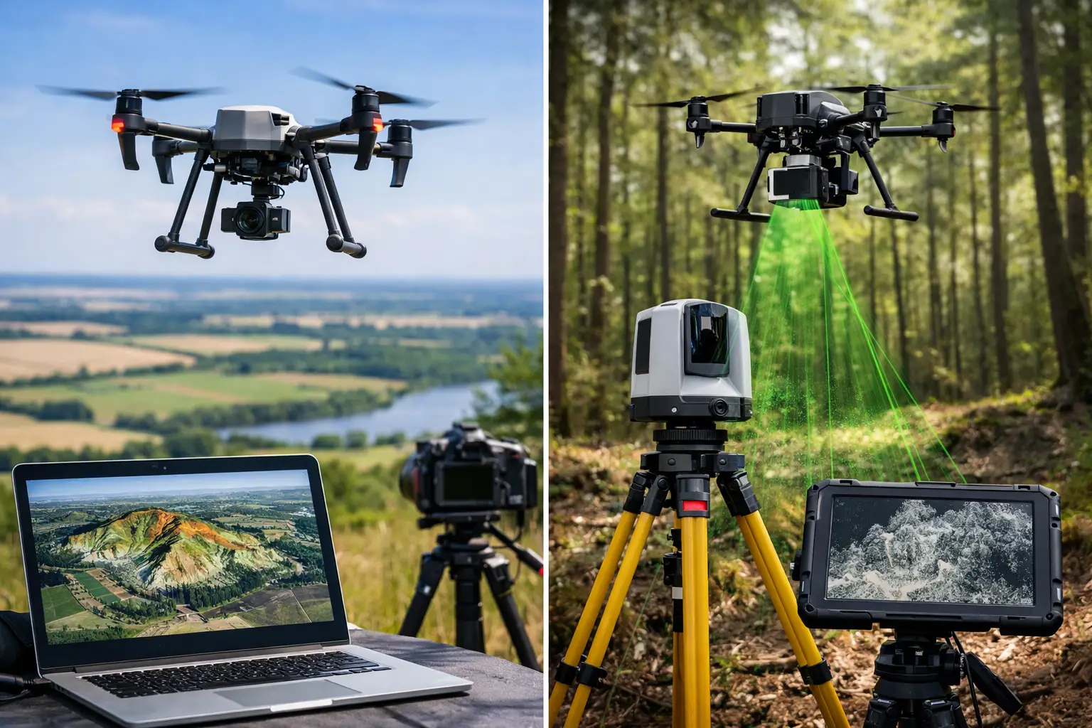
A proposed route through dense summer vegetation, an earthworks stockpile requiring weekly volumes, and a heritage façade all call for aerial data – but not necessarily the same sensor. Drone photogrammetry versus lidar is not a question of which technology is better in general. It is a specification decision shaped by surface visibility, required accuracy, deliverables, programme, and the commercial cost of getting the wrong dataset.
For UK survey, construction and asset-management teams, both methods can reduce time on site and improve coverage in difficult or hazardous areas. The distinction is in how they measure the environment and what they can reliably reveal.
Drone Photogrammetry Versus LiDAR: The Core Difference
Drone photogrammetry creates measurement from overlapping photographs. Processing software identifies matching points across many images, reconstructs the scene in three dimensions, and produces outputs such as orthomosaics, dense point clouds, digital surface models, meshes and textured 3D models. It performs best where surfaces are clearly visible and have sufficient visual texture.
Airborne LiDAR uses laser pulses rather than image matching. A LiDAR sensor records the time taken for each pulse to return from a surface, while GNSS, RTK or PPK positioning and an inertial measurement unit establish the sensor’s position and orientation. The result is a georeferenced point cloud with direct range measurements.
This difference matters most when the ground is hidden. Photogrammetry generally models the top of vegetation, whereas LiDAR can record multiple returns from foliage, branches and the ground beneath. It does not see through every canopy, but a sufficiently dense LiDAR survey often delivers a far more useful terrain model in woodland, scrub and overgrown corridors.
Where Drone Photogrammetry Delivers the Strongest Value
Photogrammetry is often the right commercial choice for open, visible sites. A planned flight can capture a large area efficiently, and the imagery itself becomes a valuable deliverable for teams that need an up-to-date visual record as well as measured data.
On construction sites, quarries, landfill operations and open agricultural land, photogrammetry supports topographic mapping, progress monitoring and stockpile measurement. Orthomosaic imagery is particularly useful for communicating conditions to project managers, planners and clients who may not work directly in point-cloud software. A textured mesh can also provide an intuitive model for façade assessments, roofs, structures and heritage documentation.
Image resolution can be extremely high when the drone is flown at an appropriate height with a suitable camera. That makes photogrammetry effective for documenting surface detail such as cracking, material changes, kerbs, drainage features and visible defects. However, visual detail is not the same as survey certainty. Poor image overlap, moving vegetation, reflective surfaces, repetitive patterns, shadows and low-light conditions can all reduce reconstruction quality.
For measured outputs, RTK-enabled drones can improve positional consistency, but ground control and independent checkpoints remain central to a defensible workflow. Surveyors should assess final accuracy against the required specification rather than relying on a drone’s published positioning capability alone.
When Airborne LiDAR Is the Better Survey Tool
LiDAR earns its place where access, vegetation and geometry make image-based reconstruction less dependable. Linear infrastructure is a common example. Rail, highways, pipelines, transmission routes and watercourses often pass through vegetation and inaccessible terrain, where a ground-level digital terrain model is more valuable than an attractive aerial image.
The technology is also well suited to complex industrial sites and structures with limited texture or demanding geometry. LiDAR point clouds can capture fine spatial form without depending on matching visual features from one photograph to the next. This can be advantageous around embankments, cuttings, bridges, retaining walls and assets with shaded or uniform surfaces.
LiDAR is not a replacement for photographs. The point cloud may be colourised using an integrated camera, but it will not normally provide the same visual richness as a high-resolution photogrammetric orthomosaic or textured mesh. For condition reporting where visible surface appearance matters, imagery may still be required alongside laser data.
LiDAR survey quality also depends on far more than the scanner’s stated range. Pulse rate, scan pattern, field of view, flight height, speed, overlap, GNSS corrections, IMU performance and processing all affect point density and positional confidence. Tree cover can reduce the number of ground returns, particularly in leaf-on conditions. A pre-survey assessment should establish whether the intended point density and ground classification result are achievable for the site.
Accuracy Is a Workflow, Not a Sensor Claim
Both approaches can support accurate, CAD-ready survey outputs when they are planned and controlled correctly. Neither should be selected from a headline accuracy figure in isolation.
Photogrammetry has the advantage of producing large volumes of image detail, but its accuracy can be affected by camera calibration, image geometry and weak control. LiDAR offers direct distance measurements, yet it requires rigorous trajectory processing and calibration between the GNSS, IMU and scanner. In either case, poor GNSS correction data, unsuitable control distribution or inadequate validation can undermine an otherwise capable system.
The practical question is not whether a platform can achieve a particular figure under ideal conditions. It is whether the complete field and processing workflow can meet the project’s required horizontal and vertical tolerances, with independent checks to demonstrate it.
For many topographic and earthworks applications, a well-executed photogrammetry survey will meet the requirement at lower sensor cost. For vegetation-covered terrain or complex assets, LiDAR may prevent expensive follow-up visits and manual infill work. That can make the higher mobilisation cost the more economical decision.
Compare the Outputs Before Choosing the Capture Method
The required deliverable should lead the sensor decision. If the client needs a current, high-resolution map of an open site, an orthomosaic and surface model from photogrammetry may be ideal. If they need levels beneath scrub for a design model, a classified LiDAR point cloud and digital terrain model are more likely to be fit for purpose.
For asset inspection, the answer may be a combined workflow. Photogrammetry can provide visual context and a detailed textured model, while LiDAR supplies reliable geometry for clearance analysis, deformation assessment or integration with existing engineering datasets. The same principle applies to heritage work, where texture, colour and accurate form can all matter.
Ask early whether the output must be a point cloud, contour plan, digital terrain model, digital surface model, mesh, orthomosaic, volume report or CAD drawing. Also establish coordinate system requirements, classification standards, expected point density, tolerances and the software environment in which the client will use the data. These decisions prevent a technically impressive survey from becoming an operationally awkward deliverable.
Cost, Speed and Site Conditions
Photogrammetry systems are typically more accessible to deploy, and data capture can be rapid over open ground. Processing can be computationally intensive, especially for dense reconstructions, but the workflow is familiar to many survey and construction teams.
LiDAR payloads carry a higher equipment and processing cost, and specialist capability is needed to manage trajectory quality, calibration and classification. However, the field programme may be substantially shorter than a conventional survey where terrain is unsafe, steep, obstructed or heavily vegetated. LiDAR can also reduce the need to return when the initial requirement is a terrain model rather than a surface model.
Weather and operating conditions influence both methods. Photogrammetry relies on usable light and stable imagery, so shadows, low sun, rain and wind deserve careful consideration. LiDAR is less dependent on daylight, but rain, mist and wet surfaces can affect returns and data quality. Safe flight planning, airspace checks, competent operators and appropriate permissions remain non-negotiable for either method.
A Practical Specification Approach
Start with the site, not the aircraft. Open ground with a need for visual reporting points towards photogrammetry. Vegetated terrain, corridor mapping and ground-model requirements point towards LiDAR. Where the project needs both visual interpretation and precise geometry, specify the two datasets together rather than forcing one sensor to do both jobs.
LiDAR Tech UK supports professional teams with enterprise drone systems, LiDAR and photogrammetry workflows, positioning equipment, training and survey deliverables. The useful conversation is not simply which payload to buy. It is how to build a repeatable capture-to-output process that meets the accuracy, programme and commercial demands of your work.
Before the next survey is commissioned, define the decisions the data must support and validate the proposed method against a representative site condition. That small step is often what separates a fast flight from a dependable survey result.