
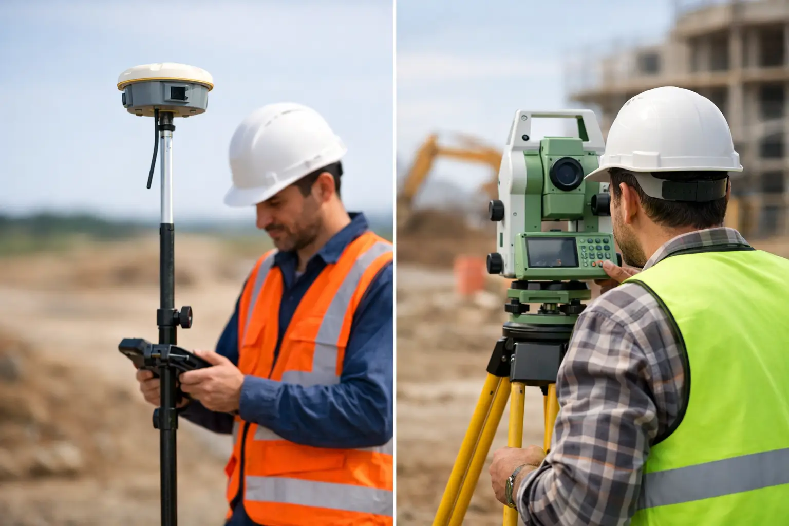
A setting-out team is delayed because a retaining wall blocks satellite visibility. On another part of the same project, a surveyor spends hours moving a total station between control points across open ground. This is where the GNSS versus total station decision becomes operational rather than theoretical. Both technologies can deliver highly reliable survey data, but they work differently, carry different constraints and suit different stages of a project.
For UK survey, construction and engineering teams, the best choice is rarely about replacing one instrument with another. It is about selecting the method that provides the required accuracy, coverage and productivity in the conditions actually present on site.
GNSS versus total station: the practical difference
A GNSS rover calculates its position from satellite signals, usually enhanced by RTK corrections from a local base station or network correction service. With a clear view of the sky and a dependable correction source, it can provide centimetre-level coordinates quickly over a large area. The operator can work independently, moving directly between points without establishing line of sight to an instrument.
A total station measures angles and distances from a known occupied point to a prism, or in some cases to a reflectorless target. It works within a local coordinate framework and does not depend on satellite reception. Its principal requirement is clear line of sight between the instrument and the target.
That difference shapes almost every field decision. GNSS is generally faster for open-site control, topographic work and large-area point collection. A total station remains highly effective where satellite signals are obstructed, where very precise local setting out is required, or where vertical and horizontal measurements must be maintained within a tightly controlled site grid.
Accuracy: specify the result, not the instrument
It is misleading to describe one technology as simply more accurate than the other. Accuracy depends on the measurement method, control arrangement, site environment, instrument quality, operator procedure and the tolerances required by the task.
An RTK GNSS system commonly supports centimetre-level work when it has good satellite geometry, stable corrections and minimal multipath. Multipath occurs when signals reflect from nearby buildings, metalwork, vehicles or water before reaching the antenna. Tree canopy and urban obstruction can also reduce reliability or prevent a fixed solution altogether.
A properly established total station can achieve millimetre-level angular and distance observations over appropriate ranges. This makes it a strong choice for structural set-out, steelwork, foundations, formwork, rail alignment, monitoring and detail survey in obstructed environments. The achievable site accuracy still depends on control quality, centring, prism handling, atmospheric conditions and sound checking procedures.
The key question is not whether GNSS or a total station is accurate. It is whether the complete workflow can demonstrate the accuracy your deliverable requires. For an earthworks volume survey, centimetre-level GNSS may be entirely appropriate. For bolt positions, structural interfaces or machine alignment, a total station may be the more defensible method.
Vertical accuracy needs particular attention
Heights are often where teams discover the limits of an assumed workflow. GNSS ellipsoidal heights must be converted using an appropriate geoid model, and the resulting levels should be checked against known benchmarks. This is especially relevant when working to a project datum or where drainage, formation levels and construction tolerances are involved.
Total stations measure vertical geometry directly from a known control point, but they too require careful instrument height, prism height and benchmark verification. Neither instrument removes the need for a controlled survey procedure.
Where GNSS delivers the greatest return
GNSS is particularly productive on open sites where points are spread over a wide area. The lack of line-of-sight requirements means one operative can collect observations efficiently without repeated instrument moves or a second person holding a prism.
Typical applications include topographic surveys, site control extension, earthworks checks, stockpile volumes, utilities asset capture, agricultural mapping, boundary reconnaissance and as-built surveys across open developments. It is also useful for establishing georeferenced ground control for drone photogrammetry and LiDAR surveys.
Its commercial advantage is coverage. A surveyor can walk directly to a required point, record an attributed observation and move on. On a highway corridor, solar farm, quarry, housing development or agricultural estate, that can materially reduce time on site.
GNSS also supports an efficient digital workflow. Field software can display CAD linework, design points, background mapping and live positional guidance. For contractors, this can speed up setting out and reduce avoidable rework, provided the design data, coordinate reference system and datum have been checked before work begins.
However, GNSS performance degrades in dense urban areas, beneath heavy canopy, close to tall structures and around reflective surfaces. A rover may still display a position, but the operator must assess solution status, estimated precision and the surrounding environment rather than accepting every coordinate at face value.
Where a total station remains essential
A total station is not legacy equipment. On many sites, it is the most controlled and efficient answer to the task.
Use cases include basement works, enclosed compounds, internal surveys, rail environments, bridges, tunnels, industrial facilities and city-centre developments. It is also often the preferred instrument where satellite visibility changes through the day or where a local site grid must be maintained independently of GNSS corrections.
For construction setting out, a robotic total station can provide substantial productivity gains. One operator can control the instrument remotely, locate points against design data and record as-built observations. The benefit is especially clear when setting out repeated locations with tight tolerances, such as pile caps, columns, kerbs, drainage runs or structural elements.
Reflectorless measurement can also capture inaccessible features, though it should be applied with care. Surface material, angle of incidence, range and target definition affect reflectorless results. A prism remains the preferred option where the highest confidence is needed.
The trade-off is field logistics. The total station must be set up over known control, oriented correctly and moved when line of sight is lost. On larger open sites, this can be slower than GNSS. It may also require a two-person team where robotic operation is not practical or available.
Site conditions that should drive the choice
Before mobilising, assess the site rather than defaulting to familiar equipment. Satellite visibility, control availability, required tolerances, point density, access and programme all matter.
GNSS is usually the efficient first option when the site is open, coordinates are required over a broad area and centimetre-level results meet the specification. It is well suited to rapid capture and control tasks where the operator can maintain a fixed RTK solution and validate work against known points.
A total station is generally the safer option where visibility to the sky is constrained, precise local geometry is critical or the work occurs beneath structures, near façades or inside buildings. It is also valuable where the client needs a clear observational chain back to established site control.
For difficult ground, the answer is often both. GNSS can establish or extend control across open areas, support rapid topographic collection and georeference the wider project. A total station can then complete work around structures, under canopy and within tolerance-sensitive construction zones. This combined approach reduces the compromise inherent in relying on either method alone.
Control, calibration and competence determine the outcome
High-quality hardware does not compensate for weak control. Before setting out or collecting survey-grade data, confirm the coordinate system, transformation parameters, site datum and benchmark values. Check GNSS observations on independent known points. For a total station, verify collimation, compensator performance, tribrach condition and orientation against known control.
Field checks should be planned, not treated as an afterthought. Re-observe selected points, compare against independent control and investigate differences beyond the project tolerance. Record instrument heights, prism heights, solution status and any environmental factors that could affect the result.
Training matters just as much as specification. A team that understands RTK fix quality, geoid settings, localisations, resection quality and total station checks will produce more reliable data and identify problems before they affect construction or deliverables.
Choosing equipment for your workflow
When comparing GNSS and total station equipment, consider more than headline accuracy. Assess the correction service options, field software, controller usability, battery strategy, data export formats, support provision and integration with CAD, machine control, drones or LiDAR workflows.
For organisations building an in-house capability, the strongest investment is often a connected survey workflow rather than an isolated instrument purchase. LiDAR Tech UK supports professional GNSS, RTK, LiDAR and drone systems alongside training, technical support and survey delivery, helping teams match the equipment and process to their actual project requirements.
Start with the tolerance, site environment and required deliverable. A short technical review before purchase or mobilisation can prevent a far more expensive issue later: collecting data that looks complete but cannot support the decisions built on it.