
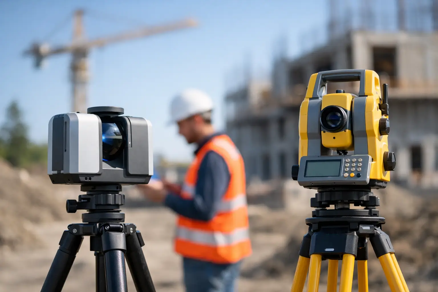
A survey team setting out steelwork, boundaries or precise drainage levels needs defensible control at known points. A team documenting a congested plant room, carriageway corridor or heritage façade needs complete spatial coverage before site access changes. Those are different capture problems, which is why the question, can LiDAR scanning replace total stations, has no single yes-or-no answer.
LiDAR can reduce field time dramatically and deliver a far richer record than measured points alone. Total stations remain exceptionally effective where millimetre-level point accuracy, setting out, or tightly controlled observations are the priority. For many UK projects, the most productive approach is not replacement but a combined workflow: establish control with GNSS and/or a total station, then capture the wider environment with LiDAR.
Can LiDAR scanning replace total stations on every job?
No. LiDAR scanning can replace a substantial proportion of conventional total station observations on as-built, topographic, asset and reality-capture work, particularly where thousands of points would otherwise be measured individually. It does not automatically replace the survey control, verification and precise set-out functions a total station performs.
A total station measures discrete points with a known instrument position, a controlled backsight and a clear line of sight to the prism or reflectorless target. It is designed for repeatable, high-precision coordinate work. This makes it well suited to construction setting out, deformation monitoring, boundary evidence, precise rail and highway observations, and detail surveys where individual features must be measured to a stated tolerance.
LiDAR measures large numbers of points rapidly to create a point cloud. Mobile, handheld and terrestrial systems can record floors, walls, kerbs, structures, vegetation and complex assets in a single pass. The result is not merely a list of surveyed coordinates, but a spatial dataset that can be revisited in processing. That difference changes the value of the survey, especially when the client may later ask for additional sections, elevations, clearance checks or BIM content.
The key distinction is simple: total stations excel at controlled, precise points; LiDAR excels at efficient, comprehensive context.
Where LiDAR delivers a clear operational advantage
LiDAR is particularly compelling when site conditions make point-by-point measurement slow, disruptive or unsafe. A scanner can capture a dense record of an industrial facility, stockpile yard, road corridor or existing building in minutes or hours rather than days of selective observations. It can also reduce the need for return visits when a missed feature becomes relevant during design.
For as-built surveys, refurbishment planning and clash investigations, point-cloud coverage is often more valuable than a limited set of conventional shots. Design teams can inspect dimensions remotely, extract profiles and generate 2D drawings or 3D models from the same dataset. Facilities and asset-management teams gain a visual record that supports future maintenance, rather than a drawing showing only what was requested at the time.
LiDAR also improves access to areas that are difficult to measure safely. This includes high-level structures, congested service areas, unstable ground, live operational sites and locations with restricted working windows. It does not remove the need for a safe system of work, but it can reduce exposure by limiting the time operators spend close to hazards.
Speed is not only about field capture. A well-planned LiDAR workflow can shorten the path from site visit to deliverable because the source data supports multiple outputs. Topographic plans, orthographic imagery, elevations, mesh models, volumes and CAD-ready feature extraction can be produced from a common controlled dataset. The saving is strongest where the alternative would involve returning to site to collect more detail.
Accuracy depends on the system and the workflow
It is misleading to compare LiDAR and total stations by quoting one generic accuracy figure. Accuracy depends on the scanner, range, scanning method, GNSS correction quality, control layout, environmental conditions, registration process and quality assurance procedures.
A total station used correctly can provide very high accuracy for individual points. It remains the preferred instrument where project tolerances are at the millimetre level or where legal, contractual or engineering controls demand a traceable observation process. On construction sites, it is indispensable for setting out positions, lines, levels and reference marks.
Modern LiDAR systems can achieve highly useful survey-grade results, but field claims must be assessed against the required deliverable tolerance. A handheld SLAM LiDAR scanner, for example, can collect extensive data quickly indoors or beneath canopy where GNSS is unavailable. However, cumulative drift, limited loop closure, reflective surfaces, feature-poor corridors and poor route planning can affect the final cloud. Ground control and independent check points are therefore essential when coordinates and accuracy matter.
Terrestrial laser scanners can offer stronger geometric performance for static work, while mobile LiDAR offers excellent productivity over larger or more complex sites. Drone LiDAR can add efficient coverage across corridors, embankments, quarries, woodland and inaccessible terrain, provided flight planning, control and classification are managed properly. Each method has a role, but none should be selected on headline specification alone.
Control turns fast capture into reliable survey data
Control is the bridge between LiDAR productivity and professional survey deliverables. A project may begin with GNSS/RTK observations to establish site control, followed by total station work where GNSS visibility is poor or tighter local precision is needed. The LiDAR data can then be registered to that control and tested against independent check points.
This approach gives the client both coverage and confidence. It also creates a transparent quality process: known control coordinates, documented residuals, check-point results and a stated datum, projection and height reference. For engineering and construction users, those details matter more than a visually impressive point cloud.
Where total stations remain the better choice
There are applications where a total station should remain the primary tool. Construction set-out is the clearest example. Setting bolt positions, pile locations, kerb lines, structural grids and finished levels requires precise transfer of design coordinates to the ground. LiDAR can verify the completed work, but it is not normally the first choice for placing it.
Monitoring is another. When movement must be detected over time, consistent observations to prisms or defined targets provide a controlled and repeatable method. LiDAR can identify wider surface change and deformation patterns, but total stations offer a stronger route for high-precision target monitoring.
Small surveys can also favour conventional methods. If a surveyor needs ten accurately located points around a straightforward feature, opening a scanner, planning a capture route, registering data and processing a cloud may not be more efficient. The right tool is the one that produces the required answer with appropriate certainty and cost.
Line-of-sight constraints still apply to LiDAR. The scanner cannot record what the laser cannot reach. Dense vegetation, parked vehicles, machinery, stored materials and occluded building features create gaps. Multiple scan positions or passes improve coverage, but they add capture and processing time. Total station observations can sometimes target a specific accessible point more directly.
Selecting the right workflow for UK survey projects
The starting point should be the deliverable, not the instrument. Ask what the client needs to make a decision: a setting-out coordinate, a topographic plan, a measured building survey, a volume calculation, a 3D model, or an enduring asset record. Then define the tolerance, coordinate reference system, site constraints and programme.
LiDAR is usually the stronger primary capture method when completeness, speed and repeat use of the data are valuable. It is highly effective for existing-condition surveys, property and heritage documentation, MEP coordination, utilities environments, infrastructure assets, stockpile volumes and complex topography. A total station remains central when discrete precision, set-out or formal control observations drive the scope.
Many organisations now benefit from equipping field teams with both capabilities. A GNSS/RTK rover provides rapid control and open-sky positioning. A total station supports precise local observations and set-out. LiDAR captures the detail between those control points at scale. This integrated method reduces manual observation time without weakening survey discipline.
The processing workflow deserves equal attention. Point-cloud registration, cleaning, classification, georeferencing and feature extraction require competent operators and software suited to the intended output. A poor registration can undermine an otherwise excellent capture, while an unverified cloud can create false confidence. Training, field procedures and quality checks should be included in the equipment decision, not treated as an afterthought.
A practical decision for survey and construction teams
LiDAR should not be bought as a total station substitute simply because it is faster. It should be adopted where richer site data, reduced access time and repeatable digital deliverables improve the commercial outcome. Conversely, relying on LiDAR alone for millimetre-critical set-out or monitoring can introduce unnecessary risk.
LiDAR Tech UK helps organisations assess the right mix of LiDAR scanning, GNSS/RTK and conventional survey control for their working environment and required outputs. The most effective deployment begins with a representative site and a clear accuracy test, rather than an assumption based on a brochure specification.
For your next project, define the tolerances and deliverables first, capture independent check points from the outset, and choose the technology that gives the field team enough control as well as enough coverage.