
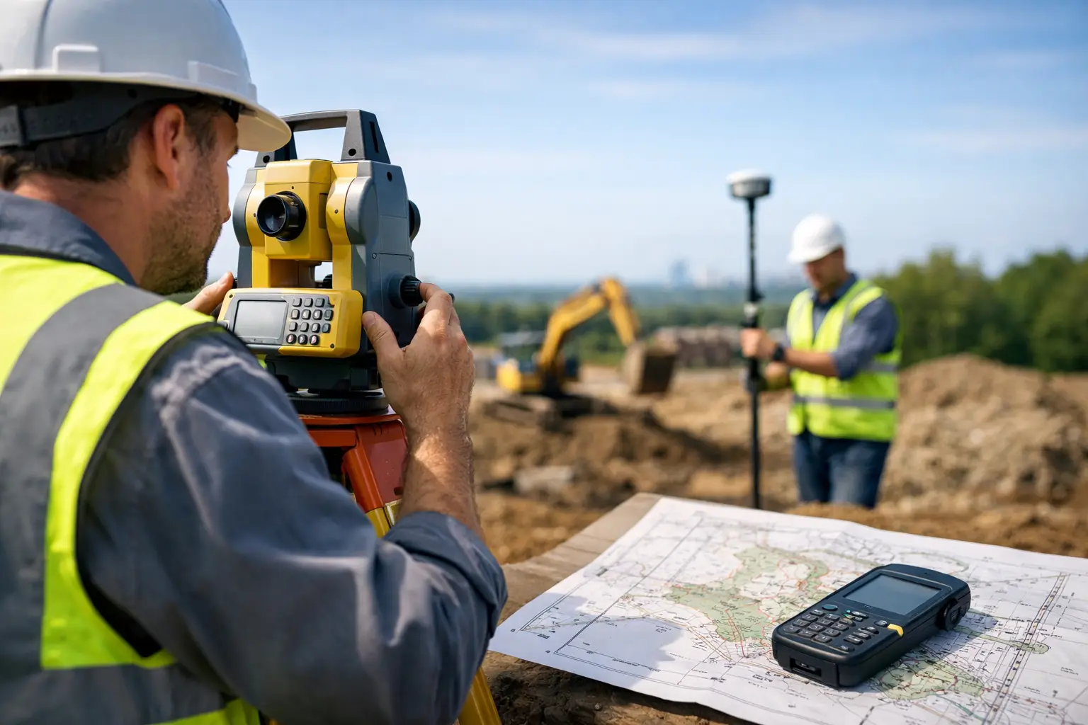
A design team can only work as accurately as the existing-condition data placed beneath its drawings. A missed retaining wall, an incorrect invert level or a poorly defined boundary can trigger redesign, delay site operations and create avoidable commercial risk. Professional land surveying services establish a dependable spatial record before those decisions are made.
For construction, civil engineering, utilities, land development and asset-management teams, the requirement is rarely just a set of points. The useful outcome is survey data at the right accuracy, in the right coordinate system and delivered in a format that supports the next stage of work. That may mean a CAD topographical survey for design, a georeferenced point cloud for modelling, an orthomosaic for site planning or verified levels for earthworks control.
What land surveying services need to deliver
A survey should answer a defined operational question. On a proposed development, this may be the position and level of surface features, buildings, boundaries, drainage covers, vegetation and changes in terrain. On an infrastructure corridor, the priority may shift to access routes, embankments, structures, clearances and condition information. For an estate or utility owner, asset identification and a repeatable record may be more valuable than a conventional drawing alone.
The specification therefore matters as much as the equipment. Survey control, coordinate reference system, feature coding, linework detail, required tolerances and final file format should be agreed before fieldwork begins. A high-density scan is not automatically the right answer if the project requires a clear, controlled 2D base plan. Equally, a sparse topographical survey may be inadequate where designers need to understand complex façades, plant areas or irregular ground conditions.
Typical deliverables include:
- Topographical surveys in CAD-ready formats, with agreed layers, feature codes and levels.
- Georeferenced point clouds for design coordination, measurement and 3D modelling.
- Digital terrain models, contours and volume calculations for planning and earthworks.
- Orthomosaic imagery and photogrammetric models for large sites and visual records.
- Asset schedules and condition-related spatial data for inspection and maintenance planning.
The most effective surveys combine these outputs only where they add value. More data can increase processing, storage and review time, so the goal is not maximum capture. It is usable information with known accuracy.
Selecting the right survey method for the site
Traditional GNSS and total-station workflows remain essential where controlled points, precise breaklines, detailed feature pickup and reliable level information are required. RTK GNSS is particularly effective in open environments, enabling survey teams to establish and capture coordinates efficiently against a suitable correction service or site control network.
Its limitations must be recognised. Tree cover, tall structures, narrow streets, deep cuttings and reflective surfaces can affect satellite visibility or signal quality. In these locations, a survey method that relies solely on GNSS may not provide the required confidence. A competent survey plan accounts for obstructed areas, independent checks and the control needed to join different datasets accurately.
Mobile LiDAR is well suited to collecting dense spatial data across complex sites. A handheld or vehicle-mounted system can rapidly capture building interiors, external structures, stockpiles, corridors and difficult terrain, producing a detailed point cloud that supports measurement and modelling. It can reduce time spent in exposed or inaccessible areas, particularly when paired with suitable control and a defined processing workflow.
However, LiDAR does not remove the need for survey discipline. Point-cloud accuracy depends on sensor performance, trajectory quality, field technique, control strategy and registration. Dense data can also obscure the features a client actually needs unless it is classified, checked and converted into an agreed deliverable. For design purposes, the distinction between a visually convincing scan and an accurately controlled survey is commercially significant.
Enterprise drones add another capability for larger sites, quarries, roof areas, embankments and inspections where ground access is slow or unsafe. Drone photogrammetry can provide high-resolution imagery, surface models and measurable orthomosaics. Drone LiDAR can improve vegetation penetration and terrain capture in certain environments. The appropriate option depends on ground cover, required accuracy, airspace constraints, weather, site permissions and the nature of the output.
Control and accuracy are not optional extras
A survey dataset is only dependable when its position can be understood and verified. This is why survey control is central to professional land surveying services. Control points connect field observations to a known reference framework and allow results from GNSS, total stations, LiDAR scanners and drone platforms to be checked against each other.
For UK projects, teams should establish whether data needs to relate to the National Grid, Ordnance Datum Newlyn, a local grid or an existing project coordinate system. A mismatch can cause serious problems when incoming survey data is overlaid with design models, utility information or previous phases of work. It may be technically possible to transform data later, but doing so without clear documentation introduces unnecessary uncertainty.
Accuracy requirements also vary by application. Early feasibility work may accept a lower level of detail than setting out, drainage design, legal boundary work or structural coordination. It is better to state the required tolerance and intended use at the outset than to assume that every survey is suitable for every downstream task.
Quality assurance should include field checks, independent validation points, metadata on coordinate systems and a review of anomalies before issue. The final drawing or model should make clear what has been surveyed, what has been interpreted and which areas could not be observed safely or directly. This clarity helps designers and project managers make informed decisions rather than treating a survey as an infallible record.
Planning surveys around operational risk
The fastest field method is not always the most efficient project solution. A busy live site may require phased capture around vehicle movements, permits, inductions and restricted work zones. Rail, highways, utilities and industrial facilities often require additional access planning, safety controls and coordination with site representatives.
Early communication prevents wasted mobilisation. Surveyors need to know the project boundary, access arrangements, known hazards, required outputs, programme deadlines and whether information such as existing drawings, control records or utility plans is available. The client also benefits from knowing where survey teams need clear access and whether vegetation, parked plant or stored materials could obstruct key areas.
For repeat work, a structured capture approach can improve consistency. The same control framework, feature definitions and asset identifiers make it easier to compare sites, monitor change and integrate new data into established GIS, CAD or asset-management systems. This is particularly useful for local authorities, estates, contractors and infrastructure operators managing large portfolios.
From field capture to usable design data
Field capture is only one part of the service. Processing converts observations into information that engineering, planning and operational teams can use. This may involve point-cloud registration, noise reduction, classification, feature extraction, terrain modelling, CAD drafting, photogrammetric processing or conversion to client-specified formats.
The right level of processing depends on the intended workflow. A modeller may need an E57 or LAS point cloud with control information. A civil engineer may need a DWG with 3D breaklines, spot levels and a clearly defined survey boundary. A project manager may require a visual site model and quantities. Supplying every possible file can create confusion, while supplying only a PDF can force costly rework.
LiDAR Tech UK supports this end-to-end approach through professional field capture, LiDAR, GNSS and drone capability, processing expertise and outputs configured for practical project use. For clients building their own capacity, the same understanding also informs equipment selection, implementation and operator training.
When to appoint a specialist survey provider
Outsourced survey support is particularly valuable when deadlines are tight, sites are complex, specialist capture technology is needed or internal teams need independent data for design assurance. It is also a practical option for one-off projects where purchasing equipment, training operators and establishing processing procedures would not be commercially justified.
When assessing a provider, look beyond the sensor specification. Ask how control will be established, what accuracy is achievable in the site conditions, how data will be checked, which formats will be issued and who will be available if the design team needs clarification. A clear scope, documented methodology and responsive technical contact are often more valuable than a headline capture rate.
Accurate site information gives project teams a firmer basis for design, pricing and safe delivery. Start by defining the decision the survey must support, then specify the data, control and outputs needed to support it with confidence.