
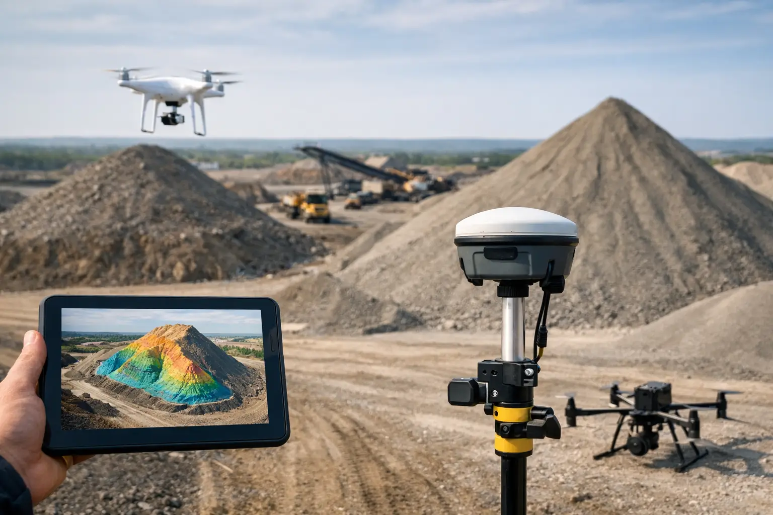
Stockpile figures often look straightforward until they are challenged. A few per cent variance in volume can affect valuation, production reporting, contractor payment and site planning. That is why understanding how to map stockpiles accurately matters far beyond the survey team. It affects commercial decisions, operational timing and confidence in the numbers being reported.
For most aggregate, waste, quarrying and construction sites, the old problem is not whether a stockpile can be measured. It is whether it can be measured quickly, safely and to a standard that stands up to scrutiny. Traditional methods still have a place, but they can be slow on busy sites and difficult around unstable slopes, uneven material surfaces or restricted access. Modern drone, GNSS and LiDAR workflows solve much of that, provided the survey is planned correctly from the start.
How to map stockpiles accurately on active sites
Accurate stockpile mapping begins before any flight or ground survey starts. The biggest errors usually come from poor control, weak surface capture or inconsistent processing rather than from the sensor alone. A good workflow needs to match the site, the material and the level of confidence required for the final volume.
If the stockpile is small, isolated and easy to access, a GNSS rover survey may be sufficient. If the pile is large, steep or spread across a busy operational site, drone photogrammetry or LiDAR is often the more efficient option. The correct method depends on pile geometry, vegetation, surface texture, line of sight, required accuracy and whether the output needs to feed directly into CAD, earthworks software or reporting systems.
Start with the required accuracy, not the equipment
The first question should be commercial and technical at the same time: what level of accuracy is actually needed? A monthly site check may tolerate a wider margin than an end-of-quarter valuation or a dispute over delivered material. When that requirement is clear, the survey method can be specified properly.
For some sites, centimetre-level accuracy is necessary and achievable with well-established GNSS control and a disciplined drone workflow. For others, relative consistency between repeat surveys matters more than the absolute figure from a single visit. That distinction is important. A repeatable method used correctly every month can be more valuable than a theoretically higher-accuracy setup used inconsistently.
Control and positioning are where confidence is built
If you want to know how to map stockpiles accurately, pay close attention to site control. Good ground control points, properly surveyed with RTK or established against a known coordinate system, anchor the whole dataset. Without reliable control, even high-quality imagery or LiDAR can produce surfaces that look convincing but fail when checked.
On UK sites, a GNSS workflow should also account for signal conditions, nearby obstructions and whether a correction service provides stable coverage across the working area. Stockpiles near plant, conveyors, buildings or steep quarry faces can introduce complications. In those environments, survey control needs to be set with care, and check points should be used to verify the final model rather than relying on assumed performance.
Choosing the right capture method
There is no single best sensor for every stockpile. The practical question is which capture method gives the right balance of speed, surface definition and accuracy for the site conditions.
Drone photogrammetry
Photogrammetry remains an efficient option for open stockpiles with clear texture and good visibility. It is well suited to aggregate yards, bulk earthworks and materials that present enough visual detail for image matching. It can cover large areas quickly and produce orthomosaics, contours and volumetric models from one flight.
Its limitation is that it depends on image quality and surface visibility. Uniform materials, reflective surfaces, deep shadows or poor lighting can reduce model quality. Steep pile faces can also be problematic if flight planning does not capture enough overlap and angle variation.
LiDAR scanning
LiDAR is often the stronger choice where surface texture is weak, geometry is complex or speed on a constrained site is a priority. It can perform well in lower-texture environments and can provide dense point clouds that capture steep or irregular surfaces more reliably than image-only methods.
That does not mean LiDAR removes all survey risk. Calibration, trajectory quality, GNSS performance and processing discipline still matter. But on difficult sites, especially where repeatable high-density surface capture is needed, LiDAR can significantly improve confidence and reduce rework.
Ground-based GNSS or total station survey
For smaller piles or verification work, a ground survey remains useful. It can be cost-effective for targeted checks, especially where access is safe and the number of stockpiles is limited. The trade-off is speed and coverage. Sparse points can miss subtle changes in shape, and sending personnel onto or around unstable piles is not always acceptable from a safety perspective.
Field practice that improves stockpile accuracy
The gap between a good survey and a poor one is often in the field method. Flight altitude, overlap, scan density, control placement and site timing all influence the result.
Survey timing matters more than many teams allow for. Freshly worked stockpiles can change shape within hours. Heavy vehicle movement, active loading and wind-blown surfaces can alter profiles enough to affect volume comparisons. If the survey is part of a reporting cycle, it should be scheduled against site activity so the measured condition reflects the commercial reporting point.
For drone work, overlap should be planned conservatively, particularly around steep faces. Nadir imagery alone may not capture the full shape of a pile with sharp edges or underdefined slopes. Oblique passes can improve model quality. Consistent lighting also helps. Harsh shadow boundaries make surface reconstruction less reliable, especially on dark materials.
For LiDAR, maintain a clean acquisition path and verify trajectory quality before leaving site. If the sensor platform suffers from weak GNSS lock or poor movement control, the resulting point cloud can drift or soften around edges. A fast survey is only useful if it does not need repeating.
Processing volumes without introducing new errors
Accurate capture is only half the job. Volume outputs depend on how the data is classified, cleaned and referenced to a base surface. Poor processing can introduce more error than the field survey itself.
The first issue is the base. Stockpile volume is calculated against a reference surface, and that surface must be defined consistently. If different operators use different toes, breaklines or historical surfaces, the reported volumes will vary even when the stockpile has not changed materially. That is why repeat surveys need a standardised method for defining boundaries and base models.
The second issue is noise and unwanted points. Plant, conveyors, edge clutter and stray returns can distort the model if they are not removed. This is particularly relevant on busy industrial sites where stockpiles sit close to infrastructure. Clean classification and sensible editing are essential if the output is going into commercial reporting.
Quality checks that should not be skipped
A professional workflow should include independent checks. Compare control and check point residuals, review cross-sections through the pile, inspect edge definition and sense-check the volume against previous surveys or operational records. If a pile appears to have grown sharply with no matching production activity, that is worth investigating before the figure is issued.
This is also where experienced processing support adds value. Professional buyers do not just need data capture. They need confidence that the result is defensible, repeatable and suitable for decision-making.
Common reasons stockpile surveys go wrong
Most stockpile mapping problems are avoidable. Weak ground control, poor flight planning, insufficient surface coverage and inconsistent base definition are common causes. So is choosing technology on headline specification alone rather than on operational fit.
A drone may be the fastest option on paper, but if the site is congested, the material lacks texture and the required output is high-confidence monthly reporting, LiDAR may be the better choice. Equally, deploying an advanced LiDAR setup for a handful of small, accessible piles may add cost without enough benefit. It depends on the site, the reporting requirement and how often the survey is repeated.
For buyers assessing equipment or outsourced survey support, the key question is not only what the hardware can do. It is whether the full workflow – positioning, capture, processing and deliverables – is set up to produce reliable volume figures under real site conditions.
How to build a repeatable stockpile workflow
The most effective stockpile operations treat surveys as a standard process rather than a one-off task. Establish site control once, define reporting boundaries clearly, use the same capture parameters where practical and document processing rules. That creates consistency across teams and reporting periods.
For organisations managing multiple sites, standardisation becomes even more important. Different operators, sensors and processing staff can all introduce variation. A managed workflow supported by the right GNSS, drone or LiDAR platform reduces that risk and shortens the path from field capture to usable outputs. This is where a supplier with practical deployment and data-processing experience can be more useful than a box-shifter. LiDAR Tech UK supports clients not only with hardware, but with implementation, training and survey delivery aligned to operational outcomes.
When stockpile figures feed directly into valuation, programme management or production reporting, accuracy is not a technical extra. It is part of running the site properly. The best approach is the one that gives you repeatable numbers, clear auditability and enough confidence to act on the result the first time.