
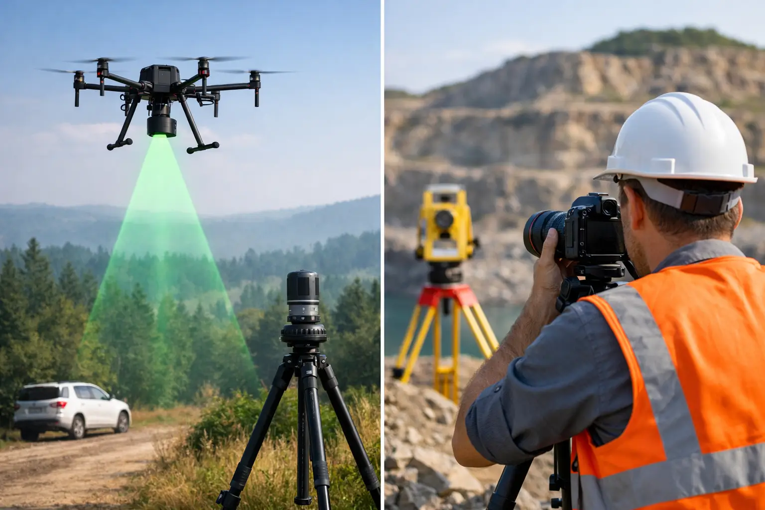
When a project team asks for a topographic survey, stockpile calculation or site model, the real question is often not whether to capture data digitally. It is whether LiDAR versus photogrammetry surveying is the better fit for the job. That decision affects accuracy, field time, processing effort, site access, and ultimately whether the final dataset is genuinely useful for design, construction or asset management.
Both methods are proven. Both can produce detailed deliverables. But they work in very different ways, and the right choice depends on the environment, the required outputs and the level of certainty your project demands.
LiDAR versus photogrammetry surveying – what is the difference?
LiDAR measures distance directly using laser pulses. A scanner, whether terrestrial, mobile or drone-mounted, records millions of points and creates a dense 3D point cloud. Because it is an active sensor, it does not rely on ambient light in the same way a camera-based workflow does.
Photogrammetry uses overlapping images to reconstruct geometry. Specialist software identifies common points across multiple photographs and calculates their position in 3D space. The result can include point clouds, orthomosaics, textured meshes and surface models.
For many buyers, the practical distinction is straightforward. LiDAR captures shape by measuring it. Photogrammetry estimates shape by matching imagery. Both approaches can achieve strong results, but one may be more dependable than the other depending on vegetation, texture, lighting and the amount of geometric complexity present on site.
Where LiDAR has the advantage
LiDAR is often the stronger choice where geometry matters more than visual appearance. On infrastructure corridors, construction sites, rail environments, quarries and complex industrial assets, laser scanning can deliver highly consistent spatial data with less dependence on surface texture.
It also performs well in low-texture environments where photogrammetry can struggle. A concrete wall, a uniform road surface or repetitive structural elements may not provide enough visual detail for stable image matching. LiDAR does not have the same limitation because it is recording range directly.
Vegetation is another key factor. If the requirement is to model the ground beneath tree cover, LiDAR generally has a clear operational advantage. Depending on the sensor, platform and survey design, laser pulses can produce returns from vegetation and from the ground below, making it possible to classify terrain more effectively than with image-only methods.
This matters in forestry, utilities, land development and flood-risk work, where a surface model of the canopy is not enough. If your team needs a more reliable terrain representation through partial cover, LiDAR is usually the safer technical choice.
Where photogrammetry makes sense
Photogrammetry remains highly effective for many commercial surveying tasks, particularly where visual context is valuable and surface visibility is good. For roofs, façades, earthworks, open sites and heritage documentation, image-based capture can provide detailed and visually rich outputs.
It is also well suited to clients who need orthomosaics, inspection imagery or textured 3D models as part of the deliverable, not just geometry. A well-planned drone photogrammetry survey can cover large areas efficiently and produce outputs that are easy for non-specialist stakeholders to interpret.
On straightforward open-ground sites, photogrammetry can be a cost-effective option when supported by proper ground control and a disciplined processing workflow. If the project tolerance allows it and the surface conditions are favourable, it can provide the required data without the additional hardware cost associated with LiDAR payloads.
Accuracy is not just about the sensor
One of the most common mistakes in LiDAR versus photogrammetry surveying comparisons is to treat accuracy as a headline figure taken from a brochure. In practice, survey accuracy depends on the entire workflow.
Control strategy, GNSS performance, RTK or PPK correction quality, flight planning, scan geometry, overlap, calibration, target placement and processing discipline all influence the result. A poorly controlled LiDAR survey can underperform. A well-executed photogrammetry project can exceed expectations.
That said, LiDAR usually offers a more predictable route to dependable geometry on complex sites. It is less vulnerable to poor texture and variable lighting, and it tends to produce stronger results where vertical surfaces, narrow structures or obscured ground are involved.
Photogrammetry can achieve very good absolute accuracy, especially on accessible sites with strong control. But it is more sensitive to environmental conditions and capture quality. Shadows, reflective surfaces, water, repetitive patterns and moving objects can all degrade model reliability.
Speed in the field versus time in processing
Field productivity is often a deciding factor for contractors and survey managers. Drone-based photogrammetry can cover large sites quickly, especially where access is uncomplicated and line of sight is good. For visual mapping over open ground, it remains an efficient option.
LiDAR can also be extremely fast in the field, particularly with mobile or drone-mounted systems, and terrestrial scanners can capture complex structures with high density in relatively short site windows. On active sites where possession time is limited or where safety constraints restrict repeat visits, that efficiency has real commercial value.
Processing time is where the balance can shift. Photogrammetry datasets can require substantial computation, careful quality checks and occasional rework if image alignment issues emerge. LiDAR processing also requires expertise, particularly for registration, classification and noise reduction, but the underlying geometry is often more stable from the outset.
For businesses working to fixed delivery dates, the most efficient method is not always the cheapest to deploy. It is the method most likely to produce usable outputs first time.
Cost comparisons need context
Photogrammetry is often described as the lower-cost option, and in some cases that is true. Camera payloads are generally more accessible, and for open-area mapping the data capture workflow can be commercially attractive.
However, project cost should be assessed against risk, rework and output quality. If a photogrammetry survey has to be repeated because of poor tie point generation, inadequate ground definition or inconsistent results on vertical assets, the apparent saving disappears quickly.
LiDAR systems typically involve higher equipment investment, but they can reduce uncertainty on technically demanding sites. For engineering surveys, as-built capture, vegetation-heavy environments or asset records where measurement confidence matters, the additional capability is often justified.
Professional buyers usually make the right decision when they compare total project value rather than sensor price alone. The question is not which method is cheaper on paper. It is which method delivers the right data with the least operational risk.
Choosing the right method for common UK applications
For topographic surveys on open development land, either approach may be suitable. If the site is clear, well controlled and the required deliverables are surface-based, photogrammetry can perform well. If there is dense vegetation, uneven visibility or a need for stronger terrain confidence, LiDAR is likely to be preferable.
For construction progress monitoring, photogrammetry is often attractive because it combines measurable outputs with imagery that project teams can review easily. Where the environment includes steelwork, vertical complexity or difficult access, LiDAR can improve reliability.
For utilities and infrastructure, LiDAR often has the edge. Corridor environments, embankments, bridges, substations and transport assets benefit from dense 3D geometry and reduced dependence on surface texture. In many of these settings, the cost of missing detail is higher than the cost of using the stronger sensor.
For forestry and rural land management, LiDAR is commonly selected when vegetation penetration and terrain modelling are important. Photogrammetry can still support canopy analysis and visual mapping, but it does not usually offer the same confidence in ground extraction beneath cover.
For heritage and façade work, the answer depends on the output. If the client wants visual realism, photogrammetry has clear strengths. If dimensional certainty and complex geometry are the priority, LiDAR may be the better base dataset. In some cases, combining both produces the best result.
When a hybrid workflow is best
The most effective answer is not always LiDAR or photogrammetry. On many projects, it is LiDAR and photogrammetry.
A hybrid workflow can pair the geometric strength of LiDAR with the visual richness of imagery. That is especially useful for assets that need accurate measurement and clear visual interpretation, such as buildings, industrial plant, infrastructure corridors and inspection targets.
This is where an experienced delivery partner adds value. Sensor choice should follow the required outcome, not the other way round. LiDAR Tech UK supports clients across equipment supply and project delivery precisely because the best workflow is rarely decided by specification sheets alone. It is decided by what the site allows, what the end user needs, and how much certainty the project can afford to lose.
What to ask before you choose
Before committing to either method, define the deliverable first. Are you producing CAD-ready linework, a digital terrain model, an orthomosaic, a textured mesh, inspection imagery or a classified point cloud? Then look at site constraints such as vegetation, access, safety, vertical complexity and available control.
Also consider who will use the data. A planning team, an engineering designer and an asset manager may all ask for a survey, but they often mean different things. The best capture method is the one aligned to the final decision the data needs to support.
If your project has little tolerance for ambiguity, choose the workflow that reduces assumptions. That usually leads to better data, fewer return visits and stronger confidence when the survey moves from field capture into commercial decision-making.