
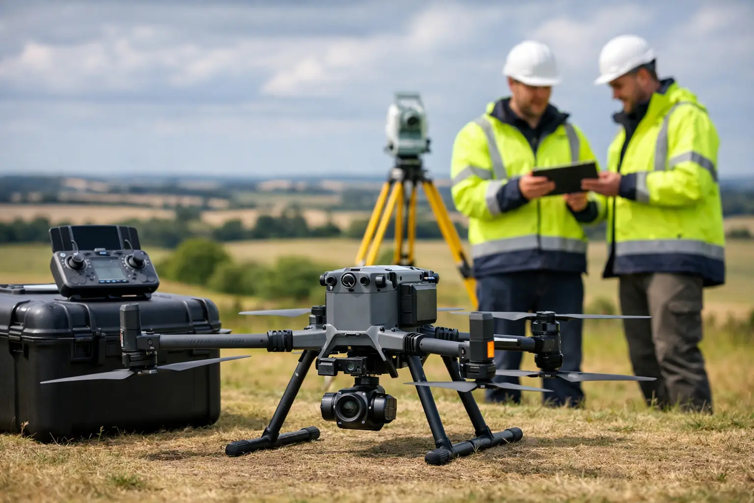
A professional drone has to earn its place in the vehicle. For survey, inspection and asset-management teams, that means more than impressive flight footage. It must carry the right sensor, maintain positional confidence, cope with changeable weather and return usable data without creating a difficult processing workflow. This DJI Matrice 350 review considers whether DJI’s enterprise platform meets those operational requirements for UK organisations.
The Matrice 350 RTK, often referred to as the M350 RTK, is designed as a flexible airframe rather than a single-purpose survey drone. It supports DJI Enterprise payloads including the Zenmuse L2 LiDAR and RGB mapping sensor, Zenmuse P1 full-frame photogrammetry camera, H20 Series inspection payloads and thermal cameras. That flexibility is its principal strength, but it also means buyers need to define their workflow before selecting the aircraft and sensor package.
DJI Matrice 350 review: what it delivers in the field
The M350 RTK is built for repeatable commercial operations. Its quoted maximum flight time of up to 55 minutes is achieved under favourable conditions with an appropriate payload, rather than in every working scenario. Even so, it represents a meaningful improvement in productive flying time for wide-area mapping and extended inspection tasks.
In practice, wind, temperature, payload weight, flight pattern and battery condition all affect endurance. A LiDAR mission flown at a controlled speed and height will produce a different result from a close-range bridge inspection involving frequent manoeuvres and hovering. Professional teams should plan missions around usable on-site endurance, safe battery reserve and the time required to change batteries, rather than treating the headline figure as a guaranteed flight duration.
The dual TB65 battery system is well suited to field operations. Batteries can be changed without shutting the aircraft down, allowing crews to maintain workflow continuity between sorties. DJI rates the TB65 batteries for up to 400 charge cycles, which may reduce long-term operating costs for frequent users, provided charging, storage and battery-health procedures are managed properly.
The aircraft also carries an IP55 protection rating. This does not make it a drone for unrestricted operation in rain, but it gives inspection and survey teams more confidence when working in the damp, dusty and variable conditions common on UK sites. The M350 RTK is a considerably more appropriate platform for demanding operational environments than a lightweight prosumer aircraft.
Flight safety and control confidence
The Matrice 350 RTK combines six-directional sensing and positioning with a low-light FPV camera to improve situational awareness. For work near structures, vegetation, pylons or industrial assets, these systems are valuable safeguards. They are not a substitute for competent planning, visual observation or a properly defined flight boundary.
Its wind-resistance capability, enterprise controller and transmission system support confident operation across larger sites. That matters on linear projects, quarry surveys, large estates and infrastructure corridors, where a short communications range or marginal aircraft stability can slow progress quickly.
For UK operators, the aircraft must still be deployed within the relevant CAA operating framework, site permissions and risk assessment. The M350 RTK’s capability does not remove the need for appropriate operational authorisation, airspace checks, trained personnel or a clear method statement.
Payload choice determines survey value
The airframe itself is only half of the purchase decision. The quality, speed and suitability of the final deliverable are determined largely by the payload and the data workflow behind it.
For photogrammetry, the Zenmuse P1 is the natural choice for high-resolution RGB capture. Its full-frame sensor and mechanical shutter are designed for efficient mapping missions, producing imagery suitable for orthomosaics, point clouds, digital surface models and textured 3D models. It is particularly effective for construction progress records, stockpile calculations, land surveys and site documentation where clean visual detail is required.
The Zenmuse L2 changes the proposition for sites with dense vegetation, complex ground form or a need for direct point-cloud capture. Combining LiDAR, an RGB mapping camera and an integrated IMU, it enables teams to acquire georeferenced laser-scanning data from the air. Forestry, utilities, rail corridors, earthworks and topographic surveys can benefit where photogrammetry alone struggles to identify ground through canopy or where consistent geometry is more valuable than photographic texture.
For inspections, an H20 Series payload can combine zoom, wide-angle and thermal imaging in one mission platform. This is useful for roofs, façades, solar arrays, transmission assets, industrial plant and inaccessible structures. The M350 RTK can therefore support a mixed fleet requirement, with one aircraft configured for mapping on one day and asset inspection on the next.
That versatility is commercially attractive, but there is a trade-off. A dedicated single-sensor system can be simpler to deploy and easier for occasional users to understand. The M350 RTK makes most sense when an organisation genuinely needs multiple payload options, expects regular operations or wants to standardise around an enterprise drone ecosystem.
RTK positioning and data accuracy
The integrated RTK module is a major benefit for geospatial work. It supports high-accuracy positioning during flight and can reduce the number of ground control points needed for many projects. This can shorten field time significantly, particularly on large, inaccessible or hazardous sites.
RTK should not be confused with a guarantee of survey-grade deliverables in every circumstance. Final accuracy depends on the payload, flight planning, GNSS correction quality, terrain, image overlap or LiDAR settings, processing software and independent validation. Check points remain good practice where a defensible accuracy statement is required.
For organisations using a local base station, network RTK correction service or PPK workflow, the M350 RTK can fit into established GNSS processes. The key is consistency. Survey teams should agree their coordinate reference system, geoid model, correction source and quality-control method before the first production mission. A technically capable aircraft cannot correct a poorly managed spatial reference framework.
Operational benefits for UK organisations
The strongest case for the M350 RTK is not simply that it flies for longer or carries better cameras. It is that it can reduce exposure to risk and compress the time between site capture and usable information.
On a construction project, the platform can support regular topographic updates, volumetric measurements and progress imagery without repeatedly mobilising a large field crew. For utilities and infrastructure managers, it can collect close visual, thermal or LiDAR data while keeping personnel away from difficult access points. In forestry and environmental work, LiDAR payloads can help build a more detailed understanding of terrain and vegetation structure across extensive areas.
Its transport case, enterprise batteries and payload change process also suit teams moving between sites. The aircraft is not compact in the way a small mapping drone is, but it is designed to be deployed as working equipment. For organisations carrying out planned weekly operations, that is often more valuable than minimum size.
Limitations to consider before buying
The M350 RTK is a premium enterprise system, and the true investment extends beyond the airframe. Payloads, spare batteries, charging equipment, RTK corrections, processing software, training, insurance and maintenance all need to be included in the budget. A low entry price is not the right comparison if the required sensor, support package and data-processing capability are missing.
There is also a skills requirement. Flying the aircraft safely is only one element. Teams need confidence in mission planning, sensor settings, control surveys, data management and quality assurance. LiDAR and photogrammetry can generate substantial data volumes, so storage, workstation performance and processing turnaround should be assessed alongside field productivity.
For straightforward roof surveys, small-area visual documentation or occasional marketing imagery, the M350 RTK may be more capability than necessary. A smaller enterprise drone can be quicker to transport and more cost-effective. Conversely, where one aircraft must support LiDAR, photogrammetry and inspection payloads with dependable endurance, the M350 RTK is a compelling platform.
Is the DJI Matrice 350 RTK the right investment?
The DJI Matrice 350 RTK is a serious operational drone for organisations that require more than imagery. Its weather-aware enterprise design, dual-battery workflow, integrated RTK capability and broad payload support make it well suited to professional survey, mapping and inspection programmes.
Its value is highest when the aircraft is selected as part of a complete workflow: a suitable sensor, reliable correction service, trained operators and a clear route from raw capture to CAD-ready, model-ready or inspection-ready outputs. LiDAR Tech UK can help assess that workflow before purchase, so the chosen platform is matched to the accuracy, deliverables and operational demands of the work ahead.
The most useful next step is to start with a representative project. Define the site conditions, expected accuracy, required output and turnaround time, then select the M350 RTK payload configuration against those requirements rather than the specification sheet alone.