Author: GaryH

  • A Guide to Construction Setting Out and Site Control

    A Guide to Construction Setting Out and Site Control

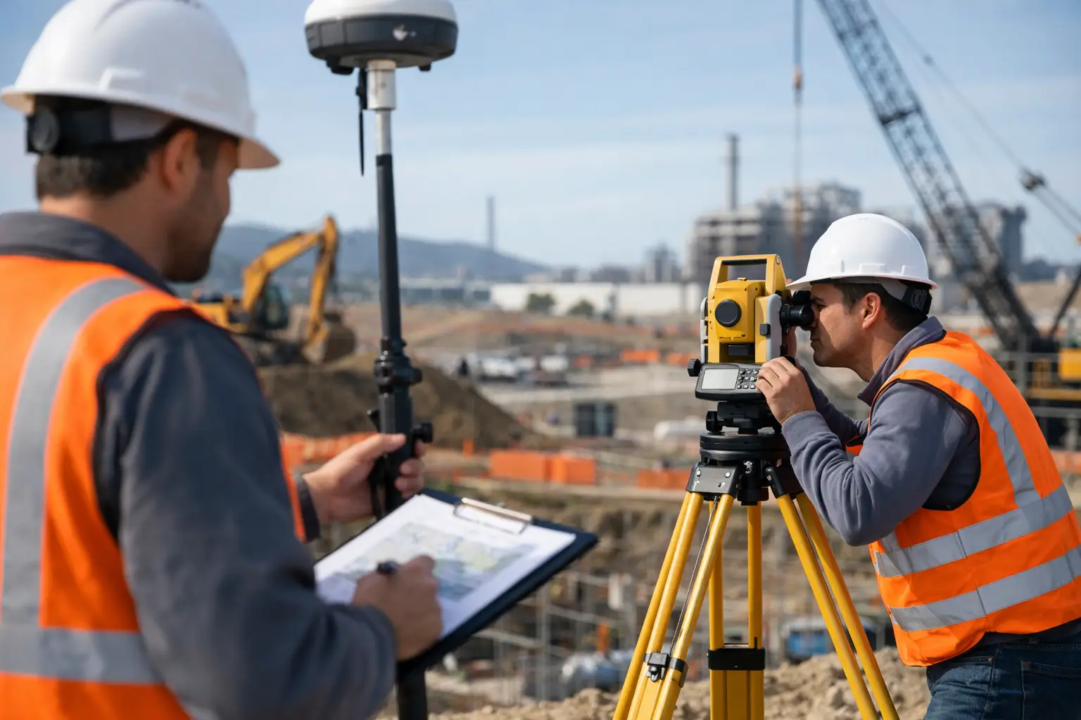
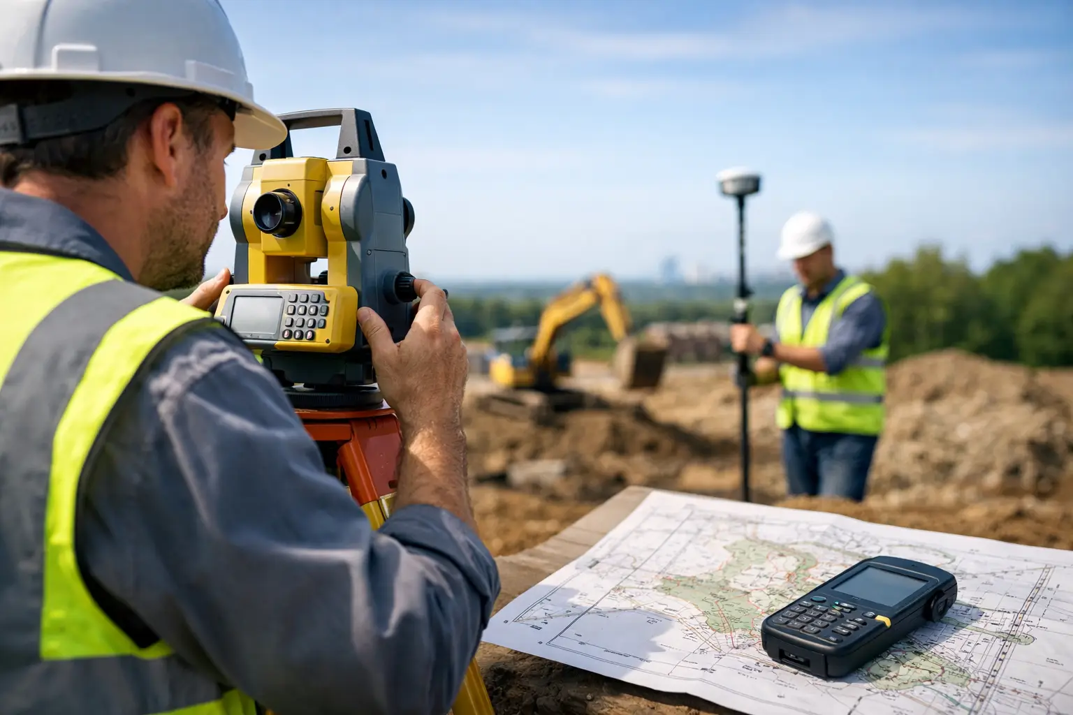
    A gridline that is 20 mm out may look insignificant on a busy site. By the time steelwork, drainage runs, precast units or façade elements rely on it, that small error can become a costly programme and coordination issue. This guide to construction setting out explains how to establish, transfer and verify design positions with the control needed for reliable construction delivery.

    Construction setting out is not simply marking points on the ground. It is the process of translating approved design information into physical positions, levels, lines and reference marks that site teams can build from. The quality of that process affects excavation, foundations, structural alignment, services installation and final as-built records.

    What construction setting out must achieve

    The objective is to provide unambiguous, traceable site information at the required accuracy. A setting-out surveyor must confirm where an element is to be built, at what level, relative to which coordinate system, and with what tolerances. Those requirements vary considerably between a bulk earthworks operation and a reinforced concrete frame.

    Typical setting-out tasks include establishing site control; positioning building corners, gridlines and pile locations; transferring formation and finished floor levels; setting drainage alignments and gradients; and checking completed work against the design. The same survey control may also support machine control, volume calculations, progress reporting and as-built surveys.

    Accuracy should be defined by the work being undertaken, not by a blanket specification. Earthworks can often be managed at centimetre-level tolerance, while steelwork, holding-down bolts and structural interfaces may require millimetre-level precision. Selecting an instrument and workflow without considering those tolerances is a common cause of avoidable rework.

    Start with reliable survey control

    Every dependable setting-out operation begins with a control network. This consists of stable, well-documented points with known coordinates and levels, tied to the project’s approved datum and coordinate reference system. It gives every trade a common spatial reference and prevents individual teams from working to inconsistent local assumptions.

    Control points should be located outside likely excavation areas, traffic routes and zones where they may be disturbed by plant. They need clear physical marking, protection and a record of coordinates, descriptions, photographs and date of verification. A point painted on a kerb or timber profile may be convenient, but it is not automatically suitable as primary control.

    A closed traverse, GNSS observations or a combination of both may be used to establish control. The right approach depends on site scale, obstructions, required precision and the relationship between the design grid and national coordinates. GNSS with RTK corrections is efficient for establishing and checking open-site control, but a total station generally provides the tighter relative precision needed for detailed structural set-out.

    Levels require equal care. A project benchmark should be checked against the approved vertical datum before work begins. On sites where precise levels matter, differential levelling remains a highly reliable method for transferring height. GNSS-derived elevations can be useful operationally, but they depend on the correct geoid model, correction service and coordinate configuration.

    Prepare the design data before going to site

    Most setting-out errors originate before the surveyor switches on an instrument. Drawings, models and coordinate schedules must be reviewed for completeness, consistency and version control. A coordinate list that has been issued from an outdated model is still wrong, even if it is set out perfectly.

    Confirm the drawing revision, units, coordinate system, grid orientation and level datum. Check whether coordinates are expressed in a local engineering grid, the British National Grid, or a project-specific transformation. A rotation, scale factor or false origin that has not been applied correctly can shift every point on site.

    For model-based workflows, extract only the information required for the activity. Grid intersections, pile centres, kerb lines, formation surfaces, drainage centre lines and offset points should be clearly named and checked against the source drawing. Avoid cluttering a field controller with unfiltered model geometry, particularly where several design options or superseded layers are present.

    Before mobilisation, carry out independent calculations on a sample of critical points. Comparing gridline distances, diagonals, levels and offsets against the approved drawings is a practical way to identify data-export mistakes. This check should be documented, especially where the works involve high-value structural elements.

    Choosing the right equipment for the task

    A robotic total station remains the primary instrument for many detailed setting-out applications. It provides high angular and distance precision, can work to a local control network and is well suited to gridlines, foundations, columns, retaining walls and structural interfaces. One-person robotic workflows can also improve productivity where access and line of sight are available.

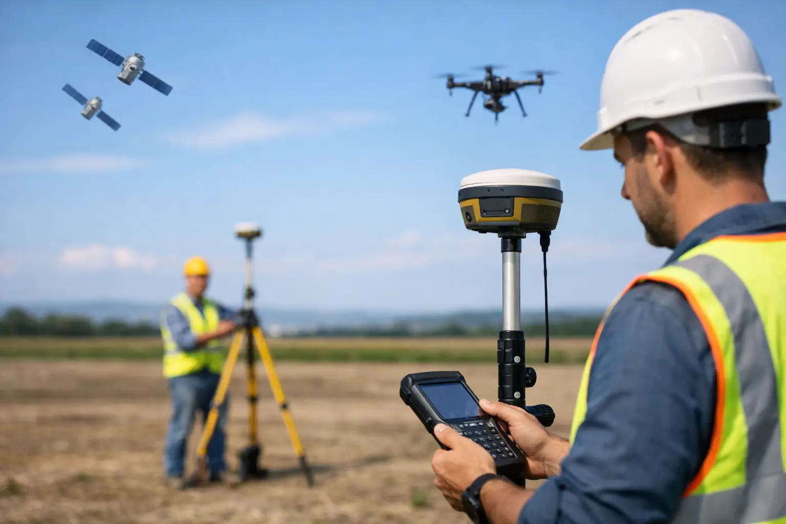
    GNSS RTK rovers are highly effective for initial control, earthworks, road alignments, utilities routes and rapid checks over larger areas. They reduce the need for line of sight between points, but performance can be affected by tree cover, buildings, multipath and limited sky visibility. They are not a substitute for a total station where tight relative tolerances apply.

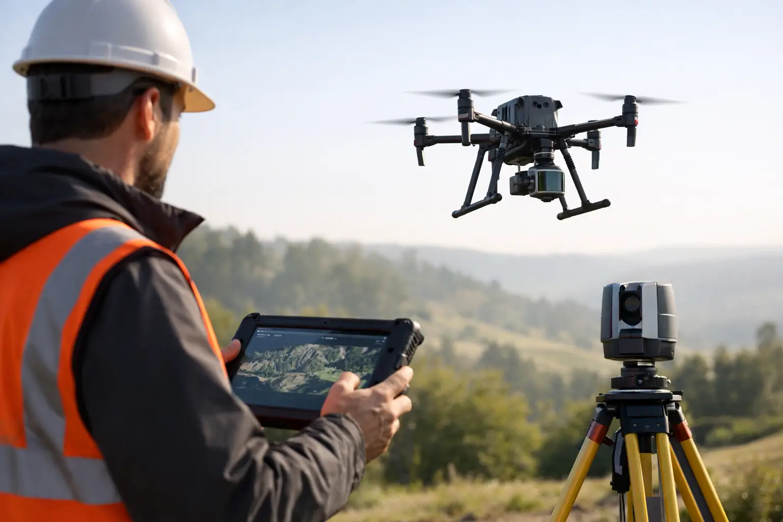
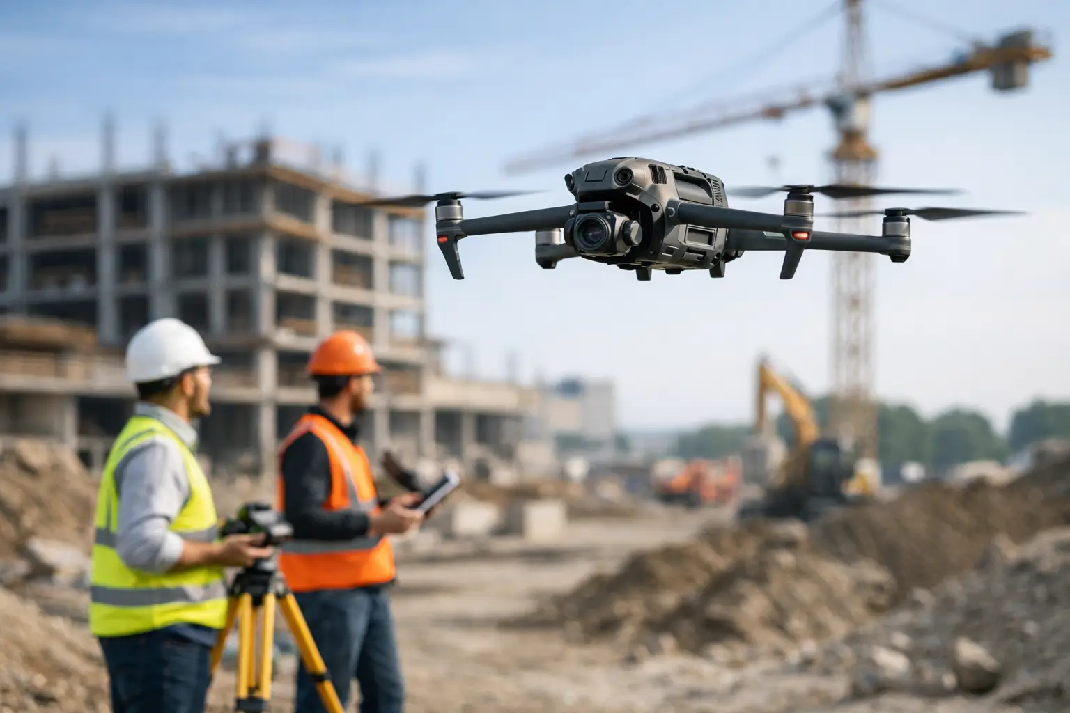
    Digital levels are appropriate when transferring precise heights, while laser levels can provide a quick reference for routine construction activities. Terrestrial LiDAR scanning and drone photogrammetry add value by capturing existing conditions, monitoring earthworks, documenting progress and producing detailed as-built point clouds. These technologies complement conventional setting out rather than replacing the need for verified control.

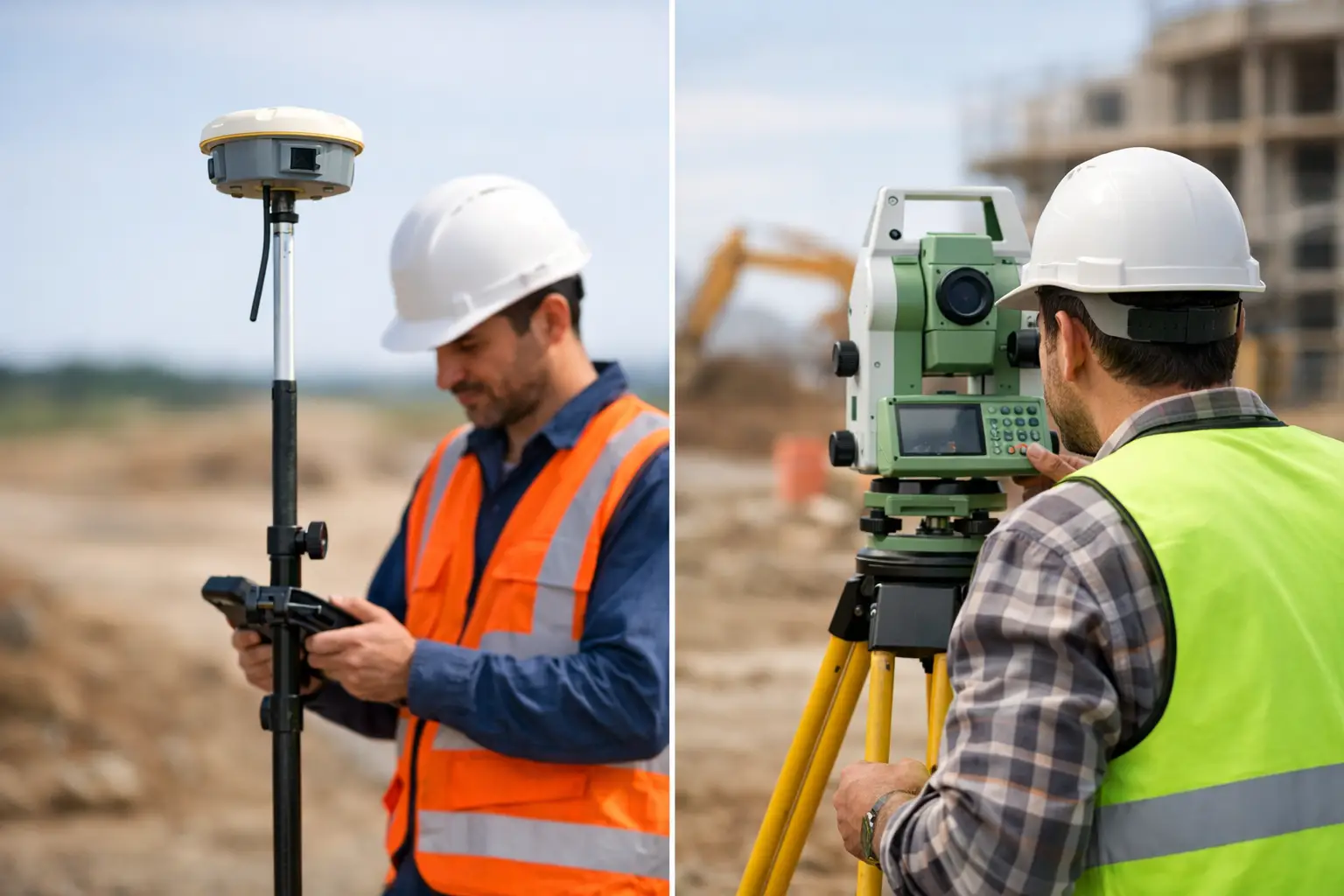
    The best choice is often a combined workflow: GNSS for efficient site-wide control and open-area work, total station measurement for precise placement, and scanning for verification and record capture.

    A practical construction setting-out workflow

    Once control and design data are approved, the field process should follow a disciplined sequence. Set up over a known point or use a known occupied station, then orient the instrument to one or more backsights. Check the instrument height, prism height and target settings before measuring any design point.

    A strong orientation check measures an additional known control point that was not used as the backsight. If the residual exceeds the project tolerance, stop and investigate rather than proceeding with set-out. The cause may be an incorrect point selection, a disturbed control mark, poor prism centring or an error in the coordinate file.

    Set out critical locations using a method appropriate to the construction stage. For a building footprint, establish primary gridline intersections and offsets that remain available after excavation. For piles, mark centres with clear identifiers and provide offset references where pile caps or ground conditions may obscure the original mark. For drainage, stake centre lines, changes of direction, manhole positions and formation levels, while ensuring gradient calculations are checked independently.

    Site marks must be understandable to the people building from them. A precise point is of limited value if the marking convention is unclear. Use agreed labels, paint colours, nails, witness marks or profiles, and record whether a mark represents a centre line, face of wall, finished level, excavation limit or offset. Communication with the site engineer and foreman is part of accurate delivery.

    Verification is where risk is controlled

    Setting out should never rely on a single observation for critical work. Independent checks provide the confidence that the right point has been placed in the right position from the right control.

    For structural work, verify gridline spacing, diagonals, offsets and levels before concrete is poured or steel is fixed. Where possible, use a second setup, a different control route or a second instrument operator. A check performed from the same station with the same incorrect orientation is not genuinely independent.

    As-built measurement is equally important. Capture completed elements before they are concealed, including foundations, drainage, service trenches and reinforcement interfaces where required. Compare measured coordinates and levels with design tolerances, then issue clear records showing any deviations and whether they have been accepted.

    LiDAR or photogrammetric capture can provide a broader verification record for complex or fast-moving sites. Point clouds are particularly useful for checking excavation profiles, concrete surfaces, stockpiles and installed assets. Their value depends on survey-grade registration and well-managed control, not simply on the volume of data collected.

    Common setting-out failures and how to avoid them

    The most damaging errors are often routine: working from a superseded drawing, assuming a control point has not moved, entering the wrong prism height, or mixing local and national coordinate systems. These issues are preventable through documented checks and clear responsibility for data release.

    Poor site conditions also matter. Heat shimmer, rain, vibration, restricted line of sight and unstable ground can affect measurements and instrument setups. Plan work around conditions where practical, use forced centring for repeat setups, and check control more frequently on active or heavily trafficked sites.

    Do not treat tolerance as an afterthought. Agree it before setting out begins, record the required standard in the survey method statement, and escalate discrepancies promptly. A small design conflict found before installation is a coordination task. The same conflict found after construction may become a commercial dispute.

    For projects that need an integrated survey workflow, LiDAR Tech UK can support professional teams with GNSS, robotic surveying, LiDAR capture and practical technical guidance matched to the accuracy and output requirements of the works.

    The most useful setting-out record is one that allows the next person on site to understand exactly what was established, checked and handed over. When control, design data and verification are treated as one connected process, site teams can build with greater confidence and far fewer surprises.
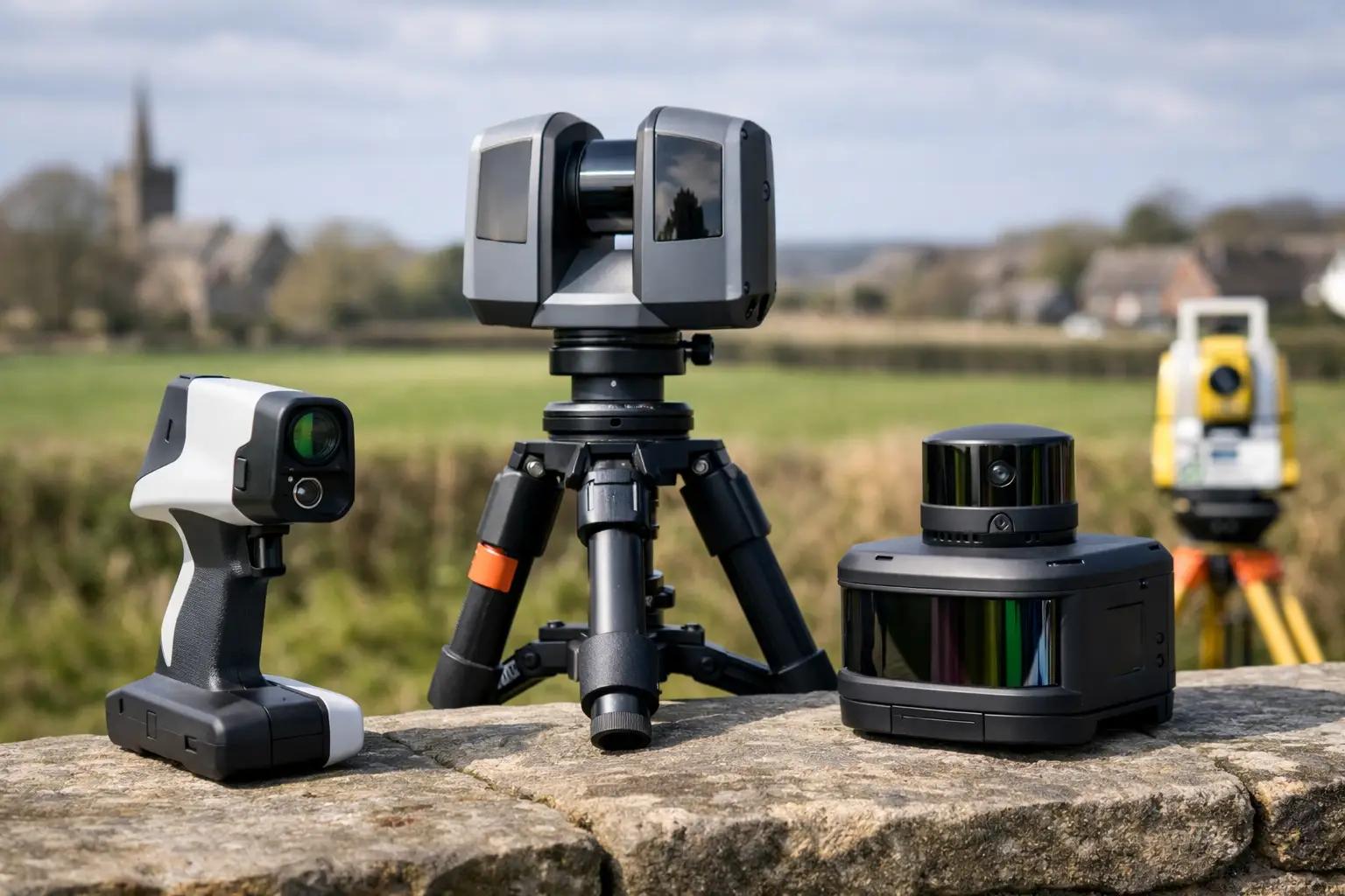
  • Best RTK Rovers Comparison for UK Surveyors

    Best RTK Rovers Comparison for UK Surveyors

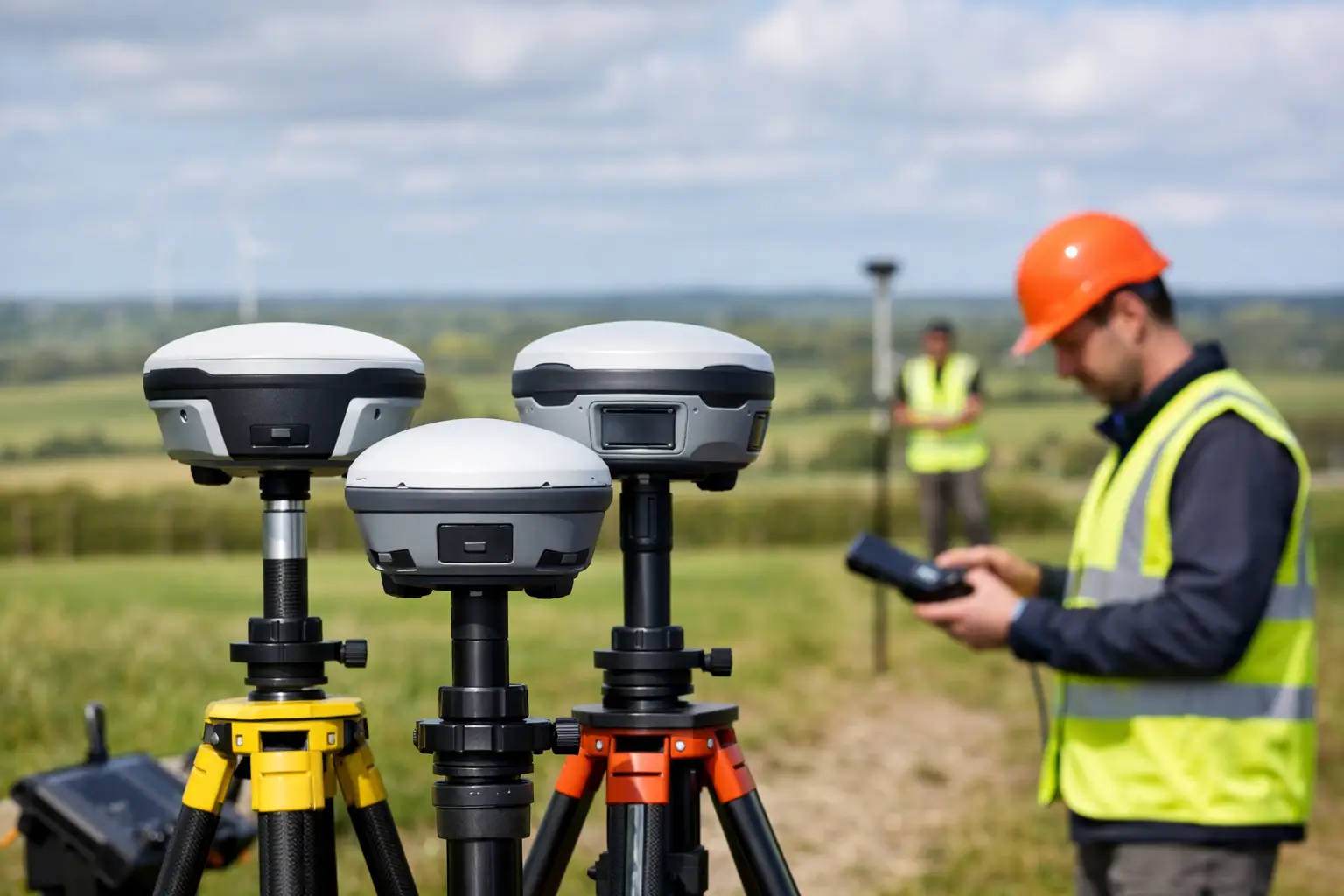
    A best RTK rovers comparison for a UK survey team should start with the work, not the specification sheet. A rover that performs well for setting out on an open construction site may be a poor fit for utility surveys beneath tree cover, while a lower-cost unit can become expensive if it creates correction, data-export or support issues in the field.

    For professional users, the best choice is usually the rover that delivers repeatable centimetre-level positions within an established workflow. That means assessing GNSS performance, correction reliability, controller software, field durability and the support available when a crew needs an answer quickly.

    What separates the best RTK rovers?

    An RTK rover receives satellite signals and applies real-time corrections from a local base station or correction network. In suitable conditions, this enables survey-grade positioning for topographic work, site control, setting out, as-built surveys, GIS capture and machine-control support.

    The headline accuracy figure matters, but it is only one part of the decision. Most professional rovers quote horizontal accuracy in millimetres plus parts per million when operating with a fixed RTK solution. In practice, the more useful question is how consistently the receiver achieves and retains that fixed solution around buildings, under partial canopy and near machinery.

    A capable rover should also fit the software and deliverables used by the business. If field crews need CAD-ready points, coded linework, stake-out reports or asset attributes, the controller and office workflow deserve the same scrutiny as the GNSS receiver.

    Best RTK rovers comparison: the key buying criteria

    Satellite tracking and signal resilience

    Modern professional GNSS rovers track multiple constellations, typically GPS, Galileo, GLONASS and BeiDou, across multiple frequencies. More tracked signals can improve solution availability, particularly where the sky view is restricted. However, multi-constellation capability does not remove the effects of dense canopy, reflective surfaces or poor correction coverage.

    For urban, infrastructure and woodland work, look beyond the advertised channel count. Ask for a demonstration in conditions that resemble the difficult parts of your sites. Observe time to fixed solution, how the unit recovers after obstruction, and whether it reports solution status clearly enough for the operator to make sound decisions.

    Correction methods and network access

    A rover is only as useful as its correction source. UK users commonly work from an NTRIP correction service through a SIM-enabled controller or receiver, although a local base and rover arrangement remains valuable on remote sites or where independent control is required.

    Network RTK reduces setup time and is often the most practical option for mobile survey teams. It depends on mobile coverage, subscription access and a correctly configured coordinate reference system. A base-rover kit gives greater control and can operate without internet coverage, but it adds setup, radio planning and base-coordinate responsibilities.

    Before purchasing, confirm the correction services available across your operating area and test the intended SIM provider on known weak-coverage sites. For critical work, a workflow with a secondary correction option is sensible.

    Field software and data flow

    The receiver may be the visible part of the kit, but field software dictates much of its daily value. A strong system should make it straightforward to create jobs, select the right coordinate system, import design data, code observations, stake out points and lines, and export files in formats accepted by CAD, GIS or machine-control platforms.

    Construction teams often prioritise fast stake-out, cut-and-fill information and clear reports. Survey practices may need survey coding, linework collection, raw observation storage and reliable integration with existing office software. Utilities and asset managers may place greater value on configurable forms, photographs and attribute capture.

    Do not assume that every controller package supports each workflow in the same way. Request a walkthrough using a representative drawing, coordinate file or asset form. This exposes avoidable friction before equipment reaches site.

    Tilt compensation

    Tilt-compensated rovers allow the pole to be held away from vertical while calculating the antenna position. This can speed up work around walls, vehicles, boundaries and inaccessible points, and it can reduce the need to level the pole at every observation.

    The trade-off is operational discipline. Tilt compensation must be correctly calibrated and used within the manufacturer’s stated limits. It does not make poor satellite geometry, multipath or an unstable pole acceptable. For control points and high-consequence setting-out tasks, many teams still adopt a more cautious observation procedure, including checks on solution quality and repeat measurements.

    Build quality, battery and connectivity

    A rover intended for daily commercial work should withstand rain, dust, vibration and repeated transport between sites. Check the stated ingress protection rating, operating temperature range, battery arrangement and warranty terms. A removable battery can be useful for long shifts, while an integrated battery can simplify handling but requires a charging plan.

    Connectivity also deserves attention. Bluetooth reliability between receiver and controller, internal modem support, radio capability, Wi-Fi configuration and USB data transfer all affect field productivity. Small delays at the start of every job become costly over a year of deployment.

    Comparing rover types for UK applications

    Entry-level professional rovers are suited to teams moving from manual tape-and-offset methods, basic GPS or subcontracted setting-out. They can offer a strong return for open-sky topographic surveys, volume calculations, agricultural measurement and routine construction layout. The limitation is usually not basic accuracy, but lower resilience, fewer workflow features or a more limited support package.

    Mid-range survey rovers are often the strongest commercial choice for contractors, consultants and multi-disciplinary survey teams. They typically combine multi-frequency tracking, tilt capability, mobile corrections and capable field software. This category is appropriate where one team needs to cover topo, as-built, stake-out and asset capture without carrying several systems.

    Premium survey-grade systems are justified where complex sites, demanding client specifications, established survey workflows and high utilisation make downtime costly. Their value may come from advanced signal handling, mature controller software, integration with total stations or machine-control environments, and an extensive support ecosystem. They should be assessed on total operational value rather than receiver price alone.

    A separate category is the compact GIS-focused rover. These are designed around efficient asset capture and attribute collection, often with mobile mapping applications. They are useful for councils, environmental teams and utilities, but may not replace a full survey rover where detailed setting out, survey coding or formal deliverables are required.

    Accuracy is a process, not a claim

    No RTK receiver should be treated as a substitute for survey control and verification. Good practice begins with the correct project coordinate system and a known control point wherever possible. The operator should check that the correction stream, antenna height, pole height and solution status are correct before collecting production data.

    On a well-managed project, crews carry out check shots during the day, repeat critical observations and record sufficient information to demonstrate how points were established. This is particularly important where data will support design decisions, quantities, legal boundaries or safety-critical construction activity.

    When comparing equipment, ask suppliers how the system handles quality indicators, residuals, raw data logging and re-observation. A clear audit trail is more valuable than a promising accuracy figure that cannot be verified later.

    Whole-life cost matters more than purchase price

    The lowest-priced rover can be a sound investment when it matches the task and the operator is competent. It becomes a false economy when crews lose time configuring corrections, struggle with exports, or wait days for technical support during an active job.

    Budget for the complete working system: rover, controller, pole, bracket, batteries, charger, protective case, correction subscription, software licences, training and any required base station. Also account for calibration procedures, firmware updates, repair turnaround and replacement equipment availability.

    For many organisations, the most valuable supplier contribution is implementation. A proper handover should cover coordinate systems, correction setup, field workflows, quality checks and data export. LiDAR Tech UK supports this broader approach, helping teams align GNSS equipment with their real survey and mapping requirements rather than simply supplying a receiver.

    How to make a confident selection

    Start by defining the outputs your team must produce and the environments where they work. Then shortlist systems that meet those requirements, arrange a practical demonstration and test them against a familiar workflow. Compare fixed-solution reliability, time on task, exported data quality and ease of use for the people who will operate the equipment every day.

    The right RTK rover should make accurate spatial data easier to capture, check and deliver. A careful field trial will show whether it can do that on your sites, with your corrections, and within the standards your clients expect.

  • Best LiDAR Scanners Comparison for UK Surveys

    Best LiDAR Scanners Comparison for UK Surveys

    A scanner that produces an impressive point cloud in a showroom can still be the wrong choice for a live construction site, rail corridor or heritage building. The most useful best lidar scanners comparison starts with the deliverable: the accuracy required, the environment being captured, the distance to cover and how quickly the data must reach CAD, BIM or asset-management systems.

    For UK survey, engineering and asset teams, LiDAR selection is rarely a simple question of range or point density. A faster capture method may reduce time on site, but it must also provide enough control, registration confidence and usable detail for the intended decision. The right scanner is the one that improves the whole workflow, rather than merely collecting data quickly.

    Best LiDAR scanners comparison: choose by workflow

    Professional LiDAR systems generally fall into four practical categories: handheld SLAM scanners, backpack or vehicle-mounted mobile mapping scanners, static terrestrial laser scanners and drone-mounted LiDAR systems. Each solves a different field problem.

    | Scanner type | Best suited to | Main advantage | Key consideration | |—|—|—|—| | Handheld SLAM LiDAR | Buildings, plant rooms, construction progress and confined spaces | Rapid, mobile capture with minimal set-up | Accuracy and drift management depend on survey control and capture route | | Backpack or mobile mapping LiDAR | Roads, rail, estates, forestry and large external sites | Efficient coverage across long corridors or wide areas | Requires careful trajectory planning and GNSS performance where used outdoors | | Static terrestrial laser scanner | High-detail surveys, deformation work, façades and complex geometry | Strong measurement control and detailed stationary scans | Multiple set-ups can increase site time and registration effort | | Drone LiDAR | Difficult terrain, roofs, quarries, utilities routes and large land areas | Safe, efficient aerial coverage | Flight permissions, vegetation penetration needs and ground control remain critical |

    There is no universal winner. A static scanner can be the better investment where millimetre-level detail and repeatable control matter more than speed. A handheld SLAM system can be more productive where access, programme pressure and complex internal routes are the limiting factors. In many projects, combining methods produces the strongest result.

    Handheld SLAM LiDAR: speed where set-up time is the problem

    Handheld LiDAR scanners use simultaneous localisation and mapping, commonly known as SLAM, to build a point cloud while the operator walks through an environment. They are particularly effective for internal surveys, multistorey buildings, industrial facilities, tunnels and construction projects where traditional static set-ups would interrupt work or take several days.

    The practical advantage is not simply that the scanner is portable. It is that the operator can capture stairwells, corridors, plant areas and external transitions in one continuous workflow. This reduces blind spots caused by static scanner positions and makes frequent progress capture commercially realistic.

    FJDynamics Trion systems are designed for this type of mobile reality capture. They offer a practical route into survey-grade SLAM workflows for teams that need to collect spatial data efficiently without carrying out a full static scan at every location. However, the scanner should not be assessed on headline specifications alone. Review how it handles loop closures, control points, challenging surfaces, low-feature corridors and processing within the software workflow your team uses.

    Handheld SLAM is an excellent fit for as-built verification, MEP coordination, measured building surveys, stockpile environments and rapid site documentation. It is less suitable as a direct replacement for static terrestrial scanning where a client requires tightly controlled, independently verified measurements across a large or high-precision survey network.

    What to check before buying a handheld scanner

    Ask for demonstrated results from a site similar to your own. A warehouse with repetitive racking, a long corridor with few visual features and a busy plant room can each challenge a SLAM workflow differently. Also establish whether you need surveyed control targets, GNSS positioning outdoors or both.

    Processing time matters as much as capture time. A system that produces a clean, registered point cloud with straightforward export to common design and modelling packages can save considerably more labour than one that requires extended manual correction after every survey.

    Backpack and mobile mapping LiDAR: cover more ground per shift

    Backpack and vehicle-based systems are intended for larger areas and longer routes. Typical applications include highways, rail estates, campuses, industrial facilities, forestry tracks, urban streets and utility corridors. The value lies in collecting dense spatial information while moving continuously, rather than stopping repeatedly for individual scanner positions.

    These systems often benefit from a combination of LiDAR, inertial measurement, GNSS/RTK positioning and SLAM. Where satellite visibility is good, GNSS can strengthen georeferencing and reduce the need for extensive downstream adjustment. Under tree canopy, beside tall buildings or inside structures, the system must rely more heavily on its inertial and SLAM performance.

    This is where operational planning becomes decisive. A poor route with no revisits, limited control or interrupted GNSS conditions can create a point cloud that looks complete but does not meet positional requirements. Surveyors should plan loops, establish check points and define a clear coordinate reference strategy before capture begins.

    For organisations maintaining assets across extensive sites, mobile mapping can make repeat surveys more affordable. It is particularly valuable when the objective is an up-to-date, measurable digital record rather than a small number of isolated measurements. The trade-off is that hardware choice, mounting method, correction service and processing standards need to work together from the outset.

    Static terrestrial scanners: where control and detail take priority

    Static terrestrial laser scanners remain the benchmark for many high-detail measured surveys. The scanner is positioned on a tripod, captures from a fixed location and is moved through a planned network of set-ups. This method is proven for architecture, structural surveys, façades, industrial installations, heritage records and situations where precise geometry must be evidenced.

    The main strength is control. With suitable target placement, survey control and registration procedures, static scanning provides dependable datasets for demanding design, conservation and engineering use. It also handles fine detail at a stand-off distance well, which can matter when access is restricted or objects cannot be approached safely.

    Its limitation is field productivity. Complex sites may require numerous scan positions to avoid occlusions, and each position needs time to establish, capture and register. For a small, detailed room this may be entirely appropriate. For a 20,000-square-metre operational building requiring weekly progress data, a mobile workflow may provide a better commercial balance.

    The decision should therefore be based on the tolerance of the final deliverable. If drawings, clash detection or asset models need highly controlled geometry, static scanning is often justified. If the goal is rapid condition recording, space planning or progress visualisation, handheld LiDAR may be more efficient.

    Drone LiDAR: a separate answer to inaccessible terrain

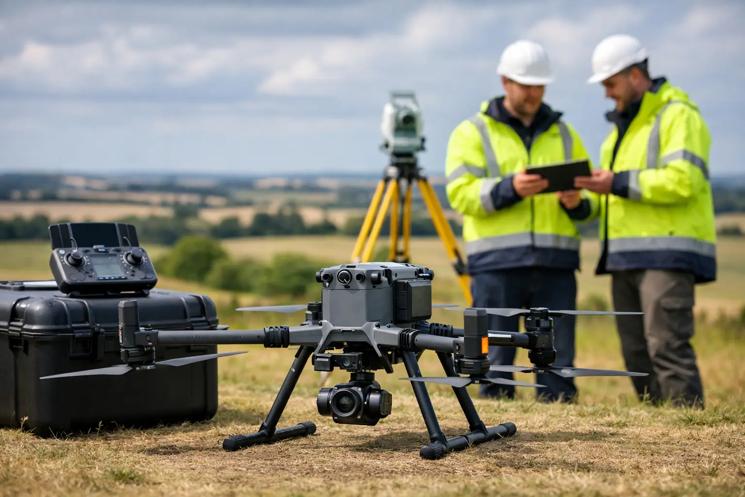
    Drone LiDAR belongs in a best LiDAR scanners comparison because it changes what can be captured safely, not because it replaces ground scanning. Aerial platforms are well suited to embankments, quarries, roof structures, woodland, transmission routes and broad infrastructure sites where walking the full area is slow, unsafe or impractical.

    LiDAR can often capture terrain through gaps in vegetation more effectively than photogrammetry, making it valuable for topographic modelling and corridor work. Yet vegetation density, flight height, scan angle, platform stability and ground control all affect the result. A drone LiDAR survey requires competent flight planning, appropriate permissions and a clear understanding of the required ground classification outputs.

    For detailed building interiors, equipment surveys and below-canopy asset checks, ground-based LiDAR remains essential. The most productive projects may use aerial LiDAR for the wider context and mobile or static scanning for detailed verification at ground level.

    The specification questions that prevent expensive mistakes

    Range, points per second and stated accuracy are useful comparison figures, but they do not tell the whole story. Ask suppliers how the published accuracy is measured and whether it refers to sensor performance, relative point-cloud precision or final georeferenced survey accuracy. These are not interchangeable.

    Consider the working environment. Reflective surfaces, glazing, black materials, rain, dust and direct sunlight can affect capture quality. So can featureless areas, moving people or vehicles, and repetitive structures. A practical demonstration should reflect these conditions rather than an idealised test space.

    Data compatibility deserves equal attention. Confirm the point-cloud formats, registration tools, classification options and exports available for your existing CAD, BIM, GIS or asset-management workflow. If the scanner requires a specialist processing route, ensure the team has the training, computing capacity and support to use it consistently.

    Finally, compare the support model. Professional LiDAR is an operational system, not just a purchase. Training, field set-up advice, software guidance, technical response times and access to processing expertise all influence whether the equipment delivers a return. LiDAR Tech UK supports organisations that need this wider implementation capability, from equipment selection through to survey delivery and usable data outputs.

    Build the comparison around the decision you need to make

    Before requesting quotations, define the required coordinate system, survey tolerance, deliverables, typical site size and target turnaround. Then test candidate scanners against a representative job. Capture the same area, process it using the proposed workflow and compare not only the point clouds, but also field time, office time, missing detail and confidence against known checks.

    The best choice is often the system that gives your team sufficient accuracy with the least operational friction. A well-supported scanner matched to the job can reduce site exposure, shorten programmes and produce data that design and asset teams can act on with confidence.

  • How to Reduce Survey Rework on Complex Sites

    How to Reduce Survey Rework on Complex Sites

    A return visit to site is rarely just an inconvenience. It can delay design decisions, hold up setting-out, increase traffic management costs and leave a project team working from data it cannot fully trust. Knowing how to reduce survey rework starts with treating capture, control, processing and deliverables as one connected workflow rather than separate tasks.

    For UK survey, engineering and asset-management teams, the goal is not simply to collect more data. It is to collect defensible data that meets the agreed specification first time, with clear traceability from site control through to CAD, BIM or GIS output.

    Why survey rework happens

    Most rework is created before the survey team reaches site. An unclear brief may omit the required coordinate reference system, tolerance, datum, deliverable format or extent of coverage. The field team then makes reasonable assumptions, but those assumptions may not match the requirements of the designer, client or downstream contractor.

    Control errors are another common cause. A well-executed scan or drone flight cannot compensate for incorrect control coordinates, an unsuitable transformation, poor GNSS correction coverage or an unrecognised level datum issue. Problems may not become visible until data is overlaid with an existing design model, by which stage mobilisation is needed again.

    There is also a practical issue of visibility. Traditional point-based methods can leave gaps where access is restricted, vegetation obscures features, traffic limits working time or complex structures contain numerous hidden surfaces. The data may be technically accurate where it exists, but insufficient for the decisions that follow.

    The answer is not to use every available technology on every project. It is to select a method that provides the required accuracy, completeness and verification within the actual constraints of the site.

    How to reduce survey rework before mobilisation

    Start with a survey brief that can be checked, not interpreted. The brief should identify the purpose of the survey, required accuracy, site limits, control basis, exclusions, linework or model requirements, and the software environment in which the data will be used. If the end user needs breaklines, classified point clouds, floor plans, mesh models or CAD-ready drawings, state this at the outset.

    It is equally useful to agree what “complete” means. For a highway corridor, that may include all visible drainage assets, kerb lines, utility indications and tie-ins beyond the proposed works. For a building survey, it may mean every plant area, soffit, service route and inaccessible façade elevation needed for design. Completeness is project-specific, so it should be defined before capture rather than debated during data processing.

    A short pre-start review should confirm the following five points:

    • the coordinate system, geoid model and vertical datum;
    • available control points and how they will be verified;
    • required absolute and relative accuracy;
    • site access, hazards, closures and working restrictions; and
    • the final file formats, naming conventions and acceptance checks.

    This review is particularly important where several organisations contribute to the same scheme. A contractor may be using a local grid, while a design team works in British National Grid and an asset owner holds records on a different historical datum. Establishing the transformation route early is faster than trying to reconcile datasets after construction has begun.

    Build control you can defend

    Reliable control is the foundation of repeatable survey data. Whether the work uses a GNSS rover, total station, mobile LiDAR system or drone, control should be independently checked rather than assumed correct because it appears in a drawing or legacy file.

    For GNSS-based work, assess correction service availability and the conditions likely to affect positional quality. Dense urban areas, tree cover, steep cuttings and proximity to structures can reduce satellite visibility or introduce multipath effects. In these environments, a fixed RTK solution alone should not be treated as proof that the final position meets the specification.

    Use check points that are separate from the points used to constrain or register the dataset. Comparing measured values against independent checks creates an audit trail and exposes systematic issues early. If the tolerance is tight, repeat observations at different times or use a complementary method to verify critical features.

    The trade-off is straightforward: additional control takes time at the beginning of a job. However, that time is usually modest compared with the cost of revisiting a live construction site, arranging possession access or revising issued drawings.

    Capture enough context, not just the requested feature

    Survey teams are often asked to capture a defined asset, boundary or structure. Rework occurs when the design team later requires the surrounding context to understand drainage falls, clearance, connections, access routes or construction interfaces.

    LiDAR and photogrammetry are valuable here because they can capture dense spatial context efficiently. A terrestrial or mobile LiDAR survey can record complex geometry and surfaces that would be slow to represent with individual observations. Enterprise drone surveys can extend coverage across larger or unsafe areas, subject to suitable ground control, airspace planning and site conditions.

    Neither method removes the need for survey judgement. Reflective surfaces, water, moving vehicles, glass, dense vegetation and occluded areas all require a considered capture plan. A point cloud may look complete in a viewer while still containing shadow areas or unreliable returns. Field staff should inspect coverage during the survey, not rely solely on post-processing to reveal omissions.

    For complex sites, work to planned routes, stations or flight blocks and record what has been completed. This makes it easier to identify gaps while access remains available. It also protects the project when site conditions change between visits.

    Validate in the field and again in the office

    The strongest field-to-office workflow has two quality gates. The first takes place on site: check control, coverage, instrument status and a sample of critical dimensions before demobilising. The second takes place during processing: verify registration quality, compare independent check points, inspect point-cloud density and review outputs against the agreed brief.

    Do not wait until drawings are nearly complete to perform these checks. Early validation allows a team to identify a missing elevation, weak registration area or inconsistent datum while a short supplementary visit is still practical. It also prevents processing effort being spent on data that will later be rejected.

    A useful approach is to define acceptance criteria before fieldwork begins. For example, a project may require specified residuals on survey control, an agreed maximum deviation at check points, full coverage of named assets and a clear record of areas that could not be observed. The exact values depend on the survey class and design use, but the principle is consistent: quality should be measured against known criteria, not assessed by appearance alone.

    Standardise the field-to-office handover

    A technically sound survey can still create rework if files arrive with ambiguous names, missing raw data, inconsistent layers or no record of processing settings. Standardisation makes work easier to check, easier to repeat and less dependent on one individual’s knowledge.

    Create a consistent project structure for raw observations, control records, images, point clouds, processed data and issued deliverables. Include a concise survey report that states equipment used, coordinate reference system, control methodology, checks completed, known limitations and achieved accuracy. This is not administrative padding. It gives designers and asset owners the information they need to use the data correctly.

    Where point clouds are delivered, agree practical requirements such as format, classification, decimation level, clipping boundary and whether registration reports are required. A high-density dataset is not always the best deliverable if the client lacks the software or computing capacity to handle it. In some cases, a clean CAD drawing, mesh, orthomosaic or extracted asset schedule is more useful alongside the source data.

    Choose technology around the risk, not the trend

    The best equipment choice depends on the site and required outcome. GNSS/RTK rovers are highly efficient for open environments and control establishment. LiDAR scanners are well suited to dense, complex or inaccessible geometry. Drones can reduce exposure and accelerate coverage across large areas. Total stations remain essential where high precision and controlled observations are required.

    In many projects, the most reliable answer is a combined workflow. GNSS can establish and verify control, LiDAR can capture detailed geometry, and targeted total-station observations can confirm critical points that are difficult to interpret from a point cloud. This approach may involve more planning, but it reduces reliance on a single source of evidence.

    LiDAR Tech UK supports organisations with the equipment, implementation guidance and data-capture capability needed to build these workflows around real site conditions rather than generic specifications.

    Make rework visible and improve the next job

    Finally, record why a return visit occurred. Was it a missing feature, unclear brief, control discrepancy, access restriction, software compatibility issue or an output that did not meet the intended use? Tracking these causes turns isolated problems into measurable process improvements.

    The most effective survey teams do not aim for zero questions during delivery. They aim to surface the right questions before mobilisation, verify the answers while still on site, and issue data that can stand up to design, construction and asset-management scrutiny.

  • What Accuracy Does RTK Deliver in Surveying?

    What Accuracy Does RTK Deliver in Surveying?

    A GNSS receiver showing a fixed RTK solution can transform a day’s work. But what accuracy does RTK deliver when the results need to stand up in a setting-out file, an as-built survey, a volume calculation or an asset record? For most professional field applications, correctly configured RTK can achieve centimetre-level absolute positioning – commonly around 8 mm horizontal and 15 mm vertical, plus a parts-per-million distance component, under favourable conditions.

    That specification is highly capable, but it is not a blanket guarantee of 1 cm everywhere on every site. RTK accuracy depends on the correction source, satellite visibility, baseline length, coordinate reference system, antenna setup and field verification. Understanding those dependencies is what turns a capable rover into a dependable survey workflow.

    What Accuracy Does RTK Deliver in Practice?

    Real-time kinematic positioning uses carrier-phase measurements from GNSS satellites and correction data from a base station or network. The rover compares its observations with the correction source, resolves the integer ambiguities and reports a fixed solution. Once fixed, it can deliver positions far more precise than standalone GNSS.

    A realistic expectation for an open-sky site, with a quality receiver and a fixed solution, is approximately 1-2 cm horizontal accuracy and 1.5-3 cm vertical accuracy at the measured point. The vertical component is normally less precise than the horizontal component. This matters when surveying drainage, carriageway levels, earthworks platforms or any feature where reduced level tolerances drive the decision.

    Manufacturers often express performance as a figure such as 8 mm + 1 ppm horizontally and 15 mm + 1 ppm vertically. The first figure is the base measurement uncertainty. The ppm element increases with separation from the correction source. At a 10 km baseline, 1 ppm adds 10 mm. Network RTK reduces the practical effect of longer distances by modelling atmospheric errors across multiple reference stations, but conditions and service quality still matter.

    It is also essential to separate precision from accuracy. A rover may repeat very closely around the same incorrect coordinate if the wrong coordinate system, transformation or antenna height has been entered. Repeatability is useful, but it is not proof that the data is correctly tied to the required project datum.

    The Difference Between a Fixed and Float Solution

    The status shown by the controller is not a minor detail. A fixed solution means the receiver has resolved the carrier-phase ambiguities with sufficient confidence. This is the condition required for centimetre-level work. A float solution has not completed that resolution and can be decimetres out, occasionally more.

    Do not treat a float coordinate as an RTK survey observation simply because corrections are being received. Wait for fixed status, review the reported horizontal and vertical precision, and re-observe critical points. If the receiver repeatedly drops from fixed to float, the underlying cause needs attention rather than a workaround.

    Typical causes include tree canopy, building façades, steelwork, parked plant, overhead obstructions and poor mobile-data coverage. These can block satellites, reflect signals and interrupt correction delivery. A good receiver cannot remove the physical limitations of the sky view.

    Why Site Conditions Change the Result

    The advertised RTK figure is normally established in controlled, open-sky conditions. Construction and infrastructure environments are rarely that simple. Multipath is one of the most common sources of poor performance: satellite signals reflect from walls, glass, water, metal or machinery before reaching the antenna. The receiver may still report fixed, yet the observation can be biased.

    Dense woodland creates another challenge. A rover may maintain a solution under light canopy, but satellite geometry and signal quality can deteriorate rapidly as foliage, branches and terrain obstruct the horizon. In forestry, boundary work or corridor mapping, it is often sensible to combine RTK with total station observations, post-processed GNSS or LiDAR and photogrammetry workflows, depending on the required deliverable.

    Satellite geometry also affects confidence. A receiver tracking many satellites does not automatically have an ideal geometry. Satellites concentrated in one area of the sky provide weaker geometric strength than a well-distributed constellation. Checking PDOP, signal quality and solution age helps the operator recognise when a measurement deserves another observation.

    Coordinate Systems Matter as Much as GNSS Performance

    For UK projects, a centimetre-level measurement in the wrong reference frame is still wrong. RTK corrections may be supplied in ETRS89 or another GNSS reference frame, while project drawings, cadastral information and engineering models may use OSGB36 National Grid. Heights introduce a separate issue: ellipsoidal GNSS height is not the same as orthometric height relative to Ordnance Datum Newlyn.

    The controller, correction service and processing software must use a consistent transformation and geoid model. A mismatch can create offsets that are far larger than the rover’s stated RTK precision. These errors can be systematic, meaning every surveyed point appears credible but is displaced by the same amount.

    Before starting work, establish the project coordinate system and vertical datum, then confirm how those are configured in the rover. On controlled sites, check known control points before and during the survey. If the project control and RTK observations disagree, do not force the data to fit without identifying whether the cause is a local grid, control issue, transformation setting or antenna-height error.

    Antenna Height Is a Small Input With Large Consequences

    RTK measures the position of the antenna phase centre, not the ground point, kerb edge or prism point of interest. The controller applies the entered antenna or pole height to calculate the final coordinate. A 20 mm height-entry error produces approximately a 20 mm error in the reported level.

    Use a stable pole, a calibrated bubble or tilt-compensation system, and the correct measurement method specified by the equipment. Tilt compensation can improve productivity when capturing detail, but it does not make poor control, multipath or a wrong antenna height disappear. For critical level work, a levelled pole and independent check remain good practice.

    Setting Out, Topographic Survey and Machine Control

    RTK is particularly effective where the tolerance aligns with centimetre-level positioning and productivity matters. Topographic surveys, utility asset capture, stockpile measurement, agricultural guidance, preliminary site models and many construction setting-out tasks are strong applications. It allows a single operator to capture or stake out large numbers of points quickly without establishing line of sight between instruments.

    The correct tolerance should always determine the method. If a task requires a few millimetres, such as precision structural alignment, settlement monitoring or certain rail and industrial installation activities, RTK alone may not be sufficient. A total station, digital level, static GNSS or a combined control approach may be more appropriate.

    For machine control, the practical question is not merely the rover’s best-case accuracy. It is the accuracy of the entire chain: design model, site calibration, base or correction network, machine antenna configuration, sensor calibration and regular checks against physical control. A 10 mm rover specification cannot compensate for an outdated design surface or a site calibration with a 30 mm residual.

    A Field Procedure That Protects Accuracy

    Reliable RTK work is built on routine checks rather than faith in a status icon. At the start of a shift, occupy at least one known point and compare the measured coordinate with the expected value. Repeat the check after moving between work areas, following a correction outage, after changing coordinate settings or when operating close to obstructions.

    For important surveyed features, take independent repeat observations. Reoccupation after a short interval, ideally with a different satellite geometry, is a practical way to reveal a questionable result. Record solution status, precision values, correction source, antenna height and any site limitations in the field notes. These details provide a useful audit trail if the data is later queried.

    Quality control should continue in the office. Review outliers, check levels against known control and confirm that the exported data uses the specified coordinate reference system. Where the results feed CAD, BIM, GIS or an engineering model, clear naming and coding reduce the risk of a correct coordinate becoming an incorrect deliverable.

    Choosing the Right RTK Setup

    A local base and rover can give excellent results where the base is established on verified control and the project needs an independent site reference. It also avoids dependence on mobile coverage for local radio-based corrections. However, it requires setup, radio planning and confidence in the base coordinate.

    Network RTK is efficient for mobile survey teams working across multiple locations. It removes the need to establish a base each day, provided the correction service is available and the rover has reliable data connectivity. For many UK survey and construction applications, it is the practical default. The decision should be based on control requirements, geography, communications and the consequence of downtime – not only on subscription cost.

    LiDAR Tech UK can help assess the appropriate rover, correction method and field-to-office workflow for the accuracy your project actually requires. The most valuable RTK result is not the smallest figure on a specification sheet; it is a verified coordinate that lets the next team make the right decision with confidence.

  • A Professional Guide to LiDAR Data Capture

    A Professional Guide to LiDAR Data Capture

    A point cloud is only as valuable as the decisions made before the scanner is switched on. This guide to LiDAR data capture is intended for UK survey, construction and asset teams that need reliable, usable spatial data rather than a large file that creates more work in the office. The objective is to define the required output, select a capture method that suits the site, establish dependable control and maintain quality checks from fieldwork through to delivery.

    Start with the required deliverable

    LiDAR capture should begin with the question: what will the data be used for? A topographic survey, volume calculation, BIM model, highway corridor, asset inventory and heritage record each require a different balance of accuracy, density, coverage and classification.

    For example, a contractor checking cut and fill may need a georeferenced surface model delivered quickly. An engineering team producing a detailed design model may require more stringent control, defined feature extraction and CAD-ready linework. A facilities manager documenting plant rooms may prioritise complete coverage around equipment and clear imagery to support identification.

    Set the specification before mobilisation. It should identify the coordinate reference system, vertical datum, required accuracy, point density, deliverable formats, exclusions and tolerances. Agree whether the client needs raw point clouds, registered scans, classified data, a digital terrain model, orthomosaic, mesh, 3D model or drawing output. This avoids a common failure point: capturing a technically impressive dataset that is unsuitable for the intended workflow.

    Guide to LiDAR data capture: choose the right platform

    There is no single best LiDAR platform. The correct choice depends on the environment, access constraints, level of detail and acceptable survey duration.

    Mobile and handheld LiDAR

    Handheld and mobile LiDAR systems are effective for buildings, stockpiles, industrial facilities, streetscapes and complex sites where the operator can walk the required route. SLAM-based scanners can collect extensive data rapidly, including areas that are slow to cover with static scanning. They are particularly useful where access is intermittent or where teams need to capture progress information without disrupting site activity.

    The trade-off is that SLAM accuracy depends on the quality of the trajectory and the geometry of the environment. Long, featureless corridors, repetitive warehouse racking and open areas with few fixed features can increase drift risk. Closing loops, maintaining consistent walking speed, scanning from multiple directions and using surveyed control points will improve confidence in the final dataset.

    Static terrestrial laser scanning

    Static terrestrial scanners remain the preferred option where maximum local detail, repeatable accuracy and comprehensive line-of-sight coverage are required. They suit structural surveys, heritage documentation, plant rooms, façades and legal or engineering work where every critical feature must be defensible.

    This method takes longer in the field because each scanner position requires set-up and registration planning. However, it can be the right commercial choice when a missed detail or poorly controlled model would cause design delay, rework or access costs later in the project.

    UAV LiDAR

    Drone-based LiDAR is suited to larger sites, inaccessible terrain, transport corridors, quarries, forestry and utilities routes. It can capture terrain through light to moderate vegetation more effectively than image-based photogrammetry, depending on canopy density and the required ground return. It also reduces exposure to steep slopes, unstable ground and live operational areas.

    UAV LiDAR requires careful flight planning, appropriate permissions, site risk assessment and a realistic view of weather conditions. Wind, rain, low light for supporting imagery, battery management and airspace restrictions all affect productivity. The flight plan should provide sufficient overlap and a consistent height above ground, while the sensor configuration must match the target point density and vegetation conditions.

    Vehicle-mounted and hybrid workflows

    For roads, rail-adjacent assets and long linear networks, vehicle-mounted systems can collect data at a pace that walking or static scans cannot match. In many projects, a hybrid approach is more effective: UAV LiDAR for broad coverage, mobile scanning for ground-level detail, and static scans for critical structures or concealed areas.

    The benefit is not simply faster capture. Combining methods closes line-of-sight gaps and gives designers a more complete representation of the site. The drawback is added registration and processing discipline, so the control strategy must be shared across every platform.

    Establish survey control before collecting data

    Survey control is the backbone of professional LiDAR work. If control is weak, even a dense and visually convincing point cloud can be displaced, tilted or inconsistent with existing design data.

    Use established control where it is verified and suitable for the required accuracy. Where new control is needed, GNSS/RTK methods can provide efficient site coverage, while total station observations may be necessary where satellite visibility is limited or tighter local precision is required. Check the coordinate system and transformation parameters against the client’s project requirements rather than assuming a site grid or legacy drawing is correct.

    Ground control points and check points serve different purposes. Control points are used to constrain or georeference the dataset. Independent check points test the final result. Keep them separate where possible. A dataset that fits its own control points well has not necessarily demonstrated independent accuracy.

    For mobile LiDAR, establish visible, well-distributed targets where the workflow benefits from them. For UAV work, position control across the full site extent and consider height variation, not just plan position. Avoid placing all points along one boundary or in easy-to-access areas. Control needs to test the terrain and geometry that matter to the final deliverable.

    Plan the route, scan geometry and site access

    A reliable capture plan considers how the sensor will see every required surface. Walk the site before scanning where practical. Identify reflective materials, glass, water, narrow spaces, moving machinery, overhead obstructions, vegetation and areas where staff or public movement could affect the survey.

    For handheld LiDAR, plan a route with deliberate loop closures. Return to previously scanned areas, revisit key junctions and avoid making one long outward journey with no opportunity for the system to reconcile its position. In buildings, scan rooms in a sequence that creates strong overlap through doorways and corridors.

    For UAV LiDAR, define flight lines around terrain, obstructions and desired ground density. Consider whether cross-flight lines are needed to strengthen the trajectory solution or improve coverage on slopes. Maintain safe separation from people, structures and operational activity, and plan take-off and landing locations that do not compromise the survey or site safety.

    Do not treat site access as an administrative detail. A scan may need possession arrangements, permits, a banksman, traffic management, induction clearance or escort access. These constraints influence both platform choice and programme. Planning them early prevents rushed field decisions that reduce data quality.

    Capture with quality assurance built into the fieldwork

    Field checks are faster and cheaper than revisiting a site. Review coverage during collection rather than waiting until processing is complete. Confirm that critical surfaces are visible, control targets are captured clearly, and the scan route or flight path has not been interrupted by a battery issue, GNSS outage or unexpected restriction.

    Monitor positioning status throughout the survey. RTK corrections, satellite geometry, multipath, obstructions and loss of communications can affect georeferencing. If a correction service is unavailable or conditions deteriorate, record the issue and decide whether the work can continue under an alternative control method. Do not rely on a later software adjustment to resolve an unrecorded positioning problem.

    Keep clear field records. Note scanner settings, scan identifiers, control observations, weather, access limitations and any areas that could not be collected. These records support processing decisions and provide an audit trail when a client asks how an accuracy result was achieved.

    Process for the intended use, not just visual appeal

    Processing should preserve traceability from raw capture to deliverable. Register scans, apply control, inspect residuals and compare independent check points before exporting final data. Review the point cloud in sections as well as in 3D. Misalignments, duplicated surfaces and trajectory drift can be difficult to spot in a visually attractive overview.

    Classification and filtering need careful judgement. Ground filtering in vegetated terrain can remove valid terrain points or retain low vegetation. Noise reduction can improve readability but may also remove small features that matter to an asset survey. Agree the level of cleaning required and retain an archived source dataset where project requirements permit.

    Deliver data in formats that fit the client’s software and downstream tasks. This may include LAS or LAZ point clouds, E57 exchange files, RCP or RCS project formats, CAD drawings, terrain models, meshes or tabulated asset information. Include a concise report covering the capture method, coordinate system, control, checks completed, accuracy results and known limitations.

    When accuracy claims need context

    Quoted scanner accuracy is only one part of the final accuracy budget. Range, incidence angle, surface material, control quality, registration method, operator technique and processing settings can all influence the result. A manufacturer specification should therefore be treated as a component performance figure, not an automatic project outcome.

    For commercially sensitive work, define acceptance criteria in measurable terms. State whether accuracy is assessed against check points, surfaces, identifiable features or model elements. Specify the confidence level where appropriate and make clear which areas are outside scope. This protects both the survey team and the end user from assumptions that point-cloud density alone equals survey certainty.

    LiDAR Tech UK supports organisations that need to select, deploy and process professional LiDAR workflows, from equipment and positioning solutions through to survey deliverables. The most effective next step is to review a representative site, required outputs and accuracy tolerance before committing to a platform. That conversation usually reveals whether the priority is speed, detail, access, repeatability or a practical combination of all five.

  • GNSS Versus Total Station: Which Fits Your Site?

    GNSS Versus Total Station: Which Fits Your Site?

    A setting-out team is delayed because a retaining wall blocks satellite visibility. On another part of the same project, a surveyor spends hours moving a total station between control points across open ground. This is where the GNSS versus total station decision becomes operational rather than theoretical. Both technologies can deliver highly reliable survey data, but they work differently, carry different constraints and suit different stages of a project.

    For UK survey, construction and engineering teams, the best choice is rarely about replacing one instrument with another. It is about selecting the method that provides the required accuracy, coverage and productivity in the conditions actually present on site.

    GNSS versus total station: the practical difference

    A GNSS rover calculates its position from satellite signals, usually enhanced by RTK corrections from a local base station or network correction service. With a clear view of the sky and a dependable correction source, it can provide centimetre-level coordinates quickly over a large area. The operator can work independently, moving directly between points without establishing line of sight to an instrument.

    A total station measures angles and distances from a known occupied point to a prism, or in some cases to a reflectorless target. It works within a local coordinate framework and does not depend on satellite reception. Its principal requirement is clear line of sight between the instrument and the target.

    That difference shapes almost every field decision. GNSS is generally faster for open-site control, topographic work and large-area point collection. A total station remains highly effective where satellite signals are obstructed, where very precise local setting out is required, or where vertical and horizontal measurements must be maintained within a tightly controlled site grid.

    Accuracy: specify the result, not the instrument

    It is misleading to describe one technology as simply more accurate than the other. Accuracy depends on the measurement method, control arrangement, site environment, instrument quality, operator procedure and the tolerances required by the task.

    An RTK GNSS system commonly supports centimetre-level work when it has good satellite geometry, stable corrections and minimal multipath. Multipath occurs when signals reflect from nearby buildings, metalwork, vehicles or water before reaching the antenna. Tree canopy and urban obstruction can also reduce reliability or prevent a fixed solution altogether.

    A properly established total station can achieve millimetre-level angular and distance observations over appropriate ranges. This makes it a strong choice for structural set-out, steelwork, foundations, formwork, rail alignment, monitoring and detail survey in obstructed environments. The achievable site accuracy still depends on control quality, centring, prism handling, atmospheric conditions and sound checking procedures.

    The key question is not whether GNSS or a total station is accurate. It is whether the complete workflow can demonstrate the accuracy your deliverable requires. For an earthworks volume survey, centimetre-level GNSS may be entirely appropriate. For bolt positions, structural interfaces or machine alignment, a total station may be the more defensible method.

    Vertical accuracy needs particular attention

    Heights are often where teams discover the limits of an assumed workflow. GNSS ellipsoidal heights must be converted using an appropriate geoid model, and the resulting levels should be checked against known benchmarks. This is especially relevant when working to a project datum or where drainage, formation levels and construction tolerances are involved.

    Total stations measure vertical geometry directly from a known control point, but they too require careful instrument height, prism height and benchmark verification. Neither instrument removes the need for a controlled survey procedure.

    Where GNSS delivers the greatest return

    GNSS is particularly productive on open sites where points are spread over a wide area. The lack of line-of-sight requirements means one operative can collect observations efficiently without repeated instrument moves or a second person holding a prism.

    Typical applications include topographic surveys, site control extension, earthworks checks, stockpile volumes, utilities asset capture, agricultural mapping, boundary reconnaissance and as-built surveys across open developments. It is also useful for establishing georeferenced ground control for drone photogrammetry and LiDAR surveys.

    Its commercial advantage is coverage. A surveyor can walk directly to a required point, record an attributed observation and move on. On a highway corridor, solar farm, quarry, housing development or agricultural estate, that can materially reduce time on site.

    GNSS also supports an efficient digital workflow. Field software can display CAD linework, design points, background mapping and live positional guidance. For contractors, this can speed up setting out and reduce avoidable rework, provided the design data, coordinate reference system and datum have been checked before work begins.

    However, GNSS performance degrades in dense urban areas, beneath heavy canopy, close to tall structures and around reflective surfaces. A rover may still display a position, but the operator must assess solution status, estimated precision and the surrounding environment rather than accepting every coordinate at face value.

    Where a total station remains essential

    A total station is not legacy equipment. On many sites, it is the most controlled and efficient answer to the task.

    Use cases include basement works, enclosed compounds, internal surveys, rail environments, bridges, tunnels, industrial facilities and city-centre developments. It is also often the preferred instrument where satellite visibility changes through the day or where a local site grid must be maintained independently of GNSS corrections.

    For construction setting out, a robotic total station can provide substantial productivity gains. One operator can control the instrument remotely, locate points against design data and record as-built observations. The benefit is especially clear when setting out repeated locations with tight tolerances, such as pile caps, columns, kerbs, drainage runs or structural elements.

    Reflectorless measurement can also capture inaccessible features, though it should be applied with care. Surface material, angle of incidence, range and target definition affect reflectorless results. A prism remains the preferred option where the highest confidence is needed.

    The trade-off is field logistics. The total station must be set up over known control, oriented correctly and moved when line of sight is lost. On larger open sites, this can be slower than GNSS. It may also require a two-person team where robotic operation is not practical or available.

    Site conditions that should drive the choice

    Before mobilising, assess the site rather than defaulting to familiar equipment. Satellite visibility, control availability, required tolerances, point density, access and programme all matter.

    GNSS is usually the efficient first option when the site is open, coordinates are required over a broad area and centimetre-level results meet the specification. It is well suited to rapid capture and control tasks where the operator can maintain a fixed RTK solution and validate work against known points.

    A total station is generally the safer option where visibility to the sky is constrained, precise local geometry is critical or the work occurs beneath structures, near façades or inside buildings. It is also valuable where the client needs a clear observational chain back to established site control.

    For difficult ground, the answer is often both. GNSS can establish or extend control across open areas, support rapid topographic collection and georeference the wider project. A total station can then complete work around structures, under canopy and within tolerance-sensitive construction zones. This combined approach reduces the compromise inherent in relying on either method alone.

    Control, calibration and competence determine the outcome

    High-quality hardware does not compensate for weak control. Before setting out or collecting survey-grade data, confirm the coordinate system, transformation parameters, site datum and benchmark values. Check GNSS observations on independent known points. For a total station, verify collimation, compensator performance, tribrach condition and orientation against known control.

    Field checks should be planned, not treated as an afterthought. Re-observe selected points, compare against independent control and investigate differences beyond the project tolerance. Record instrument heights, prism heights, solution status and any environmental factors that could affect the result.

    Training matters just as much as specification. A team that understands RTK fix quality, geoid settings, localisations, resection quality and total station checks will produce more reliable data and identify problems before they affect construction or deliverables.

    Choosing equipment for your workflow

    When comparing GNSS and total station equipment, consider more than headline accuracy. Assess the correction service options, field software, controller usability, battery strategy, data export formats, support provision and integration with CAD, machine control, drones or LiDAR workflows.

    For organisations building an in-house capability, the strongest investment is often a connected survey workflow rather than an isolated instrument purchase. LiDAR Tech UK supports professional GNSS, RTK, LiDAR and drone systems alongside training, technical support and survey delivery, helping teams match the equipment and process to their actual project requirements.

    Start with the tolerance, site environment and required deliverable. A short technical review before purchase or mobilisation can prevent a far more expensive issue later: collecting data that looks complete but cannot support the decisions built on it.

  • Land Surveying Services for Accurate Site Data

    Land Surveying Services for Accurate Site Data

    A design team can only work as accurately as the existing-condition data placed beneath its drawings. A missed retaining wall, an incorrect invert level or a poorly defined boundary can trigger redesign, delay site operations and create avoidable commercial risk. Professional land surveying services establish a dependable spatial record before those decisions are made.

    For construction, civil engineering, utilities, land development and asset-management teams, the requirement is rarely just a set of points. The useful outcome is survey data at the right accuracy, in the right coordinate system and delivered in a format that supports the next stage of work. That may mean a CAD topographical survey for design, a georeferenced point cloud for modelling, an orthomosaic for site planning or verified levels for earthworks control.

    What land surveying services need to deliver

    A survey should answer a defined operational question. On a proposed development, this may be the position and level of surface features, buildings, boundaries, drainage covers, vegetation and changes in terrain. On an infrastructure corridor, the priority may shift to access routes, embankments, structures, clearances and condition information. For an estate or utility owner, asset identification and a repeatable record may be more valuable than a conventional drawing alone.

    The specification therefore matters as much as the equipment. Survey control, coordinate reference system, feature coding, linework detail, required tolerances and final file format should be agreed before fieldwork begins. A high-density scan is not automatically the right answer if the project requires a clear, controlled 2D base plan. Equally, a sparse topographical survey may be inadequate where designers need to understand complex façades, plant areas or irregular ground conditions.

    Typical deliverables include:

    • Topographical surveys in CAD-ready formats, with agreed layers, feature codes and levels.
    • Georeferenced point clouds for design coordination, measurement and 3D modelling.
    • Digital terrain models, contours and volume calculations for planning and earthworks.
    • Orthomosaic imagery and photogrammetric models for large sites and visual records.
    • Asset schedules and condition-related spatial data for inspection and maintenance planning.

    The most effective surveys combine these outputs only where they add value. More data can increase processing, storage and review time, so the goal is not maximum capture. It is usable information with known accuracy.

    Selecting the right survey method for the site

    Traditional GNSS and total-station workflows remain essential where controlled points, precise breaklines, detailed feature pickup and reliable level information are required. RTK GNSS is particularly effective in open environments, enabling survey teams to establish and capture coordinates efficiently against a suitable correction service or site control network.

    Its limitations must be recognised. Tree cover, tall structures, narrow streets, deep cuttings and reflective surfaces can affect satellite visibility or signal quality. In these locations, a survey method that relies solely on GNSS may not provide the required confidence. A competent survey plan accounts for obstructed areas, independent checks and the control needed to join different datasets accurately.

    Mobile LiDAR is well suited to collecting dense spatial data across complex sites. A handheld or vehicle-mounted system can rapidly capture building interiors, external structures, stockpiles, corridors and difficult terrain, producing a detailed point cloud that supports measurement and modelling. It can reduce time spent in exposed or inaccessible areas, particularly when paired with suitable control and a defined processing workflow.

    However, LiDAR does not remove the need for survey discipline. Point-cloud accuracy depends on sensor performance, trajectory quality, field technique, control strategy and registration. Dense data can also obscure the features a client actually needs unless it is classified, checked and converted into an agreed deliverable. For design purposes, the distinction between a visually convincing scan and an accurately controlled survey is commercially significant.

    Enterprise drones add another capability for larger sites, quarries, roof areas, embankments and inspections where ground access is slow or unsafe. Drone photogrammetry can provide high-resolution imagery, surface models and measurable orthomosaics. Drone LiDAR can improve vegetation penetration and terrain capture in certain environments. The appropriate option depends on ground cover, required accuracy, airspace constraints, weather, site permissions and the nature of the output.

    Control and accuracy are not optional extras

    A survey dataset is only dependable when its position can be understood and verified. This is why survey control is central to professional land surveying services. Control points connect field observations to a known reference framework and allow results from GNSS, total stations, LiDAR scanners and drone platforms to be checked against each other.

    For UK projects, teams should establish whether data needs to relate to the National Grid, Ordnance Datum Newlyn, a local grid or an existing project coordinate system. A mismatch can cause serious problems when incoming survey data is overlaid with design models, utility information or previous phases of work. It may be technically possible to transform data later, but doing so without clear documentation introduces unnecessary uncertainty.

    Accuracy requirements also vary by application. Early feasibility work may accept a lower level of detail than setting out, drainage design, legal boundary work or structural coordination. It is better to state the required tolerance and intended use at the outset than to assume that every survey is suitable for every downstream task.

    Quality assurance should include field checks, independent validation points, metadata on coordinate systems and a review of anomalies before issue. The final drawing or model should make clear what has been surveyed, what has been interpreted and which areas could not be observed safely or directly. This clarity helps designers and project managers make informed decisions rather than treating a survey as an infallible record.

    Planning surveys around operational risk

    The fastest field method is not always the most efficient project solution. A busy live site may require phased capture around vehicle movements, permits, inductions and restricted work zones. Rail, highways, utilities and industrial facilities often require additional access planning, safety controls and coordination with site representatives.

    Early communication prevents wasted mobilisation. Surveyors need to know the project boundary, access arrangements, known hazards, required outputs, programme deadlines and whether information such as existing drawings, control records or utility plans is available. The client also benefits from knowing where survey teams need clear access and whether vegetation, parked plant or stored materials could obstruct key areas.

    For repeat work, a structured capture approach can improve consistency. The same control framework, feature definitions and asset identifiers make it easier to compare sites, monitor change and integrate new data into established GIS, CAD or asset-management systems. This is particularly useful for local authorities, estates, contractors and infrastructure operators managing large portfolios.

    From field capture to usable design data

    Field capture is only one part of the service. Processing converts observations into information that engineering, planning and operational teams can use. This may involve point-cloud registration, noise reduction, classification, feature extraction, terrain modelling, CAD drafting, photogrammetric processing or conversion to client-specified formats.

    The right level of processing depends on the intended workflow. A modeller may need an E57 or LAS point cloud with control information. A civil engineer may need a DWG with 3D breaklines, spot levels and a clearly defined survey boundary. A project manager may require a visual site model and quantities. Supplying every possible file can create confusion, while supplying only a PDF can force costly rework.

    LiDAR Tech UK supports this end-to-end approach through professional field capture, LiDAR, GNSS and drone capability, processing expertise and outputs configured for practical project use. For clients building their own capacity, the same understanding also informs equipment selection, implementation and operator training.

    When to appoint a specialist survey provider

    Outsourced survey support is particularly valuable when deadlines are tight, sites are complex, specialist capture technology is needed or internal teams need independent data for design assurance. It is also a practical option for one-off projects where purchasing equipment, training operators and establishing processing procedures would not be commercially justified.

    When assessing a provider, look beyond the sensor specification. Ask how control will be established, what accuracy is achievable in the site conditions, how data will be checked, which formats will be issued and who will be available if the design team needs clarification. A clear scope, documented methodology and responsive technical contact are often more valuable than a headline capture rate.

    Accurate site information gives project teams a firmer basis for design, pricing and safe delivery. Start by defining the decision the survey must support, then specify the data, control and outputs needed to support it with confidence.

  • Best Drones for Surveying on Professional Sites

    Best Drones for Surveying on Professional Sites

    A drone survey is only as useful as the coordinates, imagery and point cloud it produces. The best drones for surveying are therefore not simply the aircraft with the longest flight time or highest camera resolution. They are professional platforms selected around the required accuracy, site conditions, deliverable and workflow – whether that is an orthomosaic for a planning application, CAD-ready topographic data, stockpile volumes or a classified LiDAR point cloud.

    For UK survey, construction and infrastructure teams, the right choice usually falls into one of three categories: a compact RTK photogrammetry drone for routine mapping, a larger payload platform for specialist sensors, or an integrated LiDAR system for terrain and asset capture. Each has a clear operational role.

    What separates a survey drone from a standard camera drone?

    Surveying requires repeatable positional control and data that can stand up to scrutiny. A consumer drone may capture attractive aerial imagery, but it is not designed around the same accuracy, reliability or data-management requirements as an enterprise system.

    A professional survey drone should support RTK positioning, ideally with a compatible network correction service or local base station. RTK improves the geotagging of each image or LiDAR measurement and reduces dependence on ground control points. Ground control remains good practice where verification, client specification or challenging conditions require it, but RTK can significantly reduce field time.

    The aircraft must also carry a camera or sensor suited to the job. A mechanical-shutter mapping camera avoids image distortion during flight, while a LiDAR payload captures direct range measurements and is better able to map through vegetation. Beyond the aircraft, assess flight-planning software, processing software, batteries, spare parts, operator training and technical support. These elements determine whether the system delivers productive survey days rather than isolated flights.

    Best drones for surveying by application

    DJI Mavic 3 Enterprise for efficient site mapping

    The DJI Mavic 3 Enterprise is a strong entry point for professional photogrammetry. Its compact format makes it practical for surveyors, small construction teams and asset managers who need to mobilise quickly across multiple sites. A mechanical-shutter wide-angle camera, RTK capability through the appropriate module, and long flight endurance make it well suited to topographic surveys, progress monitoring, stockpile measurement and roof or façade documentation.

    Its main advantage is efficiency. The aircraft can be deployed with minimal logistics, making it a sensible choice where teams are surveying smaller areas frequently and need a straightforward route from capture to orthomosaic, surface model or volume calculation.

    There are limits. Photogrammetry depends on visible ground texture and clear sightlines. Dense woodland, long grass and poorly textured surfaces can reduce the reliability of the resulting terrain model. The Mavic 3 Enterprise is excellent for mapped surfaces and visible features, but it is not a substitute for LiDAR where the ground is obscured.

    DJI Matrice 4E for higher-detail photogrammetry

    The DJI Matrice 4E is designed for professional mapping and surveying work that benefits from a more capable imaging platform. It combines a mapping-focused camera with additional imaging capability in a compact enterprise aircraft, providing a practical balance between detailed site capture and rapid deployment.

    This platform is particularly relevant for civil engineering schemes, detailed construction surveys, heritage recording and larger sites where image quality, coverage and operational confidence matter. RTK positioning supports accurate georeferencing, while automated flight planning helps maintain consistent overlap and capture geometry.

    For survey practices moving beyond occasional drone work, the Matrice 4E can provide a more scalable photogrammetry workflow than a basic compact aircraft. It remains a camera-led system, however. If the specification calls for bare-earth terrain beneath tree canopy, powerline corridor classification or dense 3D point-cloud capture, a LiDAR-equipped platform will generally be the better commercial decision.

    DJI Matrice 350 RTK with Zenmuse P1 for large-area mapping

    The DJI Matrice 350 RTK is the workhorse option for organisations that need payload flexibility, tougher operating capability and a platform that can support several survey disciplines. When paired with the Zenmuse P1 full-frame photogrammetry camera, it is a highly capable solution for large-area topographic mapping, quarry surveys, route corridors and high-resolution reality capture.

    The P1’s full-frame sensor and mechanical shutter enable efficient image capture at survey-grade ground sampling distances. Combined with RTK positioning and properly planned missions, it can produce detailed datasets for processing into orthomosaics, digital surface models, meshes and measured drawings.

    The trade-off is operational overhead. A Matrice 350 RTK system requires more transport capacity, more disciplined battery management and a higher initial investment than a compact drone. That investment is justified when the business needs reliable throughput, sensor interchangeability and the ability to deploy the same aircraft for mapping, thermal inspection or LiDAR work.

    DJI Matrice 350 RTK with Zenmuse L2 for LiDAR surveying

    For sites where vegetation, complex structures or variable lighting make image-based methods less dependable, the Matrice 350 RTK with Zenmuse L2 is among the best drone combinations for surveying. The L2 integrates LiDAR, an RGB mapping camera and an IMU to generate dense georeferenced point clouds while recording imagery for colourisation and contextual interpretation.

    This configuration is well suited to woodland terrain modelling, rail and highway corridors, utility routes, embankments, quarry faces, flood-risk studies and asset surveys. LiDAR can record returns through gaps in vegetation, allowing ground classification to produce a more realistic bare-earth model than photogrammetry alone in suitable conditions.

    LiDAR does not remove the need for survey control or quality assurance. Point-cloud accuracy depends on GNSS corrections, IMU performance, flight settings, calibration, control checks and processing discipline. It also creates a more specialist workflow: operators must understand point density, overlap, strip alignment, classification and the difference between a visually impressive cloud and a defensible survey deliverable.

    RTK, PPK and ground control: choose the accuracy workflow first

    It is tempting to specify a drone around camera resolution, but the accuracy workflow should be agreed before selecting the aircraft. RTK drones receive real-time corrections during flight, typically through a network correction service or base station. This is efficient and provides high-quality image geotags, provided correction coverage is stable.

    PPK processing applies corrections after the flight and can be useful where live communications are unreliable. In either case, independent checkpoints should be used to verify the finished dataset. For high-consequence engineering work, project specifications may also require a defined ground-control layout and documented accuracy report.

    The achievable result depends on more than RTK. Flight height, image overlap, camera calibration, terrain, control quality and processing settings all influence the final model. A claim of centimetre-level accuracy should always be tested against independently surveyed checkpoints rather than assumed from the equipment specification.

    How to select the right system for your operation

    Start with the deliverable. If clients mainly require orthomosaics, cut-and-fill calculations and progress reporting on open sites, an RTK photogrammetry drone such as the Mavic 3 Enterprise or Matrice 4E may be the most commercially efficient option. If work regularly covers large sites or requires very detailed imagery, the Matrice 350 RTK with P1 offers greater capability.

    If the business needs ground models beneath vegetation, dense corridor data or detailed 3D asset point clouds, specify LiDAR from the outset. A Matrice 350 RTK and Zenmuse L2 package has a higher purchase cost, but it can reduce field exposure and capture time on projects where conventional observation or image-only processing would be slow, incomplete or unsafe.

    Also consider operational resilience. Battery availability, a suitable RTK correction method, CAA-compliant operating procedures, payload insurance, training and processing capacity should be budgeted alongside the aircraft. A well-supported compact system often generates more value than an advanced platform without a clear workflow or trained operator.

    For organisations evaluating a purchase, a demonstration using a representative site and a defined output is more useful than a generic flight display. LiDAR Tech UK can help match the aircraft, positioning method, sensor and processing route to the required survey deliverable. The most effective investment is the one that produces verified data at the required accuracy, safely and consistently, on the jobs your team actually wins.

  • DJI Matrice 350 Review for UK Survey Teams

    DJI Matrice 350 Review for UK Survey Teams

    A professional drone has to earn its place in the vehicle. For survey, inspection and asset-management teams, that means more than impressive flight footage. It must carry the right sensor, maintain positional confidence, cope with changeable weather and return usable data without creating a difficult processing workflow. This DJI Matrice 350 review considers whether DJI’s enterprise platform meets those operational requirements for UK organisations.

    The Matrice 350 RTK, often referred to as the M350 RTK, is designed as a flexible airframe rather than a single-purpose survey drone. It supports DJI Enterprise payloads including the Zenmuse L2 LiDAR and RGB mapping sensor, Zenmuse P1 full-frame photogrammetry camera, H20 Series inspection payloads and thermal cameras. That flexibility is its principal strength, but it also means buyers need to define their workflow before selecting the aircraft and sensor package.

    DJI Matrice 350 review: what it delivers in the field

    The M350 RTK is built for repeatable commercial operations. Its quoted maximum flight time of up to 55 minutes is achieved under favourable conditions with an appropriate payload, rather than in every working scenario. Even so, it represents a meaningful improvement in productive flying time for wide-area mapping and extended inspection tasks.

    In practice, wind, temperature, payload weight, flight pattern and battery condition all affect endurance. A LiDAR mission flown at a controlled speed and height will produce a different result from a close-range bridge inspection involving frequent manoeuvres and hovering. Professional teams should plan missions around usable on-site endurance, safe battery reserve and the time required to change batteries, rather than treating the headline figure as a guaranteed flight duration.

    The dual TB65 battery system is well suited to field operations. Batteries can be changed without shutting the aircraft down, allowing crews to maintain workflow continuity between sorties. DJI rates the TB65 batteries for up to 400 charge cycles, which may reduce long-term operating costs for frequent users, provided charging, storage and battery-health procedures are managed properly.

    The aircraft also carries an IP55 protection rating. This does not make it a drone for unrestricted operation in rain, but it gives inspection and survey teams more confidence when working in the damp, dusty and variable conditions common on UK sites. The M350 RTK is a considerably more appropriate platform for demanding operational environments than a lightweight prosumer aircraft.

    Flight safety and control confidence

    The Matrice 350 RTK combines six-directional sensing and positioning with a low-light FPV camera to improve situational awareness. For work near structures, vegetation, pylons or industrial assets, these systems are valuable safeguards. They are not a substitute for competent planning, visual observation or a properly defined flight boundary.

    Its wind-resistance capability, enterprise controller and transmission system support confident operation across larger sites. That matters on linear projects, quarry surveys, large estates and infrastructure corridors, where a short communications range or marginal aircraft stability can slow progress quickly.

    For UK operators, the aircraft must still be deployed within the relevant CAA operating framework, site permissions and risk assessment. The M350 RTK’s capability does not remove the need for appropriate operational authorisation, airspace checks, trained personnel or a clear method statement.

    Payload choice determines survey value

    The airframe itself is only half of the purchase decision. The quality, speed and suitability of the final deliverable are determined largely by the payload and the data workflow behind it.

    For photogrammetry, the Zenmuse P1 is the natural choice for high-resolution RGB capture. Its full-frame sensor and mechanical shutter are designed for efficient mapping missions, producing imagery suitable for orthomosaics, point clouds, digital surface models and textured 3D models. It is particularly effective for construction progress records, stockpile calculations, land surveys and site documentation where clean visual detail is required.

    The Zenmuse L2 changes the proposition for sites with dense vegetation, complex ground form or a need for direct point-cloud capture. Combining LiDAR, an RGB mapping camera and an integrated IMU, it enables teams to acquire georeferenced laser-scanning data from the air. Forestry, utilities, rail corridors, earthworks and topographic surveys can benefit where photogrammetry alone struggles to identify ground through canopy or where consistent geometry is more valuable than photographic texture.

    For inspections, an H20 Series payload can combine zoom, wide-angle and thermal imaging in one mission platform. This is useful for roofs, façades, solar arrays, transmission assets, industrial plant and inaccessible structures. The M350 RTK can therefore support a mixed fleet requirement, with one aircraft configured for mapping on one day and asset inspection on the next.

    That versatility is commercially attractive, but there is a trade-off. A dedicated single-sensor system can be simpler to deploy and easier for occasional users to understand. The M350 RTK makes most sense when an organisation genuinely needs multiple payload options, expects regular operations or wants to standardise around an enterprise drone ecosystem.

    RTK positioning and data accuracy

    The integrated RTK module is a major benefit for geospatial work. It supports high-accuracy positioning during flight and can reduce the number of ground control points needed for many projects. This can shorten field time significantly, particularly on large, inaccessible or hazardous sites.

    RTK should not be confused with a guarantee of survey-grade deliverables in every circumstance. Final accuracy depends on the payload, flight planning, GNSS correction quality, terrain, image overlap or LiDAR settings, processing software and independent validation. Check points remain good practice where a defensible accuracy statement is required.

    For organisations using a local base station, network RTK correction service or PPK workflow, the M350 RTK can fit into established GNSS processes. The key is consistency. Survey teams should agree their coordinate reference system, geoid model, correction source and quality-control method before the first production mission. A technically capable aircraft cannot correct a poorly managed spatial reference framework.

    Operational benefits for UK organisations

    The strongest case for the M350 RTK is not simply that it flies for longer or carries better cameras. It is that it can reduce exposure to risk and compress the time between site capture and usable information.

    On a construction project, the platform can support regular topographic updates, volumetric measurements and progress imagery without repeatedly mobilising a large field crew. For utilities and infrastructure managers, it can collect close visual, thermal or LiDAR data while keeping personnel away from difficult access points. In forestry and environmental work, LiDAR payloads can help build a more detailed understanding of terrain and vegetation structure across extensive areas.

    Its transport case, enterprise batteries and payload change process also suit teams moving between sites. The aircraft is not compact in the way a small mapping drone is, but it is designed to be deployed as working equipment. For organisations carrying out planned weekly operations, that is often more valuable than minimum size.

    Limitations to consider before buying

    The M350 RTK is a premium enterprise system, and the true investment extends beyond the airframe. Payloads, spare batteries, charging equipment, RTK corrections, processing software, training, insurance and maintenance all need to be included in the budget. A low entry price is not the right comparison if the required sensor, support package and data-processing capability are missing.

    There is also a skills requirement. Flying the aircraft safely is only one element. Teams need confidence in mission planning, sensor settings, control surveys, data management and quality assurance. LiDAR and photogrammetry can generate substantial data volumes, so storage, workstation performance and processing turnaround should be assessed alongside field productivity.

    For straightforward roof surveys, small-area visual documentation or occasional marketing imagery, the M350 RTK may be more capability than necessary. A smaller enterprise drone can be quicker to transport and more cost-effective. Conversely, where one aircraft must support LiDAR, photogrammetry and inspection payloads with dependable endurance, the M350 RTK is a compelling platform.

    Is the DJI Matrice 350 RTK the right investment?

    The DJI Matrice 350 RTK is a serious operational drone for organisations that require more than imagery. Its weather-aware enterprise design, dual-battery workflow, integrated RTK capability and broad payload support make it well suited to professional survey, mapping and inspection programmes.

    Its value is highest when the aircraft is selected as part of a complete workflow: a suitable sensor, reliable correction service, trained operators and a clear route from raw capture to CAD-ready, model-ready or inspection-ready outputs. LiDAR Tech UK can help assess that workflow before purchase, so the chosen platform is matched to the accuracy, deliverables and operational demands of the work ahead.

    The most useful next step is to start with a representative project. Define the site conditions, expected accuracy, required output and turnaround time, then select the M350 RTK payload configuration against those requirements rather than the specification sheet alone.