Author: GaryH

  • How to Process Drone Point Clouds

    How to Process Drone Point Clouds

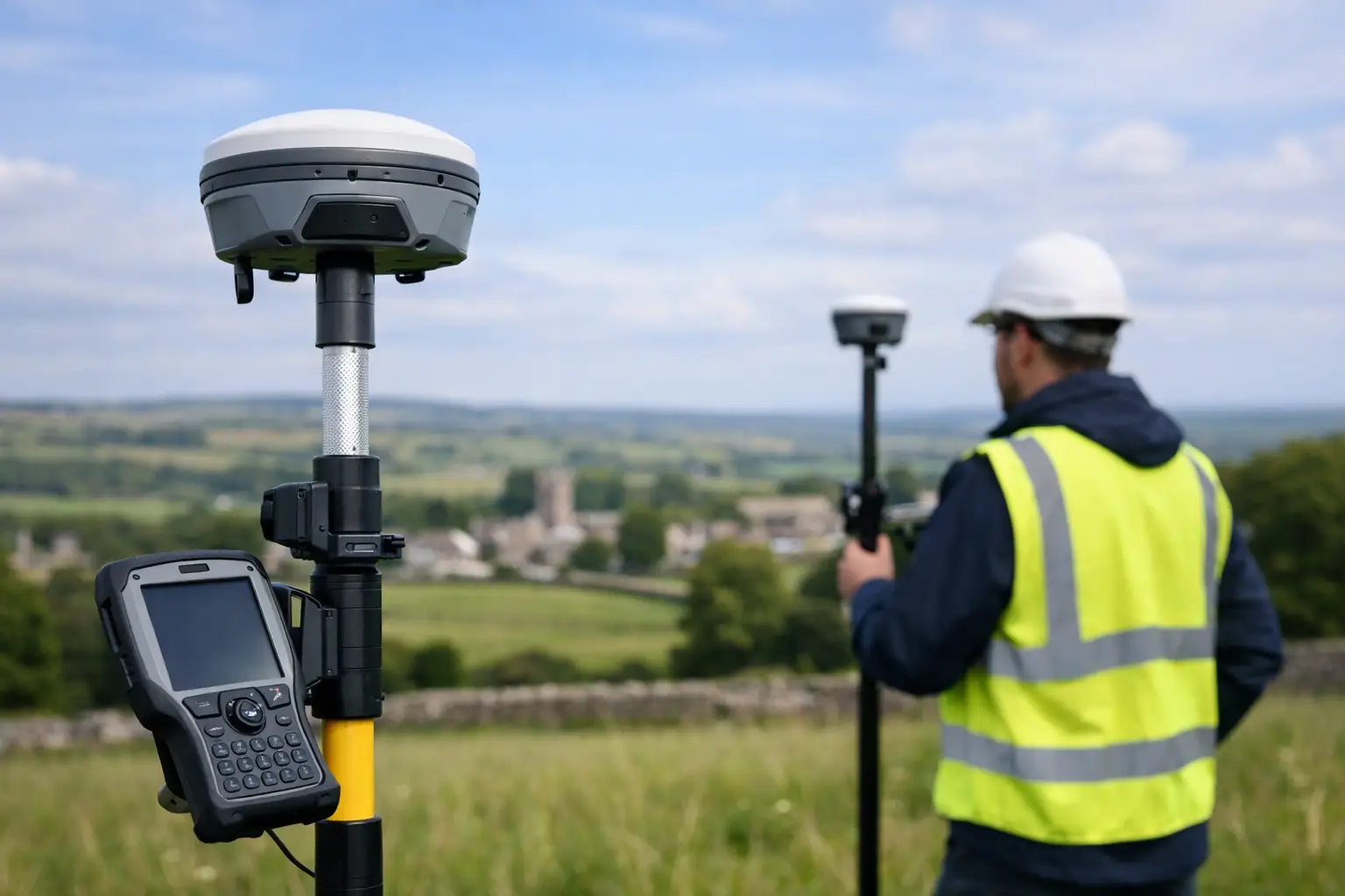
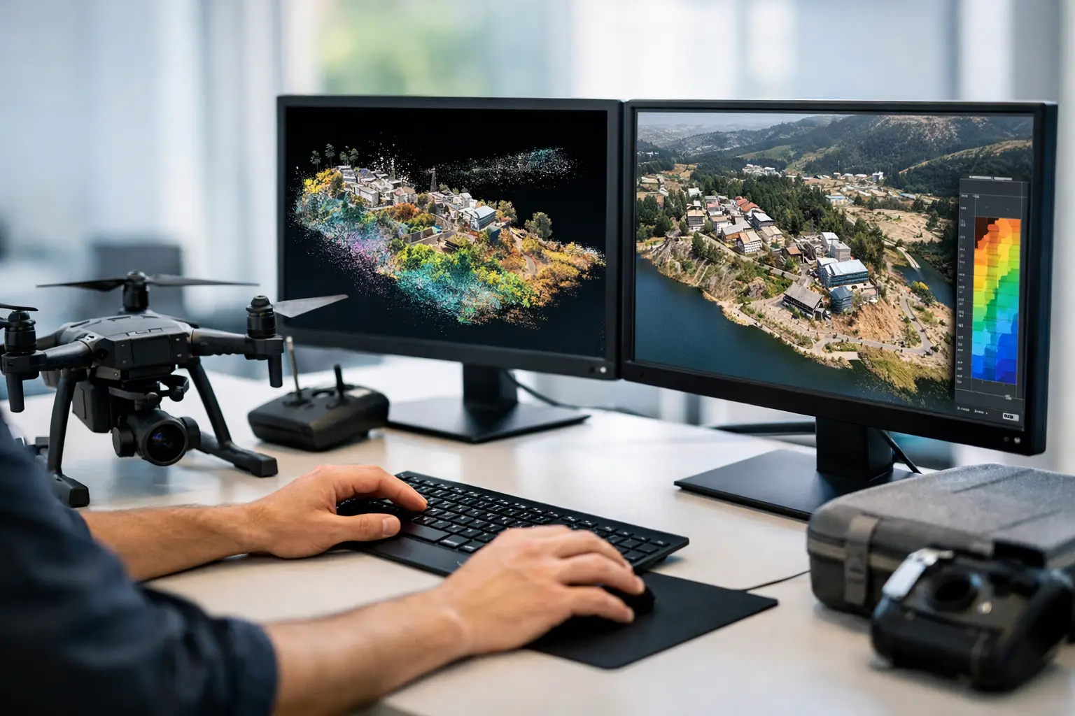
    A dense point cloud is only useful if it becomes a dependable deliverable. Many drone surveys fail at the desk rather than in the air – not because the flight data was poor, but because the processing workflow was inconsistent, over-smoothed, or not set up for the final output. If you need to know how to process drone point clouds for survey, inspection, or modelling work, the key is to treat processing as part of the survey method, not an afterthought.

    The right workflow depends on the sensor, the required accuracy, and the deliverable. A stockpile survey, a utility corridor, and a façade inspection all place different demands on classification, noise filtering, control, and export settings. That is why the best processing approach is not the one with the most automation. It is the one that preserves accuracy while producing usable data quickly.

    How to process drone point clouds: start with the end use

    Before importing anything, define what the point cloud needs to become. If the client needs a DTM for earthworks calculations, your priorities will be ground classification, vegetation removal, and reliable control. If the output is a 3D mesh for asset visualisation, surface completeness may matter more than a bare-earth model. For measured building work, edge fidelity and registration quality become more important than raw density.

    This decision affects the whole chain – flight planning, overlap, control strategy, sensor settings, software choice, and export format. Processing is far more efficient when the specification is clear from the start.

    In practical terms, identify the required coordinate system, expected tolerance, coverage area, and final deliverables before you begin. A professional workflow should also confirm whether the job requires LAS, LAZ, E57, RCP, mesh, contours, DSM, DTM, orthomosaic, or CAD-ready linework. Too many reprocessing cycles happen because that question was left until the end.

    Import, organise and verify the raw data

    The first desk-based stage is data integrity. Bring in the raw files, but do not process immediately. Check that all flight logs, image sets, LiDAR data, IMU records, and GNSS information are present and complete. If RTK or PPK has been used, verify that the corrected positioning solution is valid and that timestamps align properly across the dataset.

    Good file organisation matters more than many teams admit. Separate raw data from processed outputs, preserve original filenames, and document control coordinates, site notes, and flight metadata. On larger projects, that discipline saves time and reduces avoidable errors.

    At this stage, carry out a visual check. Look for missing strips, blurred imagery, poor overlap, excessive variation in flying height, or obvious GNSS issues. If the point cloud comes from LiDAR rather than pure photogrammetry, inspect trajectory quality and scan consistency before moving into full processing.

    Align the dataset correctly

    Alignment is where accuracy is won or lost. For photogrammetry, this means camera alignment and tie-point generation. For LiDAR, it usually means trajectory processing, strip adjustment, and registration. In hybrid workflows, it can mean combining both.

    If you are processing imagery-based point clouds, use high-quality overlap and sound camera calibration data. Ground control points and check points should be imported early, with the correct coordinate system and height datum. Control should not be used blindly. Spread it across the site, include changes in elevation, and keep independent checks aside to test the solution.

    For LiDAR workflows, pay attention to boresight calibration, IMU quality, GNSS corrections, and any drift along longer corridors. Strip alignment tools can improve consistency, but they should not be used to mask poor acquisition. If the source trajectory is weak, processing can only do so much.

    This is also the point to review residuals. Low residual values are encouraging, but they are not the whole story. You still need to inspect the model spatially. A dataset can report acceptable statistics while showing localised deformation near edges, vegetation, reflective surfaces, or uniform textures.

    Clean noise before heavy editing

    Every point cloud includes unwanted data. The trick is to remove noise without stripping out valid geometry. Over-aggressive filtering may leave you with a neat-looking model that no longer represents the site properly.

    Start with obvious outliers such as isolated airborne points, duplicated returns, and data beyond the survey boundary. Then assess whether the noise is random or systematic. Random noise often comes from vegetation movement, poor lighting, or marginal surfaces. Systematic noise may point to calibration issues, poor registration, or weak control.

    For drone LiDAR, classify low, medium, and high noise separately if the software allows it. For photogrammetric clouds, inspect vertical surfaces, water, glass, and repetitive textures carefully. These are common problem areas. It is usually better to clean in stages, checking each pass, than to apply one heavy filter and hope for the best.

    Classify the cloud to suit the job

    Classification turns a mass of points into something usable. Ground, buildings, vegetation, roads, powerlines, and site objects may all need separate classes depending on the application. The right setup depends on what the client needs to measure.

    For topographic survey work, the ground class is the priority. That means tuning parameters to remove scrub, parked plant, fences, and low structures without cutting into embankments or hard edges. In forestry, canopy structure may be the main value, so preserving multiple returns and vegetation classes becomes more important than producing a perfectly clean terrain model. For inspection work, classification may be minimal if the objective is simply a registered 3D dataset for viewing and measurement.

    Automation speeds this stage up, but it still needs manual review. Ground algorithms can struggle with steep banks, retaining walls, kerb lines, rubble, and dense undergrowth. If the terrain matters commercially, human quality control is still essential.

    Build the required surfaces and models

    Once the cloud is clean and classified, generate the products that suit the brief. A DSM includes everything visible from above, while a DTM aims to represent the bare earth. That distinction matters for cut-and-fill analysis, flood modelling, route design, and planning work.

    If you need a TIN or mesh, check whether the point density supports the level of detail expected. Very dense clouds are not always better. They can increase processing time, file size, and software instability without improving the final model. Decimation can be sensible, especially for visualisation or collaboration, but only if it does not compromise measurement quality.

    Orthomosaics, contours, breaklines, and CAD-ready exports often sit alongside the point cloud rather than replacing it. This is where specification-driven processing pays off. You should only create what the project actually requires.

    Quality check against control and site reality

    A professional output needs more than a quick screen review. Test the point cloud against check points, independent survey control, and known site dimensions. Where possible, compare sections through hard surfaces, building corners, kerbs, and other measurable features.

    Look at relative as well as absolute accuracy. A cloud can be well tied to national grid coordinates but still show local distortion. Equally, a visually clean model may contain classification errors that affect volume calculations or design inputs.

    For commercial survey work, document the QA process. Record the control method, processing settings, residuals, classification approach, and any known limitations. That record protects both the supplier and the client, especially where the data will inform design, construction, or asset decisions.

    Export point clouds in the right format

    Export is not just a final click. The format, coordinate system, class structure, and file size all affect whether the dataset is useful downstream. LAS and LAZ are common for classified point clouds. E57 is often useful for interoperability. Some clients need Autodesk-compatible outputs, while others want a simple deliverable for GIS or volume software.

    Keep units, projection, and metadata consistent. If the cloud is split into tiles, name them clearly and use a logical grid. If colour information is required, confirm that it has been retained properly. If the client needs classification codes, test the export in the receiving software before issuing the final files.

    This is also the stage to create lighter derivatives for routine viewing. A full-resolution master cloud should be preserved, but many teams also benefit from reduced-size copies for faster handling in common desktop applications.

    How to process drone point clouds efficiently at scale

    When projects become larger, speed matters as much as accuracy. The answer is standardisation. Build repeatable templates for control import, classification settings, QA checks, file naming, and export profiles. That reduces operator variation and makes turnaround more predictable.

    It also helps to match software and hardware to the sensor type. LiDAR-led workflows typically benefit from tools built for trajectory processing and classification. Image-led workflows may place more demand on GPU resources and alignment settings. There is no single best software stack for every project. It depends on the sensor, the site, and the output standard.

    For organisations running regular survey or inspection work, training is often the difference between acceptable results and dependable ones. LiDAR Tech UK supports clients not only with hardware selection but with workflows that fit operational requirements, which is often where the real value sits.

    Processing drone point clouds well is not about pushing every dataset through the same automated routine. It is about making sensible technical decisions at each stage so the final output stands up in the field, in the office, and in front of the client.
  • RTK vs PPK Mapping: Which Fits Best?

    RTK vs PPK Mapping: Which Fits Best?

    When a site programme is tight and the deliverable has to stand up to scrutiny, the RTK vs PPK mapping decision is not academic. It affects how quickly you can mobilise, how much field control you need, and how much confidence you have in the final coordinates. For surveyors, drone operators and engineering teams, the right choice usually comes down to project risk, correction availability and the way your team actually works on site.

    RTK vs PPK mapping in simple terms

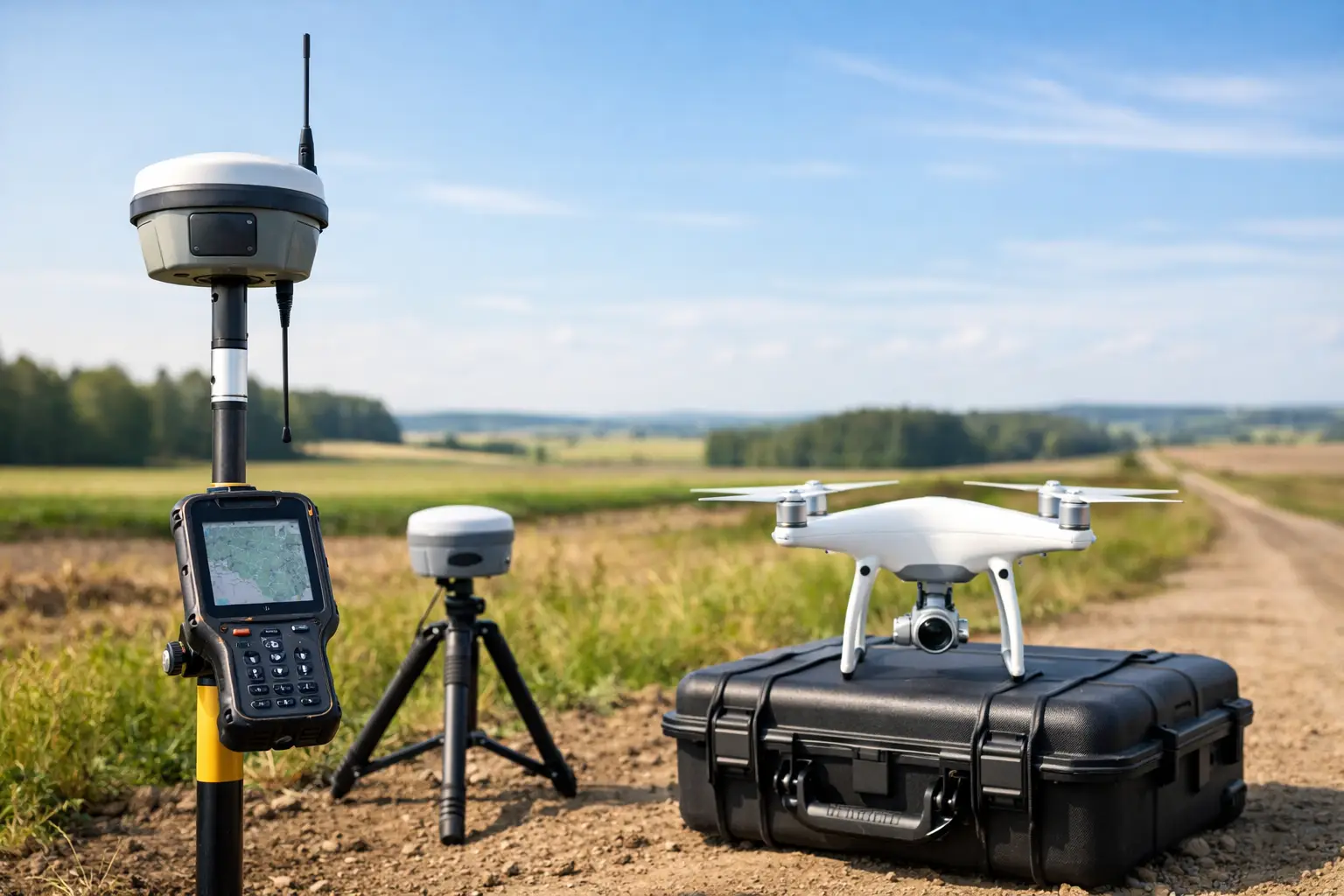
    RTK, or Real-Time Kinematic, applies correction data during the survey or flight. The rover or drone receives live corrections from a base station or network service, then fixes positions in real time. That gives you immediate feedback and allows data capture with survey-grade positioning while the work is being carried out.

    PPK, or Post-Processed Kinematic, records raw GNSS observations during the job and applies corrections later in the office. Instead of relying on a continuous live link during capture, you process the trajectory afterwards against base data or reference observations. The practical result is similar in ambition – high-accuracy positioning – but the workflow, risk profile and site requirements are different.

    For professional mapping, that difference matters. One method prioritises real-time certainty in the field. The other gives you more flexibility when communications are unreliable or the environment is difficult.

    Why the choice matters on real projects

    On a straightforward stockpile survey in an area with good mobile coverage, RTK may be the quickest option. You can fly, confirm solution status on site and move straight into processing. If the objective is speed with minimal rework, that is hard to ignore.

    On a linear infrastructure corridor, forestry site or remote utility route, the picture changes. Signal interruptions, uneven canopy, terrain masking and poor network access can all affect a live correction stream. In those cases, PPK often gives teams more resilience because the survey does not depend on maintaining a constant correction link throughout the operation.

    That is why there is no universal winner in RTK vs PPK mapping. Accuracy alone does not settle it. You also need to consider field conditions, operational pressure and what happens if something fails halfway through the job.

    Accuracy expectations: RTK vs PPK mapping

    Both methods can support centimetre-level results when deployed correctly. In practice, final accuracy depends on GNSS visibility, baseline length, quality of control, sensor calibration, flight planning and processing discipline. The positioning method is only one part of the chain.

    RTK can perform extremely well when the correction source is stable and the fix quality is maintained throughout the mission. If your drone or rover holds a reliable fixed solution and your control checks agree, the output can be very efficient and highly dependable.

    PPK can be equally strong, and in some scenarios more forgiving. Because you process afterwards, you can inspect the data quality in detail, reject poor epochs and work with a fuller view of what happened during the mission. That can be useful where live correction interruptions would otherwise create uncertainty.

    The important point for commercial buyers is this: neither RTK nor PPK removes the need for sensible survey control and validation. If the job carries contractual, engineering or legal weight, independent checks remain essential.

    Where RTK has the advantage

    RTK suits teams that need immediate positional confidence during capture. On active construction sites, quarries, development land and routine topographical work, that can reduce wasted time. You know in the field whether you have a fixed solution, whether the system is behaving as expected and whether a re-flight is needed before demobilisation.

    It also simplifies some workflows. If your equipment integrates well with a correction service and your team follows consistent setup procedures, RTK can reduce the burden of office-based trajectory processing. For busy operators managing repeat surveys across multiple sites, that efficiency has clear value.

    RTK also works well when your client expects a fast turnaround and the site environment is controlled enough to support it. If mobile data coverage is stable or a local base can be established easily, real-time correction is often the cleanest route.

    Where PPK has the advantage

    PPK comes into its own when field conditions are less predictable. Remote sites, poor mobile coverage, partial sky obstruction and long corridors all make live corrections harder to trust. With PPK, the mission can proceed without depending on a continuous correction feed.

    That can reduce operational stress. Instead of constantly monitoring whether the link has dropped out, the team focuses on consistent capture, sound base data and proper post-processing. For organisations surveying infrastructure, forestry, utilities and rural assets, that flexibility can be a decisive benefit.

    PPK is also attractive where data auditability matters. Because the trajectory is processed afterwards, there is often more opportunity to review and document what happened. For some clients and quality systems, that additional traceability is valuable.

    Ground control points still matter

    A common mistake in discussions about RTK vs PPK mapping is treating both as a complete replacement for ground control. In reality, reduced control does not mean zero control.

    RTK-enabled and PPK-enabled workflows can cut the number of ground control points needed for mapping, especially with well-calibrated sensors and disciplined procedures. That saves time on hazardous or difficult sites. But check points are still vital for validating horizontal and vertical accuracy.

    If the terrain is complex, the site is large, or the output will feed into design, volume calculations or compliance documentation, independent checks are not optional. Good practice is not just about claiming a specification. It is about proving that the delivered data meets it.

    Workflow, risk and team capability

    The better question is often not which method is more accurate, but which method introduces less risk for your operation.

    RTK shifts confidence to the field stage. If the corrections are sound and the fix remains stable, you leave site with a strong idea of data quality. The trade-off is dependency on communications and setup discipline. A weak network, poor base placement or unnoticed fix issue can undermine the result quickly.

    PPK shifts more responsibility to the office stage. You gain flexibility during capture, but you need a team that can manage raw data properly, process trajectories correctly and maintain a documented workflow. If that capability is missing, the advantage of PPK can be lost in rework or inconsistent outputs.

    This is where equipment choice and supplier support matter. Integrated GNSS, drones, correction services and processing software reduce friction, but only if the workflow is properly understood. For many organisations, a dependable support partner matters as much as the specification sheet.

    Which method suits which project?

    For construction progress mapping, routine earthworks, site stockpiles and many standard topographical drone surveys, RTK is often the practical first choice. It is fast, efficient and well suited to teams working to tight operational windows.

    For remote land surveys, utility corridors, forestry mapping and sites where coverage is unreliable, PPK often provides more resilience. It lets teams capture data without hinging success on a live correction feed.

    For higher-stakes projects, many professionals use a blended mindset rather than a rigid preference. They choose hardware that supports both approaches, apply proper check points and decide on the day based on signal conditions, site access and project tolerances. That is usually the most commercially sensible position.

    Making the right decision

    If your priority is speed in the field, straightforward workflows and immediate quality visibility, RTK is usually the stronger fit. If your priority is flexibility, resilience in difficult environments and reduced dependence on live connectivity, PPK may be the better option.

    For UK organisations investing in drone mapping or GNSS survey capability, the best decision comes from matching the method to the project environment, the required deliverable and your internal capacity to process and verify results. LiDAR Tech UK typically sees the strongest outcomes where clients assess the full workflow rather than chasing a headline feature.

    The useful test is simple: choose the method that gives you reliable coordinates with the least operational risk, not the one that sounds more advanced on paper.

  • LiDAR Tunnel Mapping Services Explained

    LiDAR Tunnel Mapping Services Explained

    When a tunnel survey has to be completed during a tight possession window, every minute matters. LiDAR tunnel mapping services give asset owners, contractors and survey teams a faster way to capture accurate 3D geometry in confined, low-light and operationally sensitive environments where traditional methods can quickly become slow, disruptive and costly.

    Where LiDAR tunnel mapping services add value

    Tunnels are difficult survey environments by default. GNSS is unavailable, visibility can be poor, access may be restricted, and safe working time is often limited by operations. At the same time, the need for dependable data is high. Rail tunnels, highway bores, utility corridors, culverts, mines and service passages all require precise measurement for inspection, clearance analysis, maintenance planning and design validation.

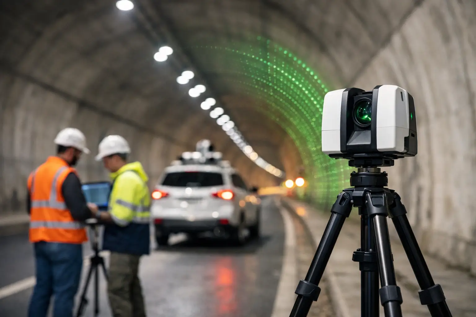
    LiDAR tunnel mapping services are well suited to these conditions because they capture dense point cloud data rapidly across long linear assets. Instead of relying on discrete measured points, project teams receive a full 3D record of the tunnel lining, track bed, cable routes, drainage runs, service penetrations and other internal features. That level of detail supports better decision-making when assessing deformation, planning remedial works or coordinating future installations.

    For many organisations, the commercial advantage is just as important as the technical one. Shorter field time can reduce possession costs, lessen operational disruption and improve site safety by limiting the duration surveyors spend in hazardous or access-controlled areas.

    What a tunnel LiDAR survey actually delivers

    A well-executed tunnel survey is not simply about collecting data quickly. The output has to be usable for engineering, design and asset management. That is where specification, control strategy and processing discipline matter.

    Most projects require a registered and georeferenced point cloud, but deliverables can vary depending on the asset and downstream use. A client may need measured cross sections at fixed intervals, clearance envelopes, deformation analysis, digital terrain and track models, 2D drawings, BIM-ready geometry or a textured 3D model for visual review. In some cases, the priority is condition assessment. In others, it is dimensional control for refurbishment, extension or clash detection.

    This is why tunnel mapping should not be treated as a one-size-fits-all scanning exercise. Scanner selection, traverse design, control establishment and data processing all need to align with the required accuracy and final output format.

    Why tunnels need a different survey approach

    The challenge with tunnels is that the environment works against standard survey workflows. Satellite positioning drops out, repetitive surfaces can complicate registration, and dust, moisture or reflective materials may affect data quality. Curved alignments, service recesses and variable lighting can also create blind spots if the capture plan is not thought through properly.

    A practical tunnel LiDAR methodology usually combines mobile or handheld scanning with static control where needed. For long corridors, mobile capture can cover ground efficiently. For areas that demand tighter tolerances, such as portal interfaces, plant rooms, structural defects or complex junctions, static scanning and total station control may still be the right choice.

    That balance matters. Mobile methods are faster, but speed alone is not the goal. If a refurbishment contractor needs millimetre-level confidence for prefabricated components, the survey design has to reflect that. If the objective is condition mapping across a long asset, a different capture strategy may be more cost-effective.

    Accuracy, speed and the trade-off between them

    Professional buyers tend to ask the same question first: how accurate is the data? The honest answer is that it depends on the tunnel, the control available and the purpose of the survey.

    LiDAR tunnel mapping services can achieve highly accurate results, but accuracy should always be defined against project tolerances rather than broad marketing claims. Relative accuracy within a local section may be excellent, while absolute accuracy across a long alignment depends heavily on control, registration and verification. In a tunnel with limited access points and long distances between control stations, maintaining confidence over the full corridor requires careful planning.

    There is also a trade-off between productivity and precision. Rapid mobile scanning can transform field efficiency, especially in rail and utilities environments, but not every job needs the same specification. A project for general asset documentation may prioritise speed and coverage. A project for structural remediation or clearance analysis may justify a slower workflow with denser control and additional validation.

    The right service provider should be clear about that distinction from the outset. Over-specifying a survey increases cost unnecessarily. Under-specifying it creates risk later, usually when design teams start relying on the data.

    Typical use cases across UK infrastructure

    In the UK market, tunnel scanning is increasingly used across transport, utilities and civil engineering projects where downtime is expensive and access is difficult. Rail operators and contractors use LiDAR for gauging, lining assessment, drainage review, cable route documentation and pre-work planning. Highway teams use it to document road tunnels, service bays, ventilation areas and structural elements prior to maintenance or upgrade works.

    Utility and infrastructure managers also benefit from 3D tunnel data when recording pipework, conduits, cable trays and associated access points. Where legacy drawings are incomplete or unreliable, a current measured dataset can significantly reduce uncertainty before intrusive works begin.

    Heritage and conservation projects are another strong fit. Historic tunnels and underground structures often have irregular geometry that is difficult to capture with traditional methods alone. LiDAR provides a detailed digital record that supports restoration, monitoring and long-term documentation.

    What to look for in a service provider

    Choosing between lidar tunnel mapping services is not just about who owns a scanner. It is about who can plan the survey properly, work safely in restricted environments and deliver data in a format your team can use immediately.

    Start with methodology. A credible provider should explain how they will establish control, manage registration, verify accuracy and deal with known tunnel constraints such as poor lighting, repetitive surfaces and access limitations. They should also be clear on whether the project is best handled with static scanning, mobile mapping or a hybrid approach.

    Experience in operational environments matters as well. Tunnel work often involves possession planning, safety protocols, coordination with principal contractors and compliance with site-specific requirements. That is not the same as scanning an empty building or open site.

    Then look closely at deliverables. Some providers stop at a raw or lightly processed point cloud. Others can supply CAD linework, sections, meshed models, asset extraction and analysis-ready datasets. If your engineering team needs a particular format, confirm that before the fieldwork begins.

    For many clients, support after capture is just as valuable as the survey itself. LiDAR Tech UK, for example, works across hardware, software and project delivery, which is useful when clients need a practical route from data capture through to usable outputs rather than a standalone scanning exercise.

    Planning a successful tunnel survey

    Good tunnel mapping starts before anyone steps on site. Scope definition is critical. The survey brief should identify the length of tunnel, access constraints, required outputs, accuracy tolerances, control available and any problem areas that need special attention.

    A site-specific risk assessment is equally important. Confined spaces, live infrastructure, uneven surfaces, water ingress and limited escape routes all affect how the survey is carried out. In many cases, the safest survey is the one completed in the shortest realistic time, provided quality is not compromised.

    Processing should also be factored into the programme from the start. Large tunnel point clouds can be data-heavy, and registration, cleaning, classification and modelling all take time. If a contractor needs fast design input for a live programme, the delivery schedule has to reflect that urgency.

    Why the cheapest option often costs more later

    Tunnel surveys sit early in the project chain, but the impact of poor data usually appears later. Misaligned point clouds, weak control or incomplete coverage can lead to design rework, site clashes, delayed approvals and repeat visits. In restricted tunnel environments, a return survey can be expensive and difficult to arrange.

    That is why value should be measured against project risk, not just day rates. Accurate, well-processed LiDAR data can reduce uncertainty across design, coordination and construction stages. It can also provide a defensible record of asset condition at a specific point in time, which is useful for compliance, handover and dispute avoidance.

    For buyers comparing providers, the best question is not simply how quickly the tunnel can be scanned. It is whether the resulting dataset will stand up to engineering use, commercial pressure and operational scrutiny.

    If you are planning works in a tunnel environment, the strongest starting point is a survey scope that matches the real decisions your team needs to make. Get that right, and the data becomes more than a visual record – it becomes a dependable basis for safer access, clearer design and better project control.

  • A Guide to Enterprise Drone Compliance

    A Guide to Enterprise Drone Compliance

    Enterprise drone programmes rarely fail because of aircraft capability. More often, they stall when compliance is treated as a one-off approval rather than an operational system. This guide to enterprise drone compliance is written for UK organisations using drones for surveying, inspection, mapping, construction, utilities, infrastructure and asset management, where legal, safety and data requirements have to stand up to scrutiny.

    For commercial teams, compliance is not just about staying on the right side of regulation. It affects whether flights can be scheduled quickly, whether clients accept deliverables without challenge, whether insurers remain satisfied, and whether internal stakeholders trust the programme enough to scale it. A drone that captures precise data but creates operational risk is not an enterprise asset. It is a liability.

    What enterprise drone compliance actually covers

    In practice, enterprise drone compliance sits across four connected areas: aviation regulation, operational safety, organisational governance and data handling. Many businesses focus only on the first of these. That is understandable, but incomplete.

    A UK operator may hold the right permissions or operate within the correct category, yet still fall short if pilot competency is inconsistent, maintenance records are weak, site risk assessments are generic, or image and LiDAR outputs are not managed under clear data controls. Enterprise use demands repeatability. The standard has to be suitable not just for one successful flight, but for dozens or hundreds of flights across varied environments.

    That is where mature procedures matter. A compliant operation is one where aircraft selection, pilot training, mission planning, field execution and data delivery all sit within a documented framework. The more safety-critical or commercially sensitive the project, the less room there is for informal practice.

    The UK regulatory baseline

    Any guide to enterprise drone compliance for the UK market has to start with the Civil Aviation Authority framework. The detail will depend on aircraft weight, operating environment, proximity to people and property, and whether the operation falls within Open, Specific or another applicable category.

    For many enterprise users, the key point is that the aircraft does not determine compliance on its own. The flight scenario does. The same platform may be straightforward to deploy on a rural survey and far more constrained around a live construction site, rail corridor or urban asset inspection. Compliance has to be assessed against the operation, not just the specification sheet.

    Pilot registration and operator registration are the obvious starting points, but they are not enough for a serious business deployment. Organisations should also be clear on competency requirements for staff, the operating limitations of each aircraft in the fleet, and the conditions attached to any authorisations in place. If your team cannot explain exactly why a mission is permitted and under what limits, the process is too weak.

    Build compliance around the mission, not the drone

    One common mistake is buying a capable enterprise aircraft and assuming the rest can be resolved later. In reality, the compliance model should be designed around mission type from the outset.

    A topographic survey over private land has a different risk profile from a façade inspection near public roads. A stockpile volume survey on a controlled quarry site is different again from a utility inspection near critical infrastructure. Each operation changes the requirements for pilot competence, airspace checks, stakeholder communication, site control, emergency planning and data security.

    That is why many organisations benefit from standard operating procedures written by use case. A single document for all drone activity often becomes too vague to be useful. Separate procedures for mapping, inspection and confined or higher-risk work usually create better operational discipline.

    Training, competency and operational oversight

    Enterprise buyers often ask which aircraft is best for compliance. The more useful question is whether the operator can maintain a competent team around that aircraft. Even advanced safety features do not replace decision-making in the field.

    Pilots should be trained not only to fly, but to assess site conditions, identify operational limits, manage observers where required, respond to interruptions and document exceptions properly. For survey and inspection work, they also need enough technical understanding to know when poor acquisition conditions will compromise output quality. Compliance and data quality are closely linked.

    Internal oversight matters just as much. Someone in the organisation should own operational governance, whether that is a drone manager, geospatial lead or HSE function. Without clear ownership, records drift, firmware updates are applied inconsistently, batteries are used without traceability, and field teams begin adapting procedures informally. That may appear efficient until an incident, audit or client review exposes the gaps.

    Document control is where many programmes weaken

    The strongest drone teams tend to be disciplined on paperwork because they know documentation is operational protection, not admin for its own sake. If a project involves regulated airspace, sensitive assets or client scrutiny, records need to be complete and current.

    That typically includes maintenance logs, battery lifecycle records, firmware and software version control, pre-flight and post-flight checklists, incident and near-miss reporting, training records, site-specific risk assessments and mission planning documentation. Where subcontract pilots are used, their qualifications and operating standards should be checked against the same benchmark as internal staff.

    There is a trade-off here. Too much paperwork can slow deployment and push teams towards workarounds. Too little creates exposure. The right balance is a documentation system that is detailed enough to stand up to review but simple enough to support day-to-day operations at pace.

    Data protection, security and client confidence

    Drone compliance is not limited to flight legality. For enterprise users, data governance is often just as commercially important. Survey outputs, thermal imagery, infrastructure models and point clouds may contain sensitive information about assets, facilities or private property. That creates obligations around capture, transfer, storage and access.

    This is especially relevant for utilities, public-sector projects, defence-adjacent environments, critical infrastructure and high-value commercial developments. In those contexts, the compliance question is not only whether the aircraft can collect the data, but where the data goes, who can access it, how long it is retained and whether the processing workflow aligns with client expectations.

    Organisations should have a clear policy on device management, memory card handling, cloud use, project folder permissions and secure transfer of deliverables. If image or sensor data is collected on behalf of a client, contractual requirements may be stricter than baseline internal policy. That is another reason enterprise drone workflows need governance from procurement through to delivery.

    Choosing equipment that supports compliance

    Aircraft choice still matters, but mainly because the right platform reduces avoidable risk. Reliability, obstacle sensing, RTK capability, remote identification features, flight logging, battery health reporting and predictable mission planning all help create a more controllable operation.

    The best-fit system depends on the application. Survey-grade mapping, corridor work, asset inspection and LiDAR capture each place different demands on payload, endurance, accuracy and flight behaviour. A platform that is excellent for inspection may be inefficient for large-area mapping, while a long-endurance mapping aircraft may be unsuitable for closer structural work.

    From a compliance perspective, standardising the fleet can simplify training, maintenance and record keeping. The trade-off is that one platform rarely covers every use case perfectly. Many organisations do better with a controlled fleet strategy: fewer aircraft types, clearly assigned to defined mission classes, with common operating procedures wherever practical.

    When outsourced delivery is the better compliance decision

    Not every organisation should run all missions in-house. That is not a weakness. It is often the more commercial and lower-risk choice.

    If flight volumes are low, sites are unusually complex, or the required output demands specialist LiDAR, photogrammetry or inspection capability, outsourcing can be more efficient than carrying the full compliance burden internally. The key is using a provider that understands both the aircraft operation and the data outcome. A compliant flight that produces unusable survey data is still a failed project.

    This is where a specialist partner can add value beyond equipment supply. Businesses such as LiDAR Tech UK support organisations not only with enterprise drone systems, but also with implementation guidance, training and operational delivery where internal capability needs reinforcement.

    A practical guide to enterprise drone compliance for scaling teams

    If your organisation is moving from occasional flights to a formal programme, the priority is to build a system that scales cleanly. Start by defining approved use cases, then map the regulatory position and operational limits for each one. Assign ownership internally, standardise training, document the workflow, and review incidents and near misses with the same seriousness as other field operations.

    After that, test whether your process works under pressure. Can a new pilot be onboarded quickly? Can a site team prove the aircraft is airworthy? Can a project manager confirm where data is stored? Can you show a client the risk assessment and flight record for a completed job? If the answer is inconsistent, the compliance framework needs work.

    Strong enterprise drone compliance is not about creating friction. It is about making deployment dependable, defensible and commercially viable. When the process is built properly, projects move faster because fewer decisions are left to improvisation.

    The organisations getting the best value from drones are not simply the ones flying the most advanced platforms. They are the ones treating compliance as part of operational performance, with the same attention they give to accuracy, safety and deliverable quality.

  • Best Drone for Asset Inspection in 2026

    Best Drone for Asset Inspection in 2026

    A bridge inspection missed in the wrong weather window, a flare stack that needs urgent visual review, or a solar farm with intermittent faults across hundreds of panels – this is where choosing the best drone for asset inspection becomes a commercial decision, not just a technical one. The right platform reduces time on site, keeps teams out of hazardous access scenarios, and produces usable inspection data the first time.

    For most professional operators, there is no single answer that suits every asset class. The best choice depends on what you are inspecting, the level of detail required, the sensor payload, site constraints, and how the data will be used after capture. A drone that performs well on roof surveys may not be the right fit for utilities, and a platform suited to broad-area thermal scans may not be ideal for confined industrial structures.

    What makes the best drone for asset inspection?

    For professional inspection work, airframe quality matters, but payload capability matters more. Asset inspection typically depends on collecting high-quality visual, thermal, or spatial data from difficult viewpoints while maintaining safe stand-off distances. That means camera resolution, zoom range, thermal sensitivity, stabilisation, and low-light performance often have a greater impact on results than headline speed alone.

    Flight performance is the next filter. Wind resistance, endurance, obstacle sensing, and transmission stability all influence whether the aircraft can work productively on live infrastructure or exposed sites. Inspection teams also need predictable operational behaviour. A drone that is theoretically capable but awkward to deploy, slow to position, or inconsistent near structures will quickly become expensive in the field.

    Data workflow should not be treated as an afterthought. The best drone for asset inspection is one that supports the end result you actually need – whether that is a defect report, thermal anomaly map, orthomosaic, 3D model, or CAD-ready dataset. If the aircraft captures good imagery but the workflow to process and present that data is weak, the operational value drops.

    Matching the drone to the asset

    Different sectors place very different demands on inspection equipment. Building and roof inspections often prioritise high-resolution RGB imaging, oblique capture, and safe operation close to structures. Utility and powerline work may require strong zoom capability and stable imaging at distance. Solar inspection depends heavily on thermal quality, repeatability, and efficient coverage over large areas. Industrial plant inspections often need a balance of zoom, thermal, and obstacle awareness where access is tight and safety controls are strict.

    This is why specification sheets on their own can be misleading. A platform with a larger sensor may produce excellent imagery, but if it lacks the zoom range to inspect elevated assets from a safe stand-off position, it may not be the best fit. Likewise, a thermal payload can look attractive on paper, but thermal resolution, calibration, and reporting workflow matter far more than simply having a heat camera on board.

    DJI Matrice 4T for general inspection work

    For many organisations, the DJI Matrice 4T is currently one of the strongest answers to the question of the best drone for asset inspection. It is particularly well suited to teams that need a compact enterprise platform for routine inspection across buildings, utilities, solar, and light industrial assets.

    Its strength is versatility. A multi-sensor payload gives operators visual and thermal capability in one aircraft, which is valuable when inspections need both defect identification and thermal verification. This reduces the need for multiple flights or separate platforms and helps site teams move from survey to assessment more quickly.

    The compact format also matters. Larger aircraft can offer payload advantages, but they are not always the most efficient choice for routine deployment. Where teams need rapid mobilisation, straightforward transport, and consistent repeat inspections, a smaller enterprise platform can offer better operational value.

    That said, suitability depends on inspection depth. If your work involves highly specialised sensors, larger payload requirements, or advanced LiDAR capture alongside imaging, a compact thermal platform may not cover every use case.

    When the Matrice 350 RTK is the better fit

    If inspections are part of a wider enterprise workflow, the DJI Matrice 350 RTK often becomes the stronger option. This is especially true for operators working across large infrastructure, demanding environments, or projects where payload flexibility is central to the job.

    The key advantage is expandability. Rather than locking you into a single inspection profile, this platform supports a broader range of payloads and mission types. That makes it suitable for organisations that carry out visual inspection one week, thermal diagnostics the next, and LiDAR or mapping work on another project. For asset owners and service providers managing mixed workloads, that flexibility can justify the higher investment.

    It also offers practical benefits in challenging field conditions. Better endurance, stronger weather resistance, and enterprise-grade redundancy improve reliability on longer or more exposed operations. For critical infrastructure inspections, those gains are not minor. They affect job completion, safety margins, and confidence in the aircraft when site conditions are less than ideal.

    The trade-off is cost and complexity. Not every inspection programme needs a heavy-duty modular platform. If your work is mainly visual and thermal capture on standard assets, the additional capability may sit underused.

    Sensor choice matters as much as the aircraft

    A professional inspection outcome is driven by sensor selection. High-resolution RGB is the baseline for crack detection, façade review, roof condition assessment, and general visual reporting. Zoom capability becomes essential when the asset cannot be approached closely or where exclusion zones limit flight paths.

    Thermal imaging is critical for several sectors, but expectations need to be realistic. It is highly effective for solar faults, building envelope issues, overheating components, and some utility inspections. It is less useful where material behaviour, ambient conditions, or asset design limit clear thermal interpretation. Good thermal surveys depend on timing, environmental conditions, and an operator who understands what the data is actually showing.

    LiDAR adds another layer where geometry matters as much as imagery. For certain assets, especially where inspection overlaps with modelling, clearance analysis, vegetation encroachment, or structural context, LiDAR can significantly improve deliverables. In those cases, the best drone for asset inspection may not be the smallest or cheapest option. It may be the one that fits into a broader geospatial workflow.

    Operational factors buyers should not overlook

    Many buying decisions focus too narrowly on camera specifications. In practice, deployment efficiency often has equal value. Battery management, controller usability, mission planning software, RTK capability, and post-processing support all influence the total cost of ownership.

    Support should also be part of the evaluation. Professional buyers are not simply purchasing an aircraft. They are investing in an operational system that may require training, compliance guidance, payload integration, maintenance planning, and workflow support. This is where working with a specialist supplier such as LiDAR Tech UK can make a measurable difference, particularly for organisations building in-house inspection capability rather than buying a single unit off the shelf.

    Another factor is output expectation. If your client or internal asset team needs annotated defect reports, thermal comparisons, or measurable 3D outputs, choose a platform and software workflow that supports those deliverables from the start. It is far more efficient to design the workflow around the required output than to retrofit reporting after capture.

    So, which is the best drone for asset inspection?

    If you need a practical answer, the best drone for asset inspection is usually an enterprise platform with integrated visual and thermal capability, strong stability near structures, dependable obstacle sensing, and a data workflow that supports reporting. For many organisations, that points to the DJI Matrice 4T as the strongest all-round choice.

    If your inspections sit inside a broader geospatial, infrastructure, or multi-payload operation, the DJI Matrice 350 RTK is often the better long-term investment. It offers more headroom, greater payload flexibility, and stronger suitability for mixed operational requirements.

    The right decision comes down to inspection type, reporting requirements, operating environment, and whether you need a single-purpose inspection drone or a platform that supports wider surveying and data capture work. The most effective buyers assess the asset first, then the sensor, then the aircraft.

    A good inspection drone should not simply get airborne. It should reduce access risk, shorten capture time, improve data quality, and fit the way your organisation actually delivers projects.

  • Ground Control Points Explained Clearly

    Ground Control Points Explained Clearly

    A drone survey can look perfect on screen and still be wrong on the ground. That gap between a clean model and a dependable dataset is often where ground control points explained becomes a practical question rather than a technical one. If you are producing mapping, orthomosaics, point clouds or measured outputs for construction, infrastructure or asset management, GCP strategy directly affects whether the result is visually acceptable or commercially usable.

    What are ground control points?

    Ground control points, usually shortened to GCPs, are clearly identifiable points on the ground whose coordinates have been measured accurately with survey-grade GNSS, total station or a combination of both. They are used to tie aerial or terrestrial data to a known coordinate system so the final dataset is positioned correctly and scaled properly.

    In simple terms, a GCP gives your drone or photogrammetry software a known real-world reference. Instead of relying only on the aircraft’s onboard GNSS, the processing software matches visible markers in the imagery to surveyed coordinates. That reduces positional drift and improves absolute accuracy across the site.

    This matters because onboard positioning, even with RTK or PPK, does not solve every error source. Camera calibration, flight height, terrain variation, image overlap, site geometry and weak satellite conditions can all affect results. GCPs help control those variables.

    Ground control points explained in real project terms

    For professional users, the value of GCPs is not academic. It shows up in whether a volume calculation is defensible, whether a design overlay lands in the right place, and whether repeat surveys align from one visit to the next.

    On a construction site, inaccurate ground control can shift an orthomosaic enough to create problems in setting-out checks or progress measurement. On a highway or rail corridor, poor control distribution can introduce distortion along the length of the model. For utilities, forestry and asset inspection, inconsistent control can limit the usefulness of outputs when they are brought into CAD, GIS or asset management systems.

    That is why ground control points explained properly should always include a key distinction: GCPs improve the geospatial reliability of the entire workflow, not just the appearance of the deliverable.

    How GCPs are used in drone mapping and photogrammetry

    In a standard drone survey workflow, visible markers are placed around and through the site before flying. These markers are then surveyed with accurate coordinates. During processing, the software identifies the markers in multiple images and uses those known positions to constrain the model.

    The result is usually stronger absolute accuracy and better overall stability. This is especially useful on larger areas, complex terrain, sites with limited distinct features, or projects where outputs will be compared against existing survey control.

    It is worth separating three related roles. Some points are used as control, meaning they guide the model adjustment. Others are used as checkpoints, meaning they are held back from processing and used only to verify the finished accuracy. That distinction is critical if you want an honest measure of performance rather than a result that only looks accurate because every point was used to force the solution.

    When ground control points are necessary

    Not every project needs the same level of control. If the task is a fast visual inspection or a general site overview, onboard GNSS may be enough. If the deliverable will inform design, payment, compliance, engineering decisions or repeatable monitoring, stronger control is usually justified.

    The need becomes more obvious on sites with long linear extents, significant elevation change, weak GNSS conditions, repetitive textures or high accuracy requirements. Urban corridors, cuttings, wooded margins, steep stockpiles and infrastructure assets often fall into this category.

    RTK and PPK drone systems have improved field efficiency significantly, but they do not make GCPs irrelevant. In many cases they reduce the number of GCPs required rather than removing the need entirely. A well-configured RTK workflow with a sensible number of checkpoints may be sufficient on some projects. On others, a full control network remains the safer option.

    It depends on required tolerance, site conditions and the downstream use of the data. That decision should be made before fieldwork starts, not after processing exposes a problem.

    Placement matters as much as quantity

    A common mistake is assuming that more GCPs automatically means better accuracy. In practice, placement is just as important as count. A small number of well-distributed points will often outperform a larger cluster placed only around the edge of the site.

    Control should normally cover the full project area, including corners, edges and internal sections where possible. On sites with height variation, include points across different elevations rather than keeping everything on a single level. Long narrow surveys need control along their length, not just at either end.

    Markers also need to be clearly visible in imagery. If the target is too small, poorly contrasted or partially obscured, the software may not identify it consistently. That introduces uncertainty before processing even begins.

    For busy operational sites, marker survivability matters too. A perfectly surveyed target is of little use if a machine moves it before the flight or site traffic covers it in mud.

    How accuracy is really checked

    The best way to assess survey quality is not to trust the software report at face value, but to review independent checkpoints and compare them against project tolerances. Horizontal and vertical errors should both be examined, because some datasets appear acceptable in plan while underperforming in elevation.

    This is particularly relevant for volume work, drainage assessment and earthworks monitoring, where small vertical errors can have a substantial operational impact. If your workflow only checks visual fit, you may miss the very issue that affects the commercial decision.

    A dependable process includes surveyed control, independent validation and clear reporting. For professional buyers, accuracy claims should always be tied to method and site conditions, not presented as a universal figure.

    Ground control points explained for LiDAR workflows

    Although GCPs are most often discussed in photogrammetry, they also matter in LiDAR projects. UAV LiDAR and mobile mapping systems can achieve excellent relative accuracy, but absolute positioning still depends on good GNSS, IMU performance and sound control procedures.

    In LiDAR workflows, control points and check points are commonly used to validate strip alignment, confirm georeferencing quality and support confidence in deliverables such as terrain models, asset coordinates and measured clearances. If the data will support engineering, planning or condition assessment, independent verification remains good practice.

    The exact role of control varies by sensor, platform and mission profile. A high-grade LiDAR system with strong trajectory processing may require fewer physical controls than a purely photogrammetric survey, but validation is still essential where accuracy is contract-critical.

    Common problems when GCPs are handled poorly

    Most GCP issues are avoidable. The usual failures are weak distribution, imprecise surveying, inconsistent target identification, or mixing coordinate systems without proper checks. Even experienced teams can lose accuracy if field and processing stages are not joined up.

    Another issue is using all measured points as control and none as checkpoints. That may improve the adjustment statistics, but it gives little evidence of real-world accuracy. It is better to prove the dataset than to overfit it.

    There is also a commercial trade-off. More control means more time on site. Less control means faster deployment, but potentially higher risk. The right balance depends on the specification, not just the desire to reduce field hours.

    Choosing the right approach for your project

    For many organisations, the question is not whether GCPs exist, but how much control is enough for the intended output. If you are surveying a small open site with an RTK-enabled enterprise drone, a limited control strategy with independent checkpoints may be efficient and fully adequate. If you are mapping a complex construction corridor for engineering decisions, more extensive control is likely to be justified.

    That is where an integrated geospatial approach makes a difference. Hardware capability, correction services, survey control, processing method and final data requirements all need to align. Treating GCPs as a separate box-ticking exercise usually leads to either overspend or underperformance.

    For clients planning drone, GNSS or LiDAR deployment, LiDAR Tech UK typically advises on control strategy in the context of the whole workflow rather than as an isolated survey task. That is generally the most reliable route to consistent, decision-ready outputs.

    Ground control is not glamorous, but it is often the difference between a dataset that looks convincing and one that stands up when accuracy really matters. If your outputs will feed into design, measurement or asset decisions, it is worth asking the harder question at the start: not simply whether you used GCPs, but whether you used them well.

  • FJD Trion S1 review for UK survey teams

    FJD Trion S1 review for UK survey teams

    When a mobile scanner is being considered for live project work, the question is rarely whether it can capture data. The real test in any FJD Trion S1 review is whether it can produce reliable, usable outputs fast enough to justify its place in a professional survey workflow. For UK surveyors, contractors and asset teams, that means looking beyond headline specifications and judging how the system performs on site, in processing, and under commercial pressure.

    FJD Trion S1 review: where it fits

    The FJD Trion S1 is positioned as a handheld and backpack-capable SLAM LiDAR system for rapid reality capture. Its appeal is straightforward. It gives teams a way to survey complex spaces far more quickly than a static terrestrial laser scanner, while avoiding some of the line-of-sight and setup constraints that slow conventional methods.

    That makes it particularly relevant for building interiors, plant rooms, facades, heritage spaces, construction progress capture, stockpile environments and sites where access is awkward or time on site is limited. If your work depends on millimetre-level control over small, high-detail features, a static scanner will still have the advantage. If your priority is efficient area coverage and practical deliverables, the Trion S1 becomes much more compelling.

    This is an important distinction. The S1 is not a replacement for every survey instrument. It is a productivity tool that suits specific workflows very well.

    What stands out in day-to-day use

    The strongest argument for the Trion S1 is speed. A competent operator can move through indoor and mixed environments quickly, gathering a large amount of spatial data in a single pass. That has obvious value for contractors documenting existing conditions before works begin, facilities teams recording service voids, or survey practices handling high volumes of as-built capture.

    The mobility of the platform also matters. In real jobs, speed only helps if the system is practical to carry, simple to deploy and forgiving enough for repeatable use across different operators. The S1 performs well here because it lowers some of the operational barriers often associated with laser scanning. There is less dependence on multiple static setups, fewer interruptions to reposition equipment and less friction when moving between rooms, levels or confined areas.

    For organisations trying to expand 3D capture without committing every project to a specialist scanning crew, that usability has commercial value. Training requirements still exist, but the path to productive deployment is generally shorter than with more traditional terrestrial systems.

    Accuracy and data quality

    Any serious FJD Trion S1 review has to address accuracy with some care, because this is where expectations need to be managed properly. SLAM-based LiDAR can be very effective, but it is not magic. Data quality depends on the environment, the route taken by the operator, the availability of distinctive geometry, the quality of loop closure and the discipline of the capture method.

    In suitable environments, the Trion S1 can generate point clouds that are more than adequate for many measured building, asset documentation and design support applications. For general floorplans, elevation work, volumetric understanding, space planning, BIM context modelling and condition recording, the output can be highly useful and cost-effective.

    Where teams need very tight tolerances, formal control integration or survey deliverables that will be scrutinised against higher-precision standards, the discussion changes. In those cases, survey control, check data and workflow validation become essential. The S1 can sit within a broader survey methodology, but it should not be treated as a shortcut around quality assurance.

    That is not a weakness unique to this unit. It is simply the reality of mobile SLAM scanning. Buyers who understand that tend to get strong results from systems like this, while buyers expecting static-scanner precision at walking pace are more likely to be disappointed.

    Processing workflow and outputs

    Field capture is only half the equation. Professional buyers need to know whether the scanner fits into existing deliverable pipelines. Here, the Trion S1 makes sense for teams that want to move efficiently from site capture to point cloud review, modelling and CAD or BIM production.

    The practical benefit is that the system supports a faster capture-to-output process for many common commercial tasks. If your business is regularly documenting interiors, service areas, industrial spaces or existing structures before refurbishment, the time saved in the field can be significant. For some jobs, the reduction in site labour and access disruption is more valuable than chasing the last few millimetres of precision.

    That said, processing discipline still matters. Mobile scans need review, registration checks where relevant, and a clear understanding of what the final deliverable requires. A fast capture workflow is only commercially useful if the resulting point cloud is clean enough for the downstream team to work efficiently.

    Strengths for UK professional users

    The Trion S1 is particularly attractive where projects involve constrained access, variable site conditions or a need for repeated surveys over time. Construction firms can use it for progress records and coordination checks. Surveyors can use it to cover large interiors and complex circulation areas quickly. Asset owners can use it to digitise buildings and plant spaces without major operational disruption.

    There is also a strong case for organisations that are building in-house capture capability. A system like this can help bridge the gap between occasional outsourced scanning and a full static-scanner-led survey department. For many businesses, that is a sensible commercial step because it allows more frequent data capture without creating excessive operational overhead.

    In the UK market, support and implementation are just as important as the hardware itself. Buyers should look closely at training, setup guidance, software workflow support and the availability of local technical help. A capable scanner without practical deployment support can still become an underused asset.

    Limits and trade-offs

    The main trade-off is precision versus productivity. That sounds obvious, but it affects procurement decisions more than any single feature on a datasheet. If your core business depends on high-accuracy control surveys, deformation monitoring or detailed heritage recording at the tightest tolerances, the S1 is unlikely to be your only scanning solution.

    Environmental conditions also matter. Feature-poor corridors, reflective surfaces, cluttered plant spaces and inconsistent movement patterns can all affect SLAM performance. Skilled capture technique reduces the risk, but it does not remove it entirely. Buyers should assess the scanner against their actual project environments rather than ideal demonstrations.

    There is also the question of internal capability. Rapid capture systems can create the impression that scanning is now simple enough for anyone to operate without much thought. In practice, successful use still depends on survey planning, route logic, quality checks and an understanding of how point cloud data will be used afterwards.

    FJD Trion S1 review: best-fit applications

    The S1 makes the most sense where speed, coverage and practical access are the leading priorities. Measured building context surveys, interior as-builts, MEP space capture, refurbishment planning, construction verification, estate documentation and digital twin groundwork are all sensible use cases.

    It is also well suited to service providers who need to increase scan volume without scaling site time at the same rate. That can improve margins on repeatable projects, especially where clients care more about timely, reliable digital records than ultra-high-detail geometric capture.

    By contrast, teams focused on formal topographic outputs over large external areas may still prefer workflows built around GNSS, total stations, UAV photogrammetry or higher-end mobile mapping systems, depending on specification. Likewise, specialist heritage and forensic applications may call for different tools or a hybrid method.

    Should you buy the FJD Trion S1?

    For the right buyer, yes. The FJD Trion S1 is a credible professional tool for organisations that need faster 3D capture of buildings, assets and complex interiors, and that understand the operational strengths of SLAM LiDAR. It offers clear efficiency gains, practical mobility and useful output quality for a broad range of commercial survey tasks.

    It is not a universal answer, and it should not be bought on the assumption that it replaces every other survey instrument. The strongest purchasing case exists where teams have a defined need for rapid reality capture, a realistic view of accuracy requirements and a plan for how point cloud data will be processed into client-ready deliverables.

    For UK businesses evaluating deployment, the most sensible next step is not simply comparing brochure specifications. It is testing the scanner against a live workflow, a known site type and an actual deliverable requirement. That is usually where the real value becomes clear.

    If the Trion S1 aligns with your survey tolerance, site conditions and turnaround expectations, it can be a very effective addition to a modern geospatial toolkit. The best results come when the technology is chosen for the job it is genuinely designed to do, then backed by proper training, support and a workflow that turns fast capture into dependable output.

  • Drone Mapping for Utilities in the UK

    Drone Mapping for Utilities in the UK

    A utility corridor rarely fails in a convenient place. It runs across farmland, along roads, through substations, over water and into areas where traditional survey access is slow, disruptive and expensive. That is exactly why drone mapping for utilities has moved from a useful option to a serious operational tool for network owners, contractors and asset managers who need timely, accurate spatial data.

    For utilities, the value is not simply that a drone can fly. The real advantage is that it can capture repeatable geospatial data across large, linear and often difficult environments, then convert that information into outputs that support maintenance, design, inspection and compliance. When deployed properly, drone mapping shortens field time, improves situational awareness and reduces the number of people exposed to live or hazardous environments.

    Where drone mapping for utilities delivers value

    Utilities operate complex asset networks with constant pressure on uptime, safety and cost control. Electricity distribution, transmission, water, wastewater, gas and telecoms all depend on current site information to make sound decisions. The challenge is that many assets are spread across broad estates or difficult terrain, and legacy records are not always current enough for modern planning.

    Drone mapping is particularly effective where teams need an up-to-date view of overhead lines, substations, pipe routes, treatment works, pumping stations, access routes and vegetation encroachment. A well-planned survey can produce orthomosaics, digital surface models, point clouds and 3D reconstructions that give engineering and asset teams a shared visual reference. That matters when multiple contractors, designers and maintenance crews are working from the same base information.

    There is also a commercial advantage. Traditional methods still have an important role, especially where statutory control, high-precision set-out or detailed ground verification is required, but they can be labour-intensive for large-area reconnaissance and periodic condition monitoring. Drone-based capture allows utilities to reserve boots-on-the-ground effort for the places that genuinely need it.

    Typical utility use cases

    The strongest use cases tend to combine access difficulty, safety exposure and the need for measurable outputs. Overhead powerline corridor mapping is one of the clearest examples. Utilities need to understand conductor clearances, nearby structures, terrain change and vegetation growth. Drone survey can collect corridor data quickly and provide a basis for identifying risk areas before they become service issues.

    Substations are another good fit, particularly when teams need current topographic context, drainage understanding, stockpile measurement, perimeter condition records or progress monitoring during upgrade works. In water and wastewater environments, drones help map treatment sites, lagoons, reservoirs and remote access routes without delaying operations. For telecoms and gas infrastructure, they can support route planning, condition recording and change detection over dispersed assets.

    It depends, however, on the level of detail required. If the brief is broad situational mapping, photogrammetry may be enough. If the site includes dense vegetation, complex vertical assets or a need for deeper terrain penetration, LiDAR often becomes the better choice.

    Photogrammetry or LiDAR?

    This is where many utility projects are won or lost. The right sensor choice affects data quality, workflow speed and whether the final outputs are actually useful to engineering teams.

    Photogrammetry is often the most economical route for generating high-resolution visual mapping. It works well for open sites, corridor overview, condition recording and surface modelling where good image overlap and clear visibility are achievable. For substations, compounds and treatment works with visible surfaces, photogrammetry can deliver excellent detail and intuitive outputs.

    LiDAR becomes more valuable when utilities need reliable elevation data in vegetated corridors, more consistent geometry in low-texture environments or detailed 3D capture of infrastructure with complex forms. For transmission routes crossing woodland, embankments or uneven ground, LiDAR can provide a far more dependable terrain model than image-only methods. It is also highly effective where engineering teams need point cloud data for modelling, clearance assessment or digital twin workflows.

    The answer is not always either-or. In many utility projects, a combined approach gives the best result. Imagery supplies visual context and inspection value, while LiDAR delivers stronger geometric performance. For professional buyers, the decision should come back to output requirements, operating environment and the cost of getting the data wrong.

    Accuracy is only useful if the workflow is controlled

    Utilities do not need attractive maps for their own sake. They need defensible data that supports real decisions. That makes positioning, ground control and processing discipline critical.

    RTK and PPK workflows improve positional performance, but they are not a substitute for survey control where the specification demands it. Ground control points, check points and clear QA procedures remain essential, particularly for regulated environments, engineering design or any deliverable that will feed into CAD or GIS systems. The same applies to flight planning. Altitude, overlap, speed, sensor angle and corridor alignment all influence the final result.

    This is one reason utility buyers often prefer a provider that understands both equipment capability and project delivery. Supplying a drone is one part of the equation. Making sure it produces dependable utility-grade outputs is another. LiDAR Tech UK works in that practical space, supporting organisations with hardware, workflow advice and survey delivery where required.

    Safety and operational access

    Safety is one of the strongest drivers behind utility drone adoption, but it should not be overstated. A drone does not remove risk. It changes the risk profile.

    Used well, it reduces the need for surveyors to work near live assets, steep embankments, unstable ground, water edges or active carriageways. It can limit scaffold requirements and reduce prolonged site occupation. For remote assets, it can also shorten exposure time and lower travel costs.

    At the same time, utility environments introduce their own constraints. Electromagnetic interference, restricted airspace, weather exposure, confined operating areas and proximity to live infrastructure all require careful planning. Competent operators, clear method statements and a realistic understanding of environmental limitations are essential. In some situations, the safest decision is to avoid flying altogether and use an alternative capture method.

    Data outputs that utility teams can actually use

    The best survey is the one that fits into the client’s workflow without creating another bottleneck. Utility teams usually need outputs that can move directly into design, analysis, inspection planning or asset records.

    That may mean orthomosaics for corridor review, DSMs and DTMs for drainage and route analysis, georeferenced imagery for condition reporting, or point clouds for 3D modelling and clash assessment. Increasingly, clients also want datasets that support change detection over time, especially on vegetation management, construction progress and erosion-prone areas.

    This is where service quality matters as much as sensor quality. If the data arrives late, in the wrong format or without adequate QA, the operational advantage disappears. Professional buyers should assess not just aircraft and payload specifications, but also data-processing standards, coordinate system handling, deliverable formats and the level of technical support behind the project.

    What to consider before adopting drone mapping

    For utilities looking to build an internal capability or appoint a delivery partner, the key question is operational fit. Start with the assets you need to survey most often and the decisions those surveys need to support. A rapid visual overview, a design-grade terrain model and a vegetation encroachment study may all require different workflows.

    Then look at scale and frequency. If you need regular repeat surveys across multiple sites, investing in enterprise drone systems, RTK infrastructure and staff training may make sense. If demand is occasional or the projects are technically demanding, outsourced delivery can be more cost-effective. Many organisations end up with a mixed model, using in-house teams for routine capture and specialist support for higher-complexity sites.

    It is also worth considering data governance from the start. Utilities handle sensitive infrastructure information, and that affects how data is captured, processed, stored and shared. Security, auditability and clear project controls should sit alongside flight performance and sensor capability in any buying decision.

    Why the market is moving this way

    Utilities are under pressure to inspect more assets, document more change and justify more investment, often with limited field resource. Drone mapping answers part of that challenge because it gives teams a faster route from site visit to actionable data. Not every utility job should be flown, and not every project needs LiDAR, but the direction of travel is clear. Organisations that combine the right aircraft, the right sensors and the right geospatial workflow are better placed to plan maintenance, reduce risk and make informed asset decisions.

    The most useful next step is usually not to ask which drone is best, but which workflow will produce the data your utility team can trust on Monday morning.

  • Choosing a LiDAR Scanner Training Course

    Choosing a LiDAR Scanner Training Course

    A lidar scanner training course is often the difference between owning capable equipment and running a dependable, profitable survey workflow. Many organisations invest in advanced scanning hardware, only to find that inconsistent field methods, poor control strategy or weak post-processing discipline reduce the value of the data. For surveyors, engineers and asset teams, training is not a box-ticking exercise. It is a direct investment in accuracy, efficiency and project delivery.

    Why a lidar scanner training course matters

    LiDAR systems can capture large volumes of spatial data quickly, but speed alone does not guarantee usable outputs. The quality of any survey still depends on operator decisions in the field, from route planning and site control to overlap, scan geometry and environmental awareness. A trained operator understands how those decisions affect point cloud integrity, registration quality and downstream modelling.

    This matters commercially as much as technically. Rework, missed features and poorly aligned datasets cost time. On live construction sites, transport corridors or complex heritage environments, those delays can affect multiple stakeholders. A structured training course reduces that risk by helping teams produce repeatable results under real operating conditions.

    There is also a safety and compliance angle. LiDAR work increasingly overlaps with drone operations, highways activity, rail environments, utilities inspections and restricted access sites. Operators need to understand not only the equipment, but also how to plan surveys responsibly and capture data without compromising site procedures or team safety.

    What a good lidar scanner training course should cover

    Not all training is equal. Some courses provide a brief equipment handover and basic familiarity. Others build real operational competence. For professional use, the second option is what matters.

    A well-structured course should start with core principles. Operators need a working understanding of how LiDAR measures distance, how GNSS and RTK positioning support georeferencing, and how IMU performance, satellite visibility and control networks influence results. Without that foundation, users can follow a workflow without fully understanding when it is likely to fail.

    Field planning and capture methodology

    Fieldwork is where most avoidable errors begin. Training should cover site reconnaissance, control point placement where required, trajectory planning, scan coverage, line of sight limitations and feature capture strategy. Mobile mapping through woodland, for example, presents different challenges from indoor measured building surveys or topographic capture on a construction site.

    Operators should also be trained to recognise poor conditions before data quality is affected. Multipath around buildings, weak GNSS reception beneath canopy, reflective surfaces and moving objects all introduce limitations. Good training explains the trade-offs rather than presenting the equipment as faultless in every scenario.

    Data processing and quality control

    Capturing data is only one part of the job. A course worth paying for should include data import, registration, trajectory correction, noise reduction, classification and export into the formats your team actually needs. That may be CAD-ready linework, terrain models, inspection datasets or 3D meshes.

    Quality control deserves particular attention. Survey teams should be able to verify accuracy against control, assess drift, identify incomplete coverage and document confidence in the final deliverable. Commercial clients and principal contractors increasingly expect this discipline. If training stops at pressing the start button and viewing a point cloud, it is not enough for business use.

    Matching the course to your application

    The right lidar scanner training course depends on how your organisation intends to use the system. A general introduction may be suitable for an internal innovation team evaluating options. It is less suitable for a surveying practice that needs chargeable outputs from week one.

    For topographic and land survey work, training should focus on georeferencing, control integration, terrain extraction and accuracy validation. For asset inspection, the priority may be repeatability, coverage of hard-to-reach structures and efficient modelling for maintenance planning. Construction teams often need workflows aligned to progress monitoring, cut and fill, clash awareness or as-built verification.

    Forestry, utilities and heritage projects each bring their own operational demands. Dense vegetation affects penetration and GNSS quality. Utility corridors require careful route planning and asset identification. Heritage capture can demand a higher standard of completeness and surface detail. A course that acknowledges application-specific requirements will produce faster operational payback than one delivered in generic terms.

    Equipment-specific training versus general LiDAR instruction

    There is value in both approaches, but they serve different purposes. General instruction helps teams understand principles that apply across platforms. This is useful for managers comparing systems or organisations running mixed fleets. However, day-to-day productivity usually depends on equipment-specific training.

    Each scanner has its own workflow, interface, calibration routine, export structure and software environment. A team using FJDynamics Trion systems, for instance, benefits most from training that reflects the actual hardware and processing tools they will use on live projects. Generic LiDAR education can support procurement decisions, but it rarely replaces practical instruction on the chosen platform.

    The strongest outcome often comes from combining the two. Start with the principles, then move quickly into application-led training on the exact scanner, GNSS configuration and software stack used by the business.

    Who should attend a lidar scanner training course

    It is tempting to send only the field operator, but that can create bottlenecks later. In most organisations, training works best when it includes the people responsible for field capture, data processing and project oversight. That shared understanding reduces handover problems and improves consistency across the workflow.

    For smaller survey firms, one or two multi-skilled staff may cover the entire process from mobilisation to deliverable. They need broad competence. Larger businesses may split responsibilities between field crews, geomatics specialists and project managers. In that case, role-specific training can be more efficient, provided the course still explains how each stage affects the next.

    Decision-makers should also consider staff turnover and scaling plans. If LiDAR capability is expected to expand, a course should not only train current operators but also help establish internal standards that future team members can follow.

    How to assess training quality before you book

    A professional course should be judged by operational outcomes, not by how polished the slides look. Ask whether the training includes live field capture, real datasets and problem-solving under realistic site conditions. Classroom-only sessions have their place, but they rarely build enough confidence for commercial deployment.

    It is worth checking whether the provider understands survey control, coordinate systems, data outputs and the practical demands of UK projects. Organisations working in construction, infrastructure or public-sector environments need training that recognises programme pressure, quality assurance requirements and site constraints.

    Support after the course also matters. Teams often discover their real questions on the first or second live project. Access to technical follow-up, workflow guidance or troubleshooting can be more valuable than an extra hour in the classroom. This is where a specialist provider with both equipment knowledge and field experience offers a clear advantage.

    The commercial case for proper training

    Training has a cost, but so does underperformance. If a team spends days correcting avoidable errors, repeating site visits or struggling to convert raw scans into usable deliverables, the true expense quickly exceeds the price of competent instruction.

    A good lidar scanner training course shortens the path to billable output. It helps operators capture clean data first time, process it more efficiently and deliver with greater confidence. That improves utilisation of the hardware and reduces dependence on a single internal expert.

    For buyers comparing suppliers, training should be seen as part of the implementation package rather than an optional add-on. The scanner, software and support model all influence the return on investment. LiDAR Tech UK works with organisations that need more than product supply alone, and that broader implementation mindset is often what turns new technology into a working service line.

    When standard training is not enough

    Some projects require more than an introductory course. If your team is moving into high-specification measured surveys, long corridor mapping, drone LiDAR workflows or multi-sensor data capture, standard onboarding may leave gaps. In those cases, tailored training is the better route.

    Tailored sessions can focus on your assets, your deliverables and your operating environment. That may include scan planning for industrial facilities, integrating RTK corrections into field procedures, or setting up processing templates for recurring project types. It is more focused, and often more commercially useful, because the learning transfers directly into your active workload.

    The same applies where organisations need to align several disciplines. Survey, engineering and asset management teams may all use the same datasets differently. Training that reflects those downstream uses helps ensure the data is captured once and used well across the business.

    Choosing with the end result in mind

    The best course is not necessarily the longest or the cheapest. It is the one that helps your team produce reliable outputs in the environments where you actually work. That means looking beyond introductory familiarity and asking whether the training improves capture quality, processing confidence and project consistency.

    If your organisation relies on accurate spatial data for surveying, inspection or modelling, a lidar scanner training course should be judged by one standard: does it make your team more capable on real jobs? When the answer is yes, training stops being a cost and starts becoming part of your delivery capability.

  • RTK Rover Buying Guide for UK Survey Work

    RTK Rover Buying Guide for UK Survey Work

    If you are comparing systems right now, an rtk rover buying guide should do more than repeat headline specs. The real question is whether a rover will hold accuracy on your sites, fit your workflow, and keep productive crews moving without adding avoidable support issues. For UK survey, construction and asset teams, the right choice is usually the one that balances correction reliability, field usability and downstream data compatibility.

    What this RTK rover buying guide should help you decide

    A professional RTK rover is not simply a box that delivers centimetre-level coordinates. It is part of an operational chain that includes GNSS tracking, correction delivery, field software, data export, training and after-sales support. If one part of that chain is weak, the whole investment underperforms.

    That is why buying on price alone often creates expensive friction later. A lower-cost rover may look competitive on a specification sheet, but if it struggles under tree cover, lacks a stable correction workflow, or produces awkward exports for your office team, the savings disappear quickly. Commercial buyers should assess the full working system, not just the hardware.

    Start with the job, not the brochure

    Before comparing models, define the type of work the rover needs to handle most often. Setting out on open construction sites is different from topographic survey near buildings, utilities work in constrained environments, or mapping linear infrastructure where crews need to cover ground quickly.

    If your sites are generally open with good mobile coverage, many modern RTK rovers will perform well enough. If your teams work near woodland, embankments, dense urban features or intermittent signal conditions, the tolerance for weak performance drops sharply. In those cases, receiver quality, multi-constellation tracking and correction resilience matter far more than headline marketing claims.

    It also helps to be honest about who will use the equipment. A surveyor with strong GNSS experience can work around limitations that may slow down a broader site team. If the rover will be used by engineers, setting-out operatives or utility crews, simple field workflows and reliable fixed solutions are often more valuable than advanced functions that rarely leave the menu.

    Accuracy claims need context

    Every rover promises high accuracy, but professional buyers should look closely at how that accuracy is achieved and under what conditions. A quoted horizontal and vertical accuracy figure is only part of the picture. The more useful question is how quickly the rover reaches a fixed solution and how consistently it maintains it during normal field use.

    This is where receiver engine quality and satellite tracking become significant. Strong support for GPS, GLONASS, Galileo and BeiDou gives the rover more observations to work with, which can improve reliability in more difficult environments. Tilt compensation can also be valuable, particularly for fast topographic work or points near walls, fences and inaccessible features. Even so, tilt should support good surveying practice, not replace it. Buyers should confirm how tilt affects achievable accuracy and whether it suits their required tolerances.

    For many professional applications, repeatability matters as much as absolute claimed precision. A rover that delivers stable, repeatable coordinates through a full working day is usually more commercially useful than one that looks exceptional in ideal test conditions but becomes inconsistent on real sites.

    Correction services will shape day-to-day performance

    An RTK rover is only as effective as the correction source behind it. In the UK, that often means working through NTRIP over mobile data, either via a national network, a regional service or a private correction setup. This part of the buying decision is frequently underestimated.

    You need to consider signal availability across your operating area, not just at head office or on one familiar site. Rural jobs, transport corridors and remote utility routes may have weaker mobile data coverage, which can interrupt correction delivery. If your crews regularly work in those environments, ask how the rover behaves during dropouts, how quickly it re-establishes a fix, and whether alternative workflows are practical.

    There is also a commercial decision here. A lower upfront hardware cost can be offset by ongoing subscription fees if the correction model is not right for your business. For some organisations, a bundled support and corrections approach is easier to manage. For others, flexibility across multiple services is more valuable.

    Field software often decides whether crews actually like using it

    A capable receiver can still become a poor purchase if the field software slows work down. In practice, your team will spend more time interacting with the controller and data collection app than thinking about the GNSS board inside the pole.

    Look closely at how the system handles common tasks such as coding points, setting out lines, checking tolerances, managing coordinate systems and exporting results. The best workflows are clear, fast and difficult to get wrong under site pressure. That matters in construction and engineering environments where time on site is expensive and mistakes can ripple into rework.

    Compatibility with your office environment is just as important. If you need outputs for CAD, GIS, machine control or asset management systems, confirm the format and process before purchase. A rover that captures good data but creates delays in handover is not efficient. This is one reason many buyers prefer to work with a supplier that understands the complete workflow rather than just dispatching hardware.

    Build quality and ergonomics matter more than they seem

    Professional rovers are field tools, so durability should not be treated as a minor detail. Weather resistance, battery performance, pole mounting security and controller robustness all affect productivity. A unit that needs frequent charging, loses connection between devices, or feels awkward over a full shift can become frustrating very quickly.

    Weight and handling also matter. If crews are carrying the system all day across mixed terrain, small differences in ergonomics can improve fatigue and speed. That is particularly relevant for topographic surveys, utilities tracing and long linear jobs where productivity is driven by steady point capture rather than occasional measurements.

    For organisations buying multiple units, standardisation can be a hidden advantage. Consistent hardware, batteries, accessories and setup processes reduce training time and simplify support.

    The real cost is ownership, not purchase price

    A practical rtk rover buying guide has to address total cost of ownership. The purchase price is only one part of the investment. You should also account for correction subscriptions, field software licences, training, support, servicing, replacement accessories and the internal cost of downtime.

    This is where the cheapest option can become the most expensive. If a failed controller stops a crew for a day, or if poor support leaves your team troubleshooting on site, the cost is immediate. For contractors and service providers, that impact is not theoretical. It affects programme delivery, client confidence and margin.

    Support quality is therefore a buying criterion, not an afterthought. Ask who provides setup assistance, firmware updates, troubleshooting and user training. Confirm whether support is UK-based and whether the supplier understands real survey and construction workflows. Buyers who need dependable outcomes usually benefit from working with a specialist partner rather than a general reseller.

    Questions worth asking before you buy

    The strongest buying decisions usually come from a live discussion or demonstration, not a static specification sheet. Ask how the rover performs near buildings and under partial canopy. Ask what correction options are recommended for your operating area. Ask how data moves from field to office. Ask what happens if a unit fails mid-project.

    It is also sensible to request a demonstration built around your use case. A construction firm may need efficient setting out with clear tolerance checks. A utilities team may prioritise fast topo capture and reliable fixes in constrained streets. A survey practice may care more about coordinate system control, repeatability and export flexibility. The right system depends on the work.

    For organisations looking at a wider geospatial workflow, there can be value in choosing a supplier that also understands LiDAR, drones, processing and outsourced field support. LiDAR Tech UK operates in that wider environment, which can be useful where RTK positioning needs to integrate with broader spatial data capture and delivery.

    Buy for reliability on your sites

    There is no single best rover for every buyer. Some organisations need a straightforward, cost-effective setup for regular site work in open conditions. Others need a more capable system that holds performance in difficult environments and integrates cleanly with demanding survey workflows.

    The better question is not which rover has the longest feature list. It is which one will give your team reliable fixed solutions, efficient field operation and dependable support over the next several years. If a system can do that, it is far more likely to deliver a sound return than one chosen purely on headline price or marketing language.

    A good purchase is the one that still feels right after a wet week on site, a tight programme, and a client who expects answers first time.