Category: Blog

  • Drone Thermal Inspection Services Explained

    Drone Thermal Inspection Services Explained

    When a roof leak, overheated electrical connection or insulation gap sits out of reach, delay usually costs more than the defect itself. Drone thermal inspection services give asset owners and contractors a faster way to identify heat-related issues across buildings, infrastructure and energy assets without relying on slow access methods or broad assumptions.

    For UK organisations managing dispersed sites, ageing infrastructure or safety-critical equipment, the value is practical. Thermal data collected from an enterprise drone can reveal temperature anomalies that are not visible in standard RGB imagery. That matters when the task is not simply to look at an asset, but to understand where heat loss, moisture ingress, electrical faults or mechanical stress may already be developing.

    What drone thermal inspection services actually deliver

    At a basic level, a thermal inspection drone captures infrared imagery that shows relative temperature differences across a surface or component. In a professional service, that raw capture is only one part of the job. The useful output is the interpretation, geo-referencing, reporting and follow-up evidence that allows maintenance teams, engineers and surveyors to act with confidence.

    A competent thermal inspection service should therefore provide more than flights and images. It should include mission planning, safe site operations, calibrated sensor use where required, environmental checks, and deliverables that make sense for the asset type. Depending on the project, that may mean annotated thermal imagery, orthomosaics, defect maps, CAD-compatible datasets, inspection reports or side-by-side RGB and thermal comparisons.

    The difference between a consumer-style aerial image set and a commercial inspection service is significant. Professional buyers need repeatability, traceable workflows and outputs that support decisions around repair, compliance, maintenance planning or further investigation.

    Where drone thermal inspection services are most effective

    Drone thermal inspection services are particularly effective where access is difficult, working at height introduces unnecessary risk, or large surface areas make manual checks inefficient. Roof inspections are a common example. Flat roofs on commercial and public-sector buildings can be surveyed quickly to identify trapped moisture, insulation defects and heat loss patterns, often with less disruption than scaffold-based investigations.

    In solar, thermal imaging is used to identify underperforming panels, hot spots and string-level anomalies across utility-scale or commercial arrays. On industrial sites, thermal inspection can support the assessment of process equipment, pipework, tanks and mechanical assets where elevated temperatures may indicate developing faults.

    Utilities and infrastructure teams also benefit. Substations, overhead assets, bridges and transport structures often require inspection in places where access windows are short and safety constraints are high. A drone-based approach can reduce time on site while improving visibility of wide or elevated asset areas.

    There is, however, an important caveat. Thermal imaging does not diagnose every defect on its own. It highlights temperature differences. The cause still needs to be understood in context, which is why experienced operators and correctly structured reporting matter.

    Why thermal inspections are not just standard drone surveys with a different camera

    Infrared sensors do not behave like ordinary visual cameras. Readings can be affected by emissivity, reflective surfaces, weather conditions, viewing angle, time of day and the thermal behaviour of the material itself. A metal roof, for example, can produce misleading results if the survey is carried out under poor conditions or interpreted without understanding how that surface responds to sunlight and ambient temperature.

    That is why project planning is critical. The best time to inspect a building for heat loss may not be the best time to inspect a solar array for performance anomalies. Wind, recent rainfall, cloud cover and solar loading can all influence results. In some cases, the right answer is to postpone the flight rather than collect compromised data.

    For professional clients, this is one of the strongest reasons to use a specialist provider rather than treating thermal capture as an add-on. The hardware matters, but the survey design and interpretation matter just as much.

    What to expect from a professional workflow

    A reliable provider will usually start by defining the asset, inspection objective and required output. That sounds straightforward, but it shapes everything from flight altitude to sensor settings and report format. If the objective is to locate roof moisture, the workflow will differ from an inspection aimed at electrical fault detection or district heat network assessment.

    Pre-site planning should cover airspace restrictions, permissions, access, risk assessment and environmental suitability. On site, the operation needs to be carried out by qualified personnel using enterprise-grade equipment with enough stability, image quality and thermal capability for the task.

    After capture, data processing is where the inspection becomes commercially useful. Thermal images may be aligned with visible imagery, stitched into mapped outputs or analysed frame by frame, depending on the application. Clear reporting should distinguish between observed anomalies, likely causes and areas where further ground verification is recommended.

    This is also where an integrated geospatial provider adds value. If the same team can support drone operations, mapping, GNSS control, LiDAR capture and data processing, the result is usually a cleaner workflow and better-aligned deliverables for engineering or asset management teams.

    Choosing the right provider for drone thermal inspection services

    Not every drone operator is an inspection specialist, and not every thermal specialist understands geospatial-grade data requirements. For commercial and public-sector buyers, provider selection should focus on capability rather than headline price alone.

    Sensor quality is one part of the decision. So is operational experience in your sector. An inspection of a school roof, a solar farm and a live utility asset may all use thermal imaging, but the planning, risk controls and reporting requirements are very different. Buyers should look for evidence of enterprise drone experience, inspection methodology, understanding of environmental constraints and the ability to deliver actionable outputs rather than generic imagery.

    It is also worth asking how findings will be presented. Maintenance teams usually need concise defect identification and location referencing. Surveyors and engineers may require georeferenced datasets and higher integration with existing mapping or CAD workflows. A service is only efficient if the output fits the downstream task.

    LiDAR Tech UK operates in exactly this space, supporting organisations that need accurate aerial inspection data, dependable field operations and deliverables that work within wider surveying and asset management processes.

    Limits, trade-offs and when another method may be better

    Drone thermal inspection is efficient, but it is not universal. Internal defects may not present a measurable external thermal signature. Dense vegetation, poor line of sight or highly reflective materials can reduce result quality. Some assets also need close-contact testing or internal access to confirm the source of a problem.

    There are also regulatory and operational limits. Airspace constraints, urban environments, weather and site safety requirements can all affect whether a drone survey is practical on a given date or at all. In those cases, a mixed-method inspection strategy may be the better option.

    The key point is that thermal drone data works best as part of a structured inspection process. It can narrow down fault locations quickly, reduce unnecessary access costs and improve maintenance prioritisation, but it should not be treated as a substitute for every other form of engineering assessment.

    The commercial case for acting earlier

    Most organisations do not lose money because a defect exists. They lose money because it is found late, after performance has dropped, energy costs have risen or access and repair requirements have expanded. Drone thermal inspection services are valuable because they bring earlier visibility to assets that are otherwise checked too slowly or too infrequently.

    That is especially relevant for portfolios. Commercial property managers, utilities teams, local authorities and contractors responsible for multiple sites need inspection methods that scale. A drone-based thermal survey can cover more ground in less time, while improving safety and giving decision-makers visual evidence they can share internally.

    For buyers comparing service options, the question is not simply whether a drone can collect thermal imagery. The real question is whether the provider can turn that imagery into reliable, site-ready information that supports maintenance, budgeting and risk reduction.

    If the cost of access is high, the asset is difficult to inspect, or heat-related faults carry operational consequences, thermal surveying by drone is often the sensible place to start. The strongest results come when the survey is planned around the asset, the environment and the decision that needs to be made next.

  • Volumetric Stockpile Survey Services Explained

    Volumetric Stockpile Survey Services Explained

    When stock figures on paper do not match what is on the ground, the cost shows up quickly – in procurement errors, billing disputes, production planning gaps, and avoidable site risk. Volumetric stockpile survey services give operators a reliable way to measure material volumes with far greater speed and consistency than manual methods, especially across large, active, or difficult-to-access sites.

    For quarries, recycling facilities, construction compounds, ports, and bulk material handlers, stockpile measurement is not just an occasional reporting task. It affects commercial control, operational planning, and compliance. The question is less whether to measure, and more how to do it accurately, safely, and often enough to support decisions that matter.

    What volumetric stockpile survey services actually provide

    At a practical level, volumetric stockpile survey services capture the shape of a stockpile or a group of stockpiles, process that survey data into a surface model, and calculate material volumes against a defined base. The end result is a measurable quantity that can be used for inventory reporting, contractor payment, progress tracking, or internal reconciliation.

    The service itself can vary depending on the site and the level of detail required. Some projects involve a straightforward monthly stock count across a quarry or depot. Others require high-frequency surveys for earthworks progress, staged excavation monitoring, or material movement analysis across multiple zones.

    What matters most is not just collecting data, but collecting the right data in the right way. A volume figure is only useful if the survey control, capture method, processing workflow, and base definition are all suitable for the site conditions and reporting purpose.

    Why traditional stockpile measurement often falls short

    Many sites still rely on methods that are workable in theory but inconsistent in practice. Manual GPS shots, tape-based checks, machine estimates, and visual approximation can all introduce unnecessary variation. On simple piles these methods may appear adequate, but once stockpiles become irregular, steep, numerous, or frequently changing, confidence in the figures drops.

    There is also the issue of access. Sending personnel onto unstable or recently worked material carries obvious safety concerns. Even where access is possible, collecting enough points to model a stockpile properly can take considerable time, particularly on busy industrial sites where plant movements and operational constraints limit survey windows.

    That is why modern survey workflows increasingly use drone photogrammetry, LiDAR scanning, and GNSS-supported control. These methods reduce time on the pile, improve coverage, and produce a denser dataset for more dependable volume calculations.

    How modern stockpile surveys are carried out

    Most current stockpile surveys begin with a review of the site, the material types, required outputs, and the level of accuracy needed. A quarry manager looking for monthly inventory totals may need a different level of detail from a contractor measuring cut and fill against a design surface.

    Ground control is usually established or verified first. This is a critical step because volume outputs are only as reliable as the positional framework behind them. Depending on the environment, this may involve GNSS, RTK correction workflows, or total station control.

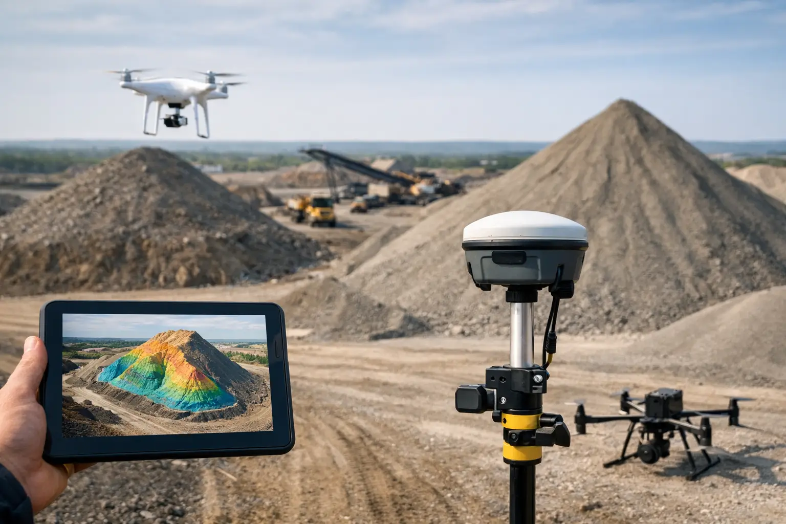
    The data capture stage then follows. For broad site coverage, enterprise drones are often the most efficient option. They can survey multiple stockpiles quickly, minimise disruption to operations, and provide dense image data suitable for photogrammetric modelling. Where vegetation, complex geometry, poor texture, or difficult lighting are factors, LiDAR may be the better fit. On some sites, a combined approach delivers the best result.

    Once captured, the survey data is processed into a terrain or surface model. Stockpile boundaries are checked, voids or noise are corrected, and volumes are calculated against an agreed base surface. Deliverables can include volume tables, orthomosaic mapping, contour plans, point clouds, CAD-ready files, and repeat-survey comparisons.

    Volumetric stockpile survey services and accuracy

    Accuracy is the point most buyers focus on, and rightly so. However, there is no single accuracy figure that applies to every project. The right standard depends on the survey method, control quality, material surface, environmental conditions, and how the result will be used commercially.

    For example, loose aggregate with a clearly defined surface is generally more straightforward to model than dark, reflective, or heavily disturbed material. Similarly, a well-controlled drone survey on an open site may produce excellent results, but if the base of the stockpile is poorly defined, the final volume can still be open to question.

    This is where an experienced provider adds value. Good volumetric stockpile survey services are not simply about flying a drone or scanning a pile. They are about selecting a method that fits the job, applying proper survey control, and explaining tolerances honestly. In commercial terms, a fast answer is not enough if the method cannot stand up to scrutiny.

    Where these services deliver the strongest return

    The commercial case is usually strongest where material volumes change regularly, where stock levels affect working capital, or where disputes over measured quantities have direct financial consequences. Quarries and aggregate businesses are obvious examples, but they are not the only ones.

    Construction and civil engineering projects use stockpile surveys to track imported fill, excavated spoil, and progress against programme. Waste and recycling operators use them to support reporting, capacity planning, and material throughput analysis. Ports and logistics sites use them to monitor bulk commodities where volume visibility supports both operational planning and customer reporting.

    There is also a strong case in environments where health and safety considerations limit conventional access. Surveying from the air or from a safe standoff position can reduce exposure to unstable slopes, moving machinery, and active loading zones.

    Choosing the right survey method for the site

    No single capture method is best in every case. Drone photogrammetry is efficient, cost-effective, and well suited to large open sites with clear visibility. It is often the preferred option for routine stockpile reporting because it balances speed and detail well.

    LiDAR comes into its own where surface texture is inconsistent, where complex structures sit close to the stockpiles, or where a dense and direct 3D measurement is required. Terrestrial or mobile LiDAR can also be useful in confined areas, under cover, or where flight restrictions apply.

    GNSS-based ground survey still has a role, particularly for control establishment, validation, or small isolated tasks. It is not obsolete. It is simply less efficient as the primary measurement method when sites are large or stockpile geometry is complex.

    The right provider should be comfortable advising on that trade-off rather than forcing every project into one workflow. That is especially relevant for UK operators dealing with mixed sites, variable weather, and live operational constraints.

    What to look for in a service provider

    The quality of the deliverable matters just as much as the survey itself. Professional buyers should look for a provider that can explain methodology clearly, define expected outputs in advance, and work within the practical realities of an operational site.

    That includes understanding access rules, RAMS requirements, flight permissions where needed, control strategy, and output formats that fit downstream workflows. If the result has to support CAD teams, commercial managers, or site engineers, the data should arrive ready to use rather than requiring further interpretation.

    It is also worth asking how repeatability is handled. If surveys are being carried out monthly or quarterly, consistency in method is essential. Trend reporting only works when capture and processing are controlled properly from one survey to the next.

    For organisations that also procure hardware, software, and support, working with a geospatial specialist that understands both service delivery and the underlying technology can simplify implementation. LiDAR Tech UK supports that broader model by combining data capture capability with practical expertise in LiDAR, GNSS, RTK, and enterprise drone workflows.

    The value is in better decisions, not just better measurements

    Volume data becomes useful when it feeds action. That might mean ordering the right amount of aggregate, validating subcontractor claims, planning extraction phases, or reconciling inventory with finance records. The more regularly and reliably a site can measure stock, the fewer assumptions operators have to make.

    There is, of course, a balance to strike. Higher survey frequency brings better visibility, but only if the reporting cycle matches operational need. Some businesses need weekly updates. Others only need month-end figures with strong confidence levels. The best approach depends on how quickly stock moves, how material is billed, and how much uncertainty the business can tolerate.

    If your site depends on accurate material quantities, volumetric stockpile survey services are not a nice-to-have. They are a practical control measure that supports safer operations, cleaner reporting, and more confident commercial decisions.

  • Topographic Survey with Drone Explained

    Topographic Survey with Drone Explained

    When a site needs current levels, contours and ground detail quickly, a topographic survey with drone can reduce days of field time to a matter of hours. That matters on live construction sites, infrastructure corridors and large land parcels where access, safety and programme pressure all affect how efficiently data can be captured.

    The value is not simply speed. Drone survey workflows now give professional teams a practical way to collect dense spatial data across complex terrain, then turn it into CAD-ready surfaces, contours, orthomosaics and volumetric outputs. For many projects, that means faster decisions, fewer repeat visits and a clearer view of site conditions before design, excavation or asset works begin.

    What a topographic survey with drone actually delivers

    A topographic survey captures the shape of the ground and the visible features on it. In practice, that can include spot levels, breaklines, contours, kerbs, roads, embankments, stockpiles, drainage routes, buildings, fences and vegetation boundaries. When captured by drone, the survey is built from aerial imagery, LiDAR data or a combination of both, supported by GNSS control and post-processing.

    The output is rarely just a map. Professional clients usually need deliverables that fit directly into design and engineering workflows. That may include a digital terrain model, digital surface model, georeferenced orthophoto, point cloud, contour set, measured sections or linework suitable for CAD and GIS environments.

    The right output depends on the job. A housebuilder may need existing levels and earthworks quantities. A civil engineering contractor may need corridor mapping ahead of drainage design. A utilities team may need a clear ground model around access constraints and surface assets. The survey method should follow the commercial need, not the other way round.

    Where drone topographic surveys make the most sense

    Drone surveys are strongest where the site is large, uneven, difficult to access or time-sensitive. Quarries, solar farms, highways schemes, land development sites, rail-adjacent areas, floodplains and agricultural estates are all good examples. A drone can cover broad extents efficiently while keeping surveyors out of hazardous ground conditions and away from moving plant.

    There is also a clear advantage on sites where regular updates are required. Progress tracking, cut and fill monitoring and stockpile measurement all benefit from repeatable aerial capture. With a consistent flight plan and control strategy, datasets can be compared over time to show measurable change.

    That said, a drone is not automatically the best choice for every topographic brief. Small urban sites with heavy tree cover, narrow access and lots of hidden ground detail may still require a stronger terrestrial component. If the critical information sits beneath canopy or beside building overhangs, aerial photogrammetry alone may leave gaps.

    Accuracy depends on method, control and site conditions

    Accuracy is the first question serious buyers ask, and rightly so. A topographic survey with drone can achieve highly usable results for many engineering and construction applications, but headline accuracy claims only mean something when tied to a proper workflow.

    Photogrammetry-based surveys rely on image quality, overlap, camera calibration, ground control, RTK or PPK positioning, flight height and good visibility of the ground. LiDAR-equipped drones add a major advantage where vegetation, low texture or uneven light make photogrammetry less reliable. They can produce more consistent ground information in challenging environments, especially where some canopy penetration is needed.

    In UK practice, accuracy requirements should be defined at the start. There is a difference between data suitable for early feasibility, detailed design support and measured quantities for commercial reporting. Control points, check points and validation against known coordinates remain essential. Without that discipline, the dataset may look convincing while still falling short of specification.

    This is where experienced deployment matters. Hardware capability is only one part of the result. Flight planning, GNSS correction quality, site control layout, processing settings and quality assurance all influence whether the final model stands up to scrutiny.

    Photogrammetry or LiDAR for topographic work?

    This is often the key technical decision. Photogrammetry is efficient, cost-effective and capable of very strong results on open sites with good surface visibility. It works well for earthworks, development land, stockpile measurement and general mapping where the ground can be clearly seen from above.

    LiDAR becomes more attractive when the site includes vegetation, poor texture, shadow-heavy terrain or a need for cleaner bare-earth extraction. On infrastructure routes, wooded land, utility corridors and mixed rural terrain, LiDAR can provide a more dependable ground model. It also handles complex vertical geometry better in some environments, especially when paired with accurate GNSS and inertial data.

    The trade-off is commercial as much as technical. LiDAR payloads and processing workflows typically come at a higher cost than standard drone photogrammetry. For some projects, that cost is easily justified by the data quality and reduced need for supplementary fieldwork. For others, photogrammetry remains the better fit because the required accuracy and site visibility do not warrant a LiDAR workflow.

    The field process behind a dependable result

    A professional drone survey starts well before take-off. Airspace status, site permissions, weather window, vegetation condition and required outputs should all be confirmed in advance. If the deliverable needs to support design or legal boundary-related work, tolerances and exclusions should be clearly stated from the outset.

    On site, survey control is established or verified using GNSS or total station methods as appropriate. The drone mission is then planned around altitude, overlap, sensor type and site geometry. Obstructions, reflective surfaces, water bodies and active machinery all affect how the capture should be carried out.

    After flying, the data moves into processing and quality control. Images or LiDAR observations are aligned, georeferenced and checked against control. Surfaces are classified, artefacts removed and outputs generated in the formats the client actually needs. If a contractor needs a terrain model for machine control planning, that should be built accordingly. If an architect needs background mapping for concept design, the output specification will be different.

    Common limitations buyers should account for

    A drone survey is not exempt from operational constraints. Weather remains a major factor in the UK, especially wind, rain and poor light. Tree canopy, standing water, reflective roofing and deep shadows can all affect data quality. Restricted airspace or congested urban settings may limit where and when flights can be carried out.

    There is also the matter of obscured detail. Aerial data captures what the sensor can see. Features hidden under dense vegetation, beneath structures or inside enclosed compounds may still need terrestrial survey methods. On many projects, the best answer is not drone versus ground survey, but drone plus ground survey.

    Decision-makers should also ask about processing standards, coordinate systems and deliverable compatibility. Fast capture is only useful if the output lands in the right format and reference frame for the wider project team.

    What commercial teams should ask before appointing a provider

    If the survey will inform design, quantities or asset records, the supplier should be able to explain expected accuracy, control methodology, sensor choice and QA process in plain terms. Asking what drone is used is less useful than asking how the result is validated.

    It is also worth checking whether the provider can support more than data capture. Many projects benefit from a partner that can advise on sensor selection, process the data in-house, supply supporting GNSS or drone hardware where needed, and scale from one-off surveys to repeat site programmes. That combination reduces friction when survey requirements evolve mid-project.

    For organisations that want to build internal capability as well as outsource fieldwork, this joined-up model is especially useful. LiDAR Tech UK operates in that space, supporting clients with professional survey technology, training and project delivery across the same geospatial workflow.

    Why this method is now part of mainstream survey delivery

    The strongest case for drone topographic surveying is not novelty. It is operational fit. When used properly, it improves coverage, shortens mobilisation time and produces dense datasets that support engineering, planning and site management decisions at pace. It also improves safety by reducing time spent in difficult or hazardous terrain.

    Still, the right answer depends on the site, the tolerance and the intended use of the data. Open ground, large extents and repeat monitoring favour drone methods strongly. Heavily obstructed sites, dense canopy and detailed feature extraction may call for a blended approach with terrestrial instruments and, in some cases, LiDAR rather than imagery alone.

    For professional buyers, that is the key point. A topographic survey with drone is not a shortcut around survey standards. It is a high-performance capture method that delivers best value when the specification, sensor and processing workflow are matched properly to the job. Get that alignment right, and the result is more than a fast survey – it is better information at the point the project needs it most.

  • Enterprise Drone Surveying Solutions That Scale

    Enterprise Drone Surveying Solutions That Scale

    When a site programme slips because survey data arrives late, the problem is rarely just field time. It is usually a workflow issue – too many handoffs, inconsistent data quality, or equipment that cannot keep pace with project demands. Enterprise drone surveying solutions address that gap by combining aircraft, sensors, positioning, software and support into a system that can deliver repeatable results at scale.

    For professional buyers, the question is not whether drones can capture data quickly. That point is already well proven. The real decision is whether a drone-based workflow can meet the accuracy, reliability and output standards your organisation needs across multiple sites, teams and use cases. That is where enterprise-grade capability matters.

    What enterprise drone surveying solutions actually mean

    The term is often used loosely, but in practice enterprise drone surveying solutions are built for operational use rather than occasional flying. They are designed to support repeatable surveying, mapping and inspection tasks with controlled data capture, dependable positioning, compatible software and a support structure behind the hardware.

    That distinction matters. A lower-cost drone may produce acceptable imagery for basic visual records, but enterprise operations need more than a useful picture. They need measurable outputs such as georeferenced orthomosaics, point clouds, digital surface models, stockpile volumes, corridor surveys and inspection datasets that can be used in CAD, GIS and asset management workflows.

    The solution therefore sits across the full chain. Aircraft performance affects coverage and uptime. Payload choice determines whether you are collecting RGB, thermal or LiDAR data. RTK or PPK capability influences positional accuracy. Processing software governs how quickly raw data becomes usable deliverables. Training and technical support reduce operational risk. If one part is weak, the whole workflow suffers.

    Where enterprise drone surveying solutions deliver value

    Surveying teams usually adopt drone systems for one of three reasons: speed, access or consistency. On many construction and infrastructure sites, all three apply at once.

    For topographic mapping, drones can cover larger areas in less time than traditional ground-only methods, especially where line of sight is poor or terrain is difficult. For inspections, they reduce the need to place personnel near unstable structures, live assets or steep embankments. For progress monitoring, they make it practical to capture the same site repeatedly and compare outputs over time.

    Utilities, highways and rail operators often see the strongest value where assets are dispersed and difficult to inspect efficiently from the ground. Forestry and land management users benefit from broad area coverage and, where required, the added penetration and surface detail that LiDAR can provide in vegetated environments. Quarrying and earthworks teams tend to focus on measurement speed, stockpile calculations and regular volumetric reporting.

    The commercial benefit is not just faster flying. It is faster decisions. When data arrives in the right format, with the right level of confidence, project teams can update quantities, verify progress, detect issues earlier and reduce revisits.

    Choosing the right sensor for the job

    Not every survey requirement needs the same payload, and this is where many purchasing decisions go wrong. The aircraft is important, but the sensor usually defines the value of the outcome.

    RGB photogrammetry remains the most widely used option for general mapping and site documentation. It is cost-effective, proven and suitable for many topographic and progress-monitoring tasks, provided lighting, overlap and ground control are managed properly. For construction, aggregates and planning work, it is often the most practical starting point.

    LiDAR becomes more relevant when terrain is obscured by vegetation, when consistent elevation capture is critical, or when clients require dense 3D data with reduced dependence on image texture. It also suits asset and corridor applications where detailed surface geometry matters. The trade-off is cost. LiDAR payloads and processing workflows are typically more expensive, so the business case should be tied to clear operational need rather than perceived prestige.

    Thermal sensors serve a different purpose again. They are less about conventional surveying and more about condition assessment, heat loss, solar inspection and fault detection. For many organisations, thermal capability complements mapping work but does not replace it.

    Accuracy is a workflow issue, not a brochure claim

    Professional buyers know that published accuracy figures only tell part of the story. Enterprise drone surveying solutions can support high-accuracy outputs, but only when the complete workflow is controlled.

    RTK and PPK positioning improve confidence in image and LiDAR georeferencing, reducing the need for dense ground control in some scenarios. Even so, site conditions, survey design, flight planning, calibration, base data and processing settings all influence the final result. A strong drone platform cannot compensate for poor mission planning or weak quality assurance.

    This is why experienced operators still validate outputs against known control and apply appropriate checks before data is issued. If your work supports engineering design, quantity verification or regulatory reporting, accuracy should be discussed in terms of achievable project outcomes, not headline specifications alone.

    For some organisations, that means building an internal QA process. For others, it makes more sense to work with a provider that can supply the hardware, training and project support together. LiDAR Tech UK operates in that space, where equipment capability and field delivery need to align.

    Integration matters more than features alone

    One of the biggest differences between entry-level and enterprise-grade adoption is integration. A drone may have an impressive sensor and flight time, but if the data cannot move efficiently into your existing workflow, the operational value drops quickly.

    Survey and engineering teams need outputs that work with the software they already use. That may mean CAD-compatible surfaces, GIS-ready layers, classified point clouds, mesh models or inspection reports that feed into asset management systems. Commercially, the strongest solutions are the ones that reduce friction between capture and action.

    This also applies to fleet management and internal governance. Larger organisations often need standard operating procedures, pilot training records, consistent file structures, maintenance planning and support arrangements that keep systems available across multiple teams. In that environment, buying a drone is easy. Running a dependable surveying operation is harder.

    What to assess before you invest

    A sensible procurement process starts with application fit rather than brand preference. Ask what you need to measure, how often you need to capture it, what outputs your teams require, and what tolerances are acceptable. That quickly narrows the right sensor, aircraft class and software stack.

    You should also assess who will operate the system. If your team already has geospatial expertise, an in-house deployment may be straightforward with the right training and support. If not, a managed service or hybrid model may be more efficient, especially where deadlines are tight or data standards are demanding.

    Budget should be viewed over the full operating life, not just the initial purchase. Hardware cost is only one line item. Training, software licensing, batteries, maintenance, correction services, processing time and staff capacity all affect total cost of ownership. Cheaper platforms can become expensive if they create rework or unreliable outputs.

    Support is another practical differentiator. When a project depends on timely capture, responsive technical help matters. Authorised supply, implementation guidance and aftersales support are often more valuable than a marginal difference in headline specification.

    When to buy equipment and when to outsource

    There is no universal answer here. If you have regular survey demand, internal resource and a clear workflow for processing and using the data, ownership can deliver strong long-term value. It gives you scheduling control, repeat capture capability and the opportunity to standardise surveys across your portfolio.

    If your requirement is intermittent, highly specialised or tied to short-term project peaks, outsourcing may be the better commercial choice. The same applies where advanced LiDAR processing, complex corridor work or inspection reporting requires expertise that would take time to build internally.

    Many organisations now take a mixed approach. They use in-house drones for routine mapping and progress capture, then bring in specialist support for higher-accuracy surveys, LiDAR missions or periods of intense demand. That model often gives the best balance of control and flexibility.

    Enterprise drone surveying solutions in the UK market

    For UK organisations, operational fit also includes local realities. Weather windows can be narrow. Airspace restrictions vary significantly by region. Site access, public safety and project compliance all need careful management. Equipment and workflows should therefore be selected with UK operating conditions in mind, not just laboratory performance.

    That is one reason buyers increasingly look for suppliers that can do more than ship hardware. They want advice on payload selection, training, correction services, deployment planning and data outputs. They also want a partner that understands how surveying, mapping and inspection requirements differ between construction, utilities, land management and public-sector work.

    The strongest enterprise drone surveying solutions are not defined by a single aircraft model. They are defined by how reliably they produce usable data, how well they fit the job, and how effectively they can be supported over time.

    If you are assessing your next surveying workflow, start with the outcome rather than the platform. The right system is the one that gives your team dependable data, repeatable processes and the confidence to scale without compromising accuracy.

  • Choosing an NTRIP Correction Service UK

    Choosing an NTRIP Correction Service UK

    A missed fix in the middle of a live survey usually costs more than the subscription. When teams assess an NTRIP correction service in the UK, they are rarely comparing abstract features. They are trying to avoid rework, protect programme time and keep GNSS rovers, machine control or UAV workflows producing dependable coordinates every day.

    For UK users, the right service is not simply the one with the lowest annual fee. Performance depends on where you work, the network geometry behind the corrections, mobile data reliability on site, rover compatibility and the level of support available when something stops behaving as expected. That is why correction services should be assessed as part of an operational workflow, not as a standalone line item.

    What an NTRIP correction service in the UK actually needs to deliver

    At a technical level, NTRIP distributes GNSS correction data over the internet so a rover can resolve position more accurately than standalone GNSS. In practice, buyers are paying for three things: accuracy, consistency and uptime.

    Accuracy matters, but consistency often matters more. A service that performs well in one open-sky test but becomes unreliable around urban edges, tree cover or mixed terrain quickly creates problems for production work. Surveyors need repeatable positions. Contractors need machine guidance they can trust. Drone teams need reliable georeferencing that reduces downstream processing time.

    A capable UK service should also reflect how GNSS is used across different sectors. A topo survey on a housing development, a utilities stakeout near obstructions, and an agricultural guidance task place different demands on the correction stream. The best fit depends on whether your priority is fine tolerances, broad regional coverage, quick initialisation or resilience across changing site conditions.

    Coverage matters more than headline claims

    A common mistake is assuming national availability means uniform performance. It does not. The underlying base station network, spacing, maintenance standards and regional density all influence the quality of corrections delivered to the field.

    This is particularly relevant in the UK because operating environments vary sharply. Dense urban centres can create multipath and poor sky visibility. Remote rural areas may have weaker mobile connectivity. Coastal and infrastructure corridors often combine access challenges with pressure to maintain productivity. A provider may look strong on paper yet still be a poor operational fit if your teams regularly work in fringe coverage areas.

    Before committing, it is worth asking practical questions. Where are your crews actually working month to month? Do you need dependable performance in one county, across England and Wales, or throughout the whole UK? Are your projects clustered around infrastructure routes, city centres or exposed open land? Those answers matter more than generic claims about national service.

    Accuracy is not the only metric

    Most professional buyers understand that RTK and network RTK can achieve centimetre-level positioning under suitable conditions. The more useful conversation is about how often that level is sustained in real work.

    Initialisation time is one example. If a rover regains a fixed solution quickly after signal interruption, field productivity improves. If teams are repeatedly waiting for a fix after moving near buildings, under canopy or between work zones, the hidden cost grows fast.

    There is also the issue of stability. A service may technically offer acceptable precision, but if fixes drift, drop back to float too often or vary between sessions, confidence in the data falls away. For commercial users, that can be more damaging than a slightly less ambitious specification that is delivered consistently.

    When comparing services, look beyond a simple accuracy figure and consider repeatability, fix reliability and performance across your actual operating conditions.

    Hardware compatibility and field setup

    An NTRIP correction service in the UK is only as useful as its fit with your equipment stack. Most modern GNSS rovers and controllers support NTRIP, but setup quality still varies. Mountpoint configuration, datum handling, coordinate systems and modem or SIM arrangements all affect whether the service works cleanly in the field.

    This is where professional support becomes commercially important. A correction service should not leave your team to interpret technical settings without guidance, especially if multiple receivers, software platforms or project deliverables are involved. Small configuration errors can produce very expensive consequences, particularly where stakeout, as-built records or compliance documentation are concerned.

    Buyers should also think about future scaling. If you are adding more rovers, integrating UAV workflows or supporting subcontract teams, the service needs to remain manageable. Simple account administration and responsive support become more valuable as fleets and field teams grow.

    Mobile data and the reality of UK site conditions

    Because NTRIP relies on internet delivery, correction quality in the field is linked to mobile data performance. This is often overlooked at procurement stage. In many parts of the UK, especially on remote infrastructure, utilities or rural land projects, signal strength can be inconsistent.

    That does not automatically rule out an NTRIP workflow, but it does mean you need a realistic view of site communications. Some teams benefit from multi-network SIMs or carefully selected mobile providers. Others need fallback options for areas where data coverage is weak. The right solution depends on how critical uninterrupted RTK is to the task and how costly downtime becomes if the correction stream drops.

    For organisations running multiple crews, it is worth reviewing communications and correction services together rather than as separate purchasing decisions.

    Support is part of the service, not an extra

    For professional surveying and mapping operations, support should be judged on response time, technical depth and practical field understanding. A helpdesk that can only repeat setup instructions is limited value when a crew needs to diagnose network access, coordinate output, datum alignment or receiver behaviour under time pressure.

    This is one of the clear differences between a generic subscription and a service-led geospatial partner. Organisations often need more than log-in credentials. They need someone who understands the receiver, the controller, the software, the site conditions and the expected output.

    That is especially true for buyers who are standardising workflows across surveying, drone mapping and construction teams. If one provider can support the correction service alongside GNSS hardware, training and project implementation, the operational risk is usually lower.

    Who benefits most from a UK correction service

    Survey practices are the obvious users, but the case is broader than traditional topographic work. Construction firms use network corrections to speed setting out and quality control. Civil engineering teams rely on them for repeatable site positioning across changing phases of work. Utilities and infrastructure operators need dependable coordinates for asset records, inspections and maintenance planning.

    There is also a growing fit with drone and LiDAR workflows. Accurate ground control and georeferenced capture can reduce processing time and improve confidence in outputs, particularly where data must feed directly into CAD, GIS or engineering environments. In those cases, the correction service has a direct effect on downstream efficiency, not just field positioning.

    How to assess value rather than just price

    The cheapest subscription can become the most expensive option if it creates delays, repeat visits or uncertainty around survey quality. Value should be measured against the cost of downtime, the number of field teams relying on the service and the commercial impact of poor positional confidence.

    For some buyers, a lower-cost service may be perfectly adequate because project tolerances are modest and work is concentrated in strong coverage areas. For others, especially those supporting high-accuracy surveying, construction layout or critical asset documentation, a more dependable service with stronger technical support is the better commercial decision.

    A sensible evaluation looks at the whole workflow. How fast can crews get started each morning? How often do they lose fix? How easy is onboarding for new devices? How quickly can support resolve issues? Those are operational questions, but they are also financial ones.

    Choosing the right NTRIP correction service in the UK for your workflow

    The right choice comes down to fit. A small surveying team working locally may prioritise simplicity and dependable regional performance. A national contractor may need broader coverage, account management and support across multiple devices and business units. A drone operator may focus on compatibility with existing GNSS base and rover workflows. There is no single best service in every case.

    What matters is whether the provider understands how corrections sit inside the wider geospatial process. That includes hardware setup, coordinate integrity, field productivity and the final quality of deliverables. For many professional buyers, that joined-up approach is where the real value sits. LiDAR Tech UK works in that space – connecting hardware, correction services, support and operational delivery so clients can build accurate, repeatable workflows rather than patching systems together.

    If you are reviewing options now, the most useful next step is to assess the service against your actual projects, devices and coverage areas, not a generic feature list. Good correction data should disappear into the background and let your team get on with accurate work, on time, with fewer return visits.

  • How Does RTK Surveying Work in Practice?

    How Does RTK Surveying Work in Practice?

    A standard GNSS receiver can place you within a few metres. On a construction set-out, a boundary survey, or a control network check, that margin is nowhere near good enough. When clients ask how does RTK surveying work, they are usually asking a more practical question – how does satellite positioning become precise enough for real survey and engineering decisions?

    The short answer is that RTK, or Real-Time Kinematic surveying, improves satellite positioning by applying live correction data from a known point. That lets a rover calculate its position far more accurately than standalone GNSS. In the right conditions, RTK can consistently deliver centimetre-level results, which is why it has become a standard workflow across surveying, civils, utilities, agriculture, and drone operations.

    How does RTK surveying work?

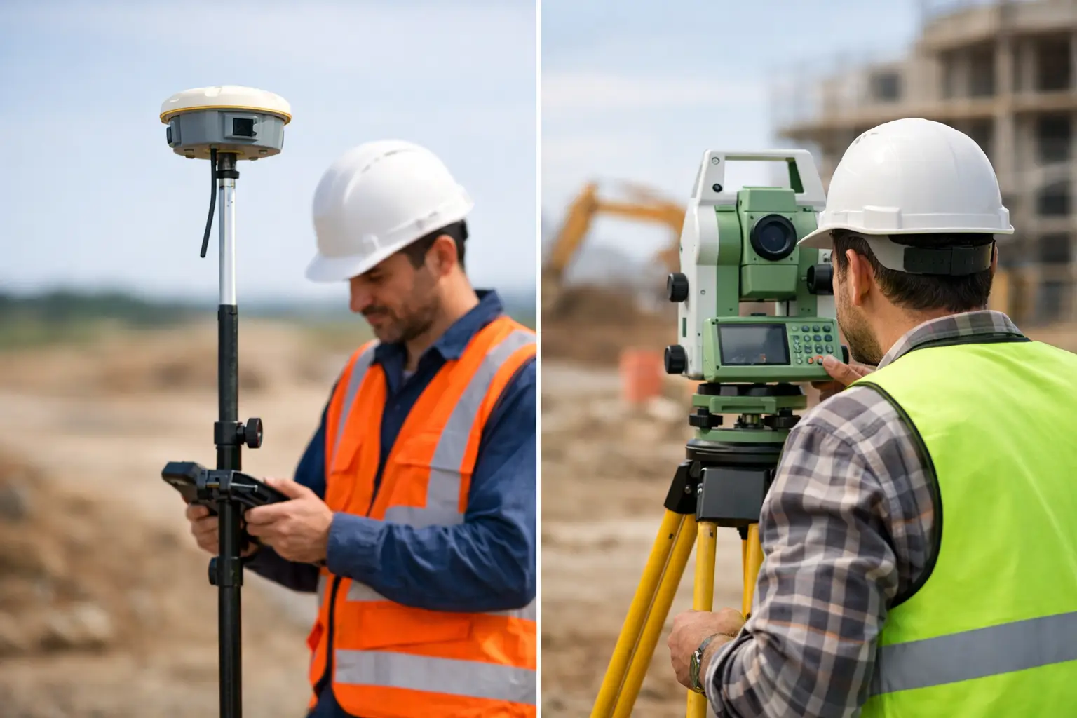
    RTK surveying works by combining satellite observations from two GNSS receivers. One receiver sits on a known point and acts as the base station. The other is the rover, which moves through the site collecting positions. Because both receivers are observing many of the same satellites at the same time, the system can compare what the rover sees against what the base sees.

    The base station already knows its true coordinates. It can therefore work out the errors affecting the GNSS signals at that moment, including satellite orbit uncertainty, clock errors, atmospheric delay, and some local effects. It then sends correction data to the rover in real time, usually by radio or mobile data connection.

    The rover uses those corrections to resolve its position much more precisely than it could on its own. Rather than relying only on a broad code-based position, RTK uses carrier phase measurements from the satellite signals. This is where the high accuracy comes from. The system is effectively measuring fractions of the signal wavelength and resolving integer ambiguities to refine the final position.

    That is the technical core of RTK. In practical terms, it means your rover is no longer guessing within a few metres. It is calculating a corrected position tied to a known reference, updated live as you work.

    The key components in an RTK workflow

    An RTK setup is straightforward on paper, but performance depends on each part of the chain working properly.

    Base station or correction source

    The correction source can be a local base station set up on site or a network RTK service delivered over mobile internet. A local base gives you direct control and can perform very well on contained sites. A network service uses multiple permanent reference stations and computes corrections across a wider area, which is often more convenient for mobile teams covering different locations.

    The right choice depends on site size, mobile coverage, required traceability, and whether your team is working repeatedly in the same area.

    Rover receiver

    The rover is the field unit used to record points, stake out coordinates, or collect topographic data. Modern rovers track multiple constellations such as GPS, GLONASS, Galileo, and BeiDou. More satellites generally improve reliability, especially around obstructions or during challenging sky conditions.

    Data link

    Corrections must reach the rover quickly and consistently. If that link drops, so does the quality of the RTK fix. UHF radio is common for local base-to-rover setups. NTRIP over 4G or 5G is common for network RTK or internet-connected base stations.

    Survey software and control

    The software manages coordinate systems, logging, quality checks, stake-out routines, and export. This matters more than many buyers expect. Good hardware with poor configuration can still produce poor outcomes.

    Why RTK is more accurate than standard GNSS

    Standalone GNSS calculates a position from satellite timing signals, but several error sources affect the result. Satellite clocks are not perfect. Orbits are predicted rather than absolute. Signals slow as they pass through the ionosphere and troposphere. Reflections from buildings, vehicles, and structures can introduce multipath.

    RTK improves this because the base station experiences nearly the same satellite and atmospheric conditions as the rover, provided the two are not too far apart. By comparing observations, the system removes much of the common error. The remaining challenge is resolving the carrier phase ambiguities correctly. Once fixed, the rover can report a highly precise position in real time.

    That is also why RTK performance is not just about owning a rover. Accuracy depends on baseline length, correction quality, satellite visibility, receiver capability, and operator practice.

    What accuracy can you expect?

    Under suitable conditions, RTK commonly delivers around 10 to 20 mm horizontal accuracy and 20 to 30 mm vertical accuracy, though this varies by equipment, environment, method, and quality control. Manufacturers may quote similar figures, but field conditions always matter more than brochure numbers.

    Open-sky sites with good satellite geometry and a stable correction link usually perform well. Tight urban corridors, steep cuttings, tree cover, heavy plant movement, or reflective surfaces can degrade results. Vertical accuracy is usually less forgiving than horizontal, which is important when setting levels, drainage falls, or finished surfaces.

    For that reason, professional users should think in terms of achievable site accuracy rather than ideal laboratory accuracy.

    Where RTK works well – and where it does not

    RTK is highly effective for topographic surveys, construction set-out, as-built capture, machine control support, ground control for drone surveying, utility mapping, and agricultural guidance. It is fast, efficient, and well suited to projects where teams need accurate coordinates immediately in the field.

    It is less effective where satellite visibility is poor or unstable. Dense woodland, urban canyons, tunnels, indoor spaces, and locations with severe multipath can all limit the ability to maintain a fixed solution. In these cases, users may need to switch methods, integrate total station workflows, or use post-processed techniques.

    This is one of the key trade-offs. RTK is quick and accurate, but it is still dependent on signal conditions. It is not a universal substitute for every survey instrument on every site.

    How does RTK surveying work on a live project?

    On a live project, the workflow usually starts with control. If using a local base, the base station is set over a known coordinate or established control point. If using a network correction service, the rover connects through the appropriate mountpoint and coordinate framework.

    The operator then initialises the rover, confirms satellite lock, and waits for a fixed RTK solution rather than a float solution. That distinction matters. A fixed solution means the carrier phase ambiguities have been resolved with confidence. A float solution is less certain and generally not suitable for precision work.

    Once fixed, the surveyor can begin recording points, checking features, or staking out design coordinates. Good practice includes regular checks against known control, monitoring precision indicators, and being alert to changes in signal quality. If the fix status drops, the operator should stop and verify rather than simply continue logging.

    For organisations running multiple field teams, this is where a supported workflow makes the difference. Equipment choice, correction service configuration, training, and data handling all affect whether RTK saves time or creates rework.

    Common reasons RTK results go wrong

    Most RTK problems are not caused by the concept itself. They come from setup, environment, or process.

    Using the wrong coordinate system is a common issue, particularly when moving between grid, local, and site calibration workflows. Poor base setup, unstable poles, inaccurate antenna heights, weak mobile coverage, and inadequate checks can all compromise results. Operators can also place too much trust in a fixed status without considering whether the broader survey control supports it.

    There is also a commercial point here. Buying capable GNSS hardware is only part of the decision. Teams also need training, technical support, and a workflow that fits the project environment. That is why many UK organisations work with providers such as LiDAR Tech UK that can support equipment supply, correction-enabled workflows, implementation, and field delivery rather than simply dispatching a box.

    RTK versus other high-accuracy methods

    RTK is often compared with PPK, static GNSS, and total station surveying. Each has a place.

    RTK is strongest when you need immediate coordinates on site. PPK can be advantageous where live corrections are unreliable but raw data can be processed afterwards. Static GNSS is better suited to longer occupation control work. Total stations remain essential where line of sight is available but satellite visibility is poor, or where extremely precise local measurement is required.

    For many projects, the best answer is not one method alone. It is a combined workflow built around the site constraints and required deliverable.

    If you are assessing RTK for operational use, the real question is not simply whether it works. It is whether the equipment, corrections, support, and survey method are aligned well enough to produce repeatable, defensible results when time and accuracy both matter.

  • Mobile LiDAR Scanner for Land Surveys

    Mobile LiDAR Scanner for Land Surveys

    A site that would take days to measure with total stations and GNSS alone can often be captured in a few hours with a mobile lidar scanner for land surveys. That difference matters when access is restricted, traffic management is costly, or a contractor is waiting on reliable topographic data to keep a programme moving.

    For professional buyers, the question is not whether mobile LiDAR is useful. It is where it fits, what level of accuracy is realistic, and whether the workflow stands up commercially. In land surveying, the value comes from faster coverage, denser spatial data and safer collection in environments where conventional methods become slow or inefficient.

    What a mobile LiDAR scanner for land surveys actually does

    A mobile LiDAR scanner records dense 3D point cloud data while the operator moves through the site. Depending on the system, that movement may be on foot, mounted on a vehicle, or integrated with a drone-based workflow. The scanner emits laser pulses, measures return times and builds a spatial model of terrain, structures, boundaries, corridors and surface features.

    In land surveying, this changes the field method. Instead of collecting one point at a time, the operator captures a continuous dataset across the whole environment. That is particularly useful on complex sites where retaining walls, embankments, vegetation edges, kerb lines, facades and service corridors all need to be represented in a single survey output.

    The commercial benefit is speed, but speed on its own is not enough. The real advantage is speed with traceable survey control, practical processing workflows and outputs that can support CAD, BIM, GIS or volumetric analysis.

    Where mobile LiDAR delivers the strongest return

    The best use cases are not always the largest sites. They are the sites where time on the ground is expensive, hazardous or operationally disruptive.

    Construction and civil engineering teams use mobile systems to capture existing conditions before design, monitor progress, document earthworks and verify built assets. Utilities teams use them along roads, substations and service routes where access windows are short and traditional methods can create bottlenecks. Infrastructure managers benefit when they need consistent corridor data with enough density to support clearance assessment, asset location and surface modelling.

    For topographic work, a mobile lidar scanner for land surveys is especially effective where the site contains a high volume of breaklines, level changes and hard detail. It can also help with stockpile measurement, drainage assessment, highway environments, quarry work and brownfield redevelopment.

    That said, not every project suits a mobile approach. If the brief is a very small area with a limited number of defined points, conventional survey may still be more efficient. Likewise, if the requirement is millimetre-level detail on specific installed components, static scanning or targeted total station work may be the better fit.

    Accuracy expectations in real survey conditions

    Accuracy is where buyers need clarity. Mobile LiDAR is not one single performance category. Results depend on the scanner, the GNSS environment, IMU quality, survey control, operator method and post-processing discipline.

    In open conditions with a strong positioning solution and proper control, mobile systems can achieve highly usable survey-grade results for many land and engineering applications. In dense urban streets, woodland, under bridges or beside tall structures, the positioning environment becomes more difficult. Drift, occlusion and degraded satellite visibility can affect the dataset if the workflow is not designed correctly.

    This is why specification sheets only tell part of the story. A stated accuracy figure is useful, but the more relevant question is whether the full workflow can achieve the tolerance your project requires. If the output is for feasibility mapping, route planning or general site modelling, mobile LiDAR may be ideal. If the output supports legal boundary definition, deformation monitoring or precise set-out control, additional methods and checks are likely to be necessary.

    Professional deployment means treating mobile LiDAR as part of a survey system, not as a standalone shortcut. Ground control, check points and sensible validation remain essential.

    Why control still matters

    Even with advanced SLAM and integrated GNSS, survey control provides the framework that turns fast capture into defensible output. It allows the point cloud to be tied into the required coordinate system, checked against known values and aligned with other datasets.

    For organisations managing repeated surveys across multiple sites, that consistency becomes even more important. Reliable control supports change detection, phased construction comparison and clean integration with existing mapping.

    Mobile LiDAR versus traditional methods

    The comparison should be practical rather than ideological. Total stations, GNSS rovers, static laser scanners, drones and mobile LiDAR all have a place. The right choice depends on terrain, detail, access and final deliverables.

    A total station remains excellent for precise discrete points, set-out and controlled feature capture. GNSS is efficient in open sky and ideal for many topographic tasks, but it becomes less effective under canopy or around built obstructions. Static laser scanning produces very high-detail data, though with more set-up positions and more time in the field. Drone LiDAR adds major value for larger areas, inaccessible ground and corridor mapping, but may involve airspace restrictions, permissions and weather limitations.

    Mobile LiDAR sits in the middle as a productivity tool for dense 3D capture over operational land. It is often the best answer when you need more detail than conventional point collection provides, but without the field time burden of repeated static set-ups.

    Choosing a mobile lidar scanner for land surveys

    Selection should start with job requirements, not with headline range or marketing claims. A buyer should assess the likely survey environment, expected tolerance, deliverable format and the capability of the team who will operate and process the data.

    Sensor quality matters, but so do positioning performance, software maturity and support. A scanner that captures quickly but creates slow, inconsistent processing is not efficient in real terms. Equally, a strong hardware platform without training and technical backup can leave a survey team underusing the equipment or introducing avoidable errors into production.

    For UK organisations, practical support is often the deciding factor. Buyers need to know how quickly they can get advice, calibration guidance, workflow help and, if required, project assistance. This is one reason many professional users prefer to work with suppliers that understand both the equipment and the survey outcomes expected on live projects.

    Questions worth asking before you buy

    Ask what coordinate workflows the system supports, how it performs in poor GNSS conditions, what quality control tools are available in software and how easily data exports into your existing CAD or GIS environment. It is also worth asking what level of training is included and whether there is access to processing support when workloads increase.

    The cheapest entry point is not always the lowest operating cost. If the system reduces revisits, shortens processing and produces dependable deliverables first time, it usually offers the better return.

    Processing, deliverables and operational reality

    Field capture is only half the job. The point cloud then needs to be registered, georeferenced, cleaned, classified and converted into usable outputs. Depending on the brief, that may include DTM generation, contours, cross-sections, measured linework, volumetric reports or 3D models.

    This is where many organisations underestimate the workflow. Dense data is valuable, but it also needs storage, computing capacity and a clear production method. If your team is set up for conventional topographic drafting only, moving into mobile LiDAR may require changes in software, training and quality assurance.

    Handled properly, though, the gain is significant. One well-executed capture can support multiple deliverables and reduce the need for return visits. It also creates a detailed site record that can be revisited digitally if additional measurements are needed later.

    Buy equipment or outsource the survey?

    That depends on survey frequency, staff capability and the commercial model of the business. If mobile LiDAR will be used regularly across infrastructure, development, utilities or asset programmes, owning the equipment can make strong financial sense. It gives the team control over deployment and can reduce dependence on subcontract availability.

    If usage is occasional or the organisation is still evaluating workflows, outsourced delivery may be the better route. It allows the business to test outputs, understand accuracy in its own operating context and assess return on investment before committing to capital purchase.

    Some buyers also take a hybrid route – using a specialist partner for initial projects while building internal capability over time. For firms that want both equipment access and operational support, LiDAR Tech UK works well because it combines supply, training and project delivery within the same geospatial offering.

    What good looks like on a live project

    A good mobile LiDAR survey is not just fast. It is planned around control, site constraints and deliverables from the start. The capture path makes sense, the positioning strategy reflects the environment, and the final dataset is checked against known values before issue.

    When that happens, mobile LiDAR becomes more than a data collection tool. It becomes a way to reduce site time, improve safety, increase detail and keep downstream design or construction decisions moving with fewer delays.

    The strongest results usually come from a simple principle: choose a mobile system because it suits the survey problem, not because it is the newest method. When the workflow matches the job, the technology earns its place very quickly.